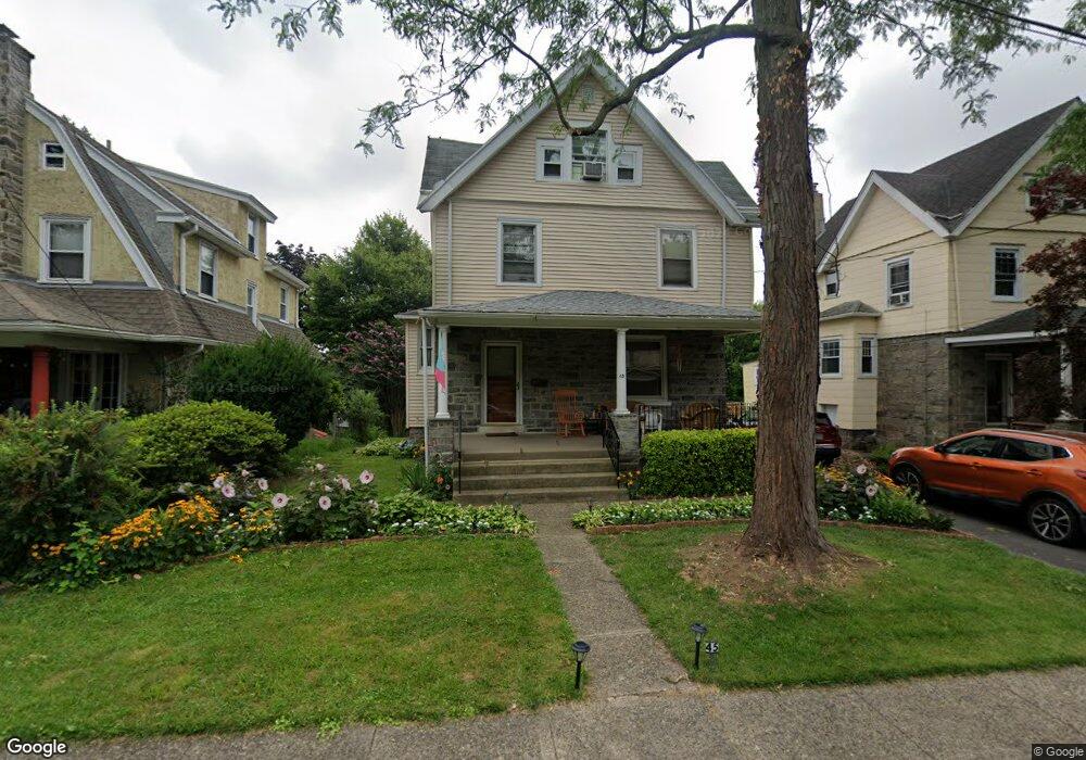
45 N Maple Ave Lansdowne, PA 19050
Estimated Value: $206,000 - $311,000
5
Beds
2
Baths
2,100
Sq Ft
$125/Sq Ft
Est. Value
About This Home
This home is located at 45 N Maple Ave, Lansdowne, PA 19050 and is currently estimated at $262,260, approximately $124 per square foot. 45 N Maple Ave is a home located in Delaware County with nearby schools including East Lansdowne Elementary School, Penn Wood Middle School, and Penn Wood High School - Cypress Street Campus.
Ownership History
Date
Name
Owned For
Owner Type
Purchase Details
Closed on
Apr 20, 2001
Sold by
Kleinberg Norman E and Kleinberg Margaret S
Bought by
Thompson Reginald E and Thompson Beverly J
Current Estimated Value
Home Financials for this Owner
Home Financials are based on the most recent Mortgage that was taken out on this home.
Original Mortgage
$112,500
Outstanding Balance
$40,947
Interest Rate
6.85%
Estimated Equity
$221,313
Create a Home Valuation Report for This Property
The Home Valuation Report is an in-depth analysis detailing your home's value as well as a comparison with similar homes in the area
Home Values in the Area
Average Home Value in this Area
Purchase History
| Date | Buyer | Sale Price | Title Company |
|---|---|---|---|
| Thompson Reginald E | $125,000 | Commonwealth Land Title Ins |
Source: Public Records
Mortgage History
| Date | Status | Borrower | Loan Amount |
|---|---|---|---|
| Open | Thompson Reginald E | $112,500 |
Source: Public Records
Tax History Compared to Growth
Tax History
| Year | Tax Paid | Tax Assessment Tax Assessment Total Assessment is a certain percentage of the fair market value that is determined by local assessors to be the total taxable value of land and additions on the property. | Land | Improvement |
|---|---|---|---|---|
| 2025 | $6,188 | $150,290 | $38,020 | $112,270 |
| 2024 | $6,188 | $150,290 | $38,020 | $112,270 |
| 2023 | $5,899 | $150,290 | $38,020 | $112,270 |
| 2022 | $5,784 | $150,290 | $38,020 | $112,270 |
| 2021 | $8,685 | $150,290 | $38,020 | $112,270 |
| 2020 | $5,548 | $84,590 | $24,880 | $59,710 |
| 2019 | $5,455 | $84,590 | $24,880 | $59,710 |
| 2018 | $5,361 | $84,590 | $0 | $0 |
| 2017 | $5,243 | $84,590 | $0 | $0 |
| 2016 | $464 | $84,590 | $0 | $0 |
| 2015 | $474 | $84,590 | $0 | $0 |
| 2014 | $464 | $84,590 | $0 | $0 |
Source: Public Records
Map
Nearby Homes
- 75 E Stewart Ave
- 32 N Wycombe Ave
- 37 E Stratford Ave
- 230 Wynnewood Ave
- 226 E Greenwood Ave
- 209 E Greenwood Ave
- 315 E Essex Ave
- 317 E Essex Ave
- 319 E Essex Ave
- 608 Pembroke Ave
- 178 N Union Ave
- 49 Elberon Ave
- 29 W Stratford Ave
- 164 Woodland Ave
- 192 Fairview Ave
- 38 W Stratford Ave
- 408 S Union Ave
- 144 Fairview Ave
- 88 E Essex Ave
- 239 N Maple Ave
- 41 N Maple Ave
- 112 E Stratford Ave
- 37 N Maple Ave
- 116 E Stratford Ave
- 33 N Maple Ave
- 107 E Stratford Ave
- 115 E La Crosse Ave
- 120 E Stratford Ave
- 44 N Maple Ave
- 52 N Maple Ave
- 40 N Union Ave
- 109 E Stratford Ave
- 105 E Stratford Ave
- 115 E Stratford Ave
- 103 E Stratford Ave
- 40 N Maple Ave
- 36 N Maple Ave
- 117 E Stratford Ave
- 121 E La Crosse Ave
- 99 E Stratford Ave