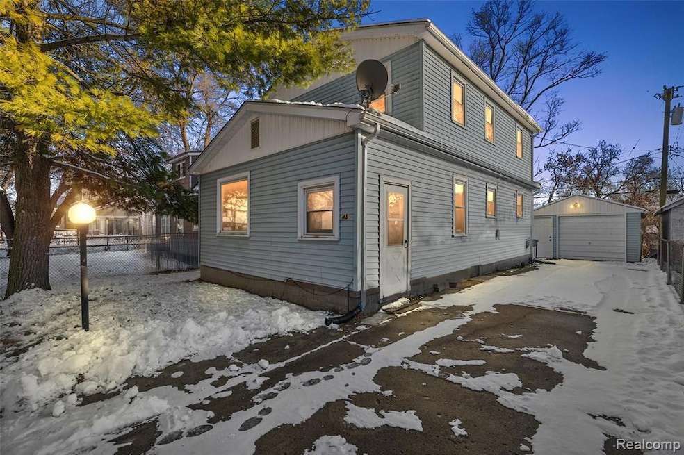
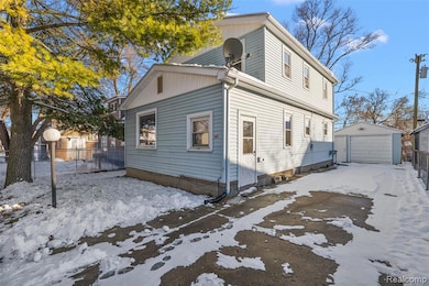
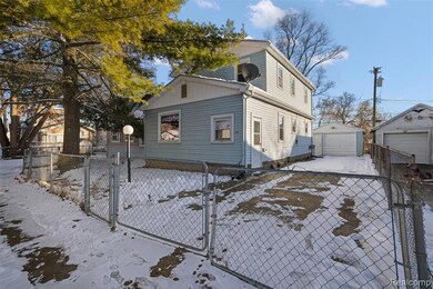
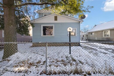
45 N Merrimac St Pontiac, MI 48340
Estimated payment $1,105/month
Highlights
- Colonial Architecture
- 1 Car Detached Garage
- Forced Air Heating System
- No HOA
- Patio
- Ceiling Fan
About This Home
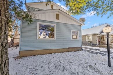
Beautifully Updated 4-Bedroom Colonial!
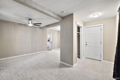
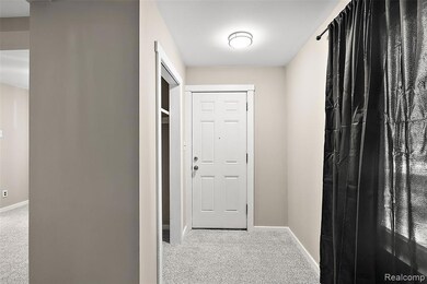
Welcome to this charming 2-story colonial featuring 4 spacious bedrooms and 2 fully updated bathrooms. This home has been refreshed from top to bottom with fresh paint, new carpet, and new kitchen flooring and countertops. The kitchen includes some new cabinets and a new built-in microwave, offering both modern convenience and style.
Both full bathrooms feature new tub surrounds and updated vanities, giving each space a clean, updated feel. Throughout the home, you’ll enjoy new lighting fixtures, ceiling fans, and plenty of closet space for comfortable everyday living. Additional updates include a new garage roof in 2025 and a house roof that is approximately 8 years old, giving peace of mind for years to come. All new blinds and curtains. The property is built on a crawl space with a very small basement for extra storage. Outside, you’ll find a 1-car detached garage and classic colonial curb appeal. Move-in ready and thoughtfully updated, this home blends timeless charm with modern upgrades. A must-see!
Home Details
Home Type
- Single Family
Est. Annual Taxes
Year Built
- Built in 1915 | Remodeled in 2025
Lot Details
- 3,485 Sq Ft Lot
- Lot Dimensions are 40x91
- Fenced
Parking
- 1 Car Detached Garage
Home Design
- Colonial Architecture
- Block Foundation
- Asphalt Roof
- Vinyl Construction Material
Interior Spaces
- 1,501 Sq Ft Home
- 2-Story Property
- Ceiling Fan
- Unfinished Basement
- Crawl Space
Kitchen
- Gas Cooktop
- Microwave
Bedrooms and Bathrooms
- 4 Bedrooms
- 2 Full Bathrooms
Laundry
- Dryer
- Washer
Outdoor Features
- Patio
- Breezeway
Location
- Ground Level
Utilities
- Forced Air Heating System
- Heating System Uses Natural Gas
- Natural Gas Water Heater
Listing and Financial Details
- Assessor Parcel Number 1420133010
Community Details
Overview
- No Home Owners Association
- Civic Improv Cos Merrimac Subdivision
Amenities
- Laundry Facilities
Map
Home Values in the Area
Average Home Value in this Area
Tax History
| Year | Tax Paid | Tax Assessment Tax Assessment Total Assessment is a certain percentage of the fair market value that is determined by local assessors to be the total taxable value of land and additions on the property. | Land | Improvement |
|---|---|---|---|---|
| 2024 | $1,386 | $64,920 | $0 | $0 |
| 2023 | $1,321 | $57,640 | $0 | $0 |
| 2022 | $1,338 | $51,750 | $0 | $0 |
| 2021 | $1,299 | $45,180 | $0 | $0 |
| 2020 | $803 | $39,600 | $0 | $0 |
| 2019 | $869 | $34,160 | $0 | $0 |
| 2018 | $834 | $28,890 | $0 | $0 |
| 2017 | $792 | $27,620 | $0 | $0 |
| 2016 | $817 | $23,760 | $0 | $0 |
| 2015 | -- | $23,060 | $0 | $0 |
| 2014 | -- | $21,890 | $0 | $0 |
| 2011 | -- | $26,210 | $0 | $0 |
Property History
| Date | Event | Price | List to Sale | Price per Sq Ft |
|---|---|---|---|---|
| 12/03/2025 12/03/25 | For Sale | $185,900 | -- | $124 / Sq Ft |
Purchase History
| Date | Type | Sale Price | Title Company |
|---|---|---|---|
| Interfamily Deed Transfer | -- | Attorney | |
| Warranty Deed | -- | None Available | |
| Sheriffs Deed | $54,596 | None Available | |
| Sheriffs Deed | $30,000 | None Available | |
| Deed | $47,000 | -- |
Mortgage History
| Date | Status | Loan Amount | Loan Type |
|---|---|---|---|
| Previous Owner | $47,444 | No Value Available |
Source: Realcomp
MLS Number: 20251055227
APN: 14-20-133-010
Disclaimer: Certain information contained herein is derived from information provided by parties other than Homes.com. All information provided is deemed reliable, but is not guaranteed to be accurate and should be independently verified.
![]() IDX provided courtesy of Realcomp II Ltd. via Ten-X and MLS
IDX provided courtesy of Realcomp II Ltd. via Ten-X and MLS
Copyright 2025 Realcomp II Ltd. Shareholders
IDX information is provided exclusively for consumers' personal, noncommercial use and may not be used for any purpose other than to identify prospective properties consumers may be interested in purchasing. The accuracy of all information, regardless of source, is not guaranteed or warranted. All information should be independently verified.
Listing Information presented by local MLS brokerage: Ten-X, local REALTOR®- Arlene Richardson - (888)-952-6393
- 32 N Merrimac St
- 80 W Mansfield Ave
- 54 Hudson Ave
- 998 Dewey St
- 32 Riker St
- 0 Riker St
- 00 Riker St
- 686 Lounsbury Ave
- 89 W Fairmount Ave
- 74 E Fairmount Ave
- 0000 Blaine Ave
- 24 W Fairmount Ave
- 111 Hamilton St
- 235 W Rutgers Ave
- 117 W Strathmore Ave
- 44 Euclid Ave
- 123 Adelaide St
- 1017 Cherrylawn Dr
- 73 Poplar Ave
- 130 Baldwin Ave
- 195 W Kennett Rd
- 70 E Rutgers Ave
- 79 Blaine Ave
- 44 Euclid Ave Unit 2
- 121 W Columbia Ave
- 268 Cesar e Chavez Ave
- 592 E Montcalm St
- 591 E Mansfield Ave
- 269 Stonegate W Unit 57
- 149 N Perry St
- 655 E Beverly Ave
- 957 N Perry St
- 24 Cochrane Place
- 639 Balboa Place
- 227 Tucker St Unit 74
- 16 Victory Dr Unit 18
- 1301 Woodlake Ln
- 44 Lincoln St
- 101 Mechanic St
- 601 Seville Blvd
