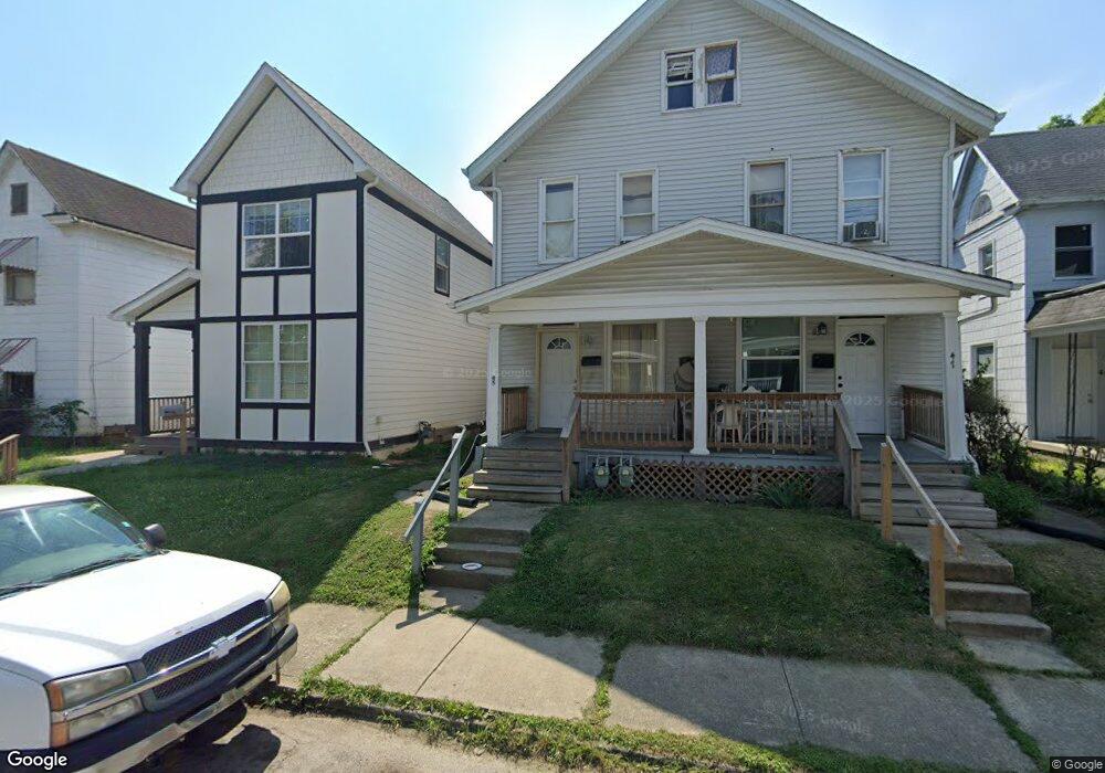
45 N Wayne Ave Unit 47 Columbus, OH 43204
North Hilltop NeighborhoodEstimated Value: $165,000 - $265,000
4
Beds
2
Baths
2,448
Sq Ft
$80/Sq Ft
Est. Value
About This Home
This home is located at 45 N Wayne Ave Unit 47, Columbus, OH 43204 and is currently estimated at $195,945, approximately $80 per square foot. 45 N Wayne Ave Unit 47 is a home located in Franklin County with nearby schools including West Broad Elementary School, Westmoor Middle School, and West High School.
Ownership History
Date
Name
Owned For
Owner Type
Purchase Details
Closed on
Feb 1, 1999
Sold by
Shaw H Douglas
Bought by
Yasnowski Michael A
Current Estimated Value
Home Financials for this Owner
Home Financials are based on the most recent Mortgage that was taken out on this home.
Original Mortgage
$39,920
Outstanding Balance
$11,919
Interest Rate
9.75%
Estimated Equity
$184,026
Purchase Details
Closed on
Jun 1, 1979
Create a Home Valuation Report for This Property
The Home Valuation Report is an in-depth analysis detailing your home's value as well as a comparison with similar homes in the area
Home Values in the Area
Average Home Value in this Area
Purchase History
| Date | Buyer | Sale Price | Title Company |
|---|---|---|---|
| Yasnowski Michael A | $49,900 | Title First Agency Inc | |
| Shaw H Douglas | $16,000 | Title First Agency Inc | |
| -- | $10,700 | -- |
Source: Public Records
Mortgage History
| Date | Status | Borrower | Loan Amount |
|---|---|---|---|
| Open | Yasnowski Michael A | $39,920 | |
| Closed | Yasnowski Michael A | $9,980 |
Source: Public Records
Tax History Compared to Growth
Tax History
| Year | Tax Paid | Tax Assessment Tax Assessment Total Assessment is a certain percentage of the fair market value that is determined by local assessors to be the total taxable value of land and additions on the property. | Land | Improvement |
|---|---|---|---|---|
| 2024 | $2,195 | $47,890 | $5,010 | $42,880 |
| 2023 | $2,317 | $47,880 | $5,005 | $42,875 |
| 2022 | $1,519 | $25,770 | $2,910 | $22,860 |
| 2021 | $1,522 | $25,770 | $2,910 | $22,860 |
| 2020 | $1,693 | $25,770 | $2,910 | $22,860 |
| 2019 | $1,484 | $21,460 | $2,420 | $19,040 |
| 2018 | $1,404 | $21,460 | $2,420 | $19,040 |
| 2017 | $1,418 | $21,460 | $2,420 | $19,040 |
| 2016 | $1,451 | $20,620 | $4,520 | $16,100 |
| 2015 | $1,325 | $20,620 | $4,520 | $16,100 |
| 2014 | $1,279 | $20,620 | $4,520 | $16,100 |
| 2013 | $792 | $24,255 | $5,320 | $18,935 |
Source: Public Records
Map
Nearby Homes
- 27 S Oakley Ave
- 67 N Wheatland Ave
- 57 S Eureka Ave
- 120 N Eureka Ave Unit 122
- 117-119 N Wheatland Ave
- 146 N Wayne Ave
- 66 S Wheatland Ave
- 95 S Eureka Ave
- 149 N Eureka Ave
- 75 N Terrace Ave
- 188 N Eureka Ave
- 151 S Wayne Ave Unit 153
- 78 N Burgess Ave
- 121 N Terrace Ave
- 210 N Oakley Ave
- 66 N Burgess Ave
- 137 S Highland Ave
- 126 S Richardson Ave
- 127 N Burgess Ave
- 118 N Ogden Ave
- 45-47 N Wayne Ave
- 49 N Wayne Ave
- 39 N Wayne Ave
- 45 N Wayne Ave Unit 35X
- 53 N Wayne Ave
- 35 N Wayne Ave
- 59 N Wayne Ave
- 31 N Wayne Ave
- 63 N Wayne Ave
- 25 N Wayne Ave
- 25 S Wayne Ave
- 44 N Eureka Ave
- 44 N Wayne Ave
- 48 N Wayne Ave
- 19 N Wayne Ave Unit 21
- 38 N Wayne Ave
- 0 N Wayne Ave
- 65 N Wayne Ave
- 19-21 N Wayne Ave
- 34 N Wayne Ave