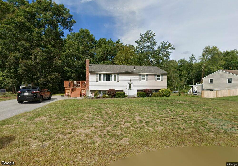
45 Parkwood Dr Pepperell, MA 01463
Estimated Value: $456,000 - $537,000
3
Beds
1
Bath
1,397
Sq Ft
$355/Sq Ft
Est. Value
About This Home
This home is located at 45 Parkwood Dr, Pepperell, MA 01463 and is currently estimated at $495,355, approximately $354 per square foot. 45 Parkwood Dr is a home located in Middlesex County with nearby schools including North Middlesex Regional High School, Pepperell Christian Academy, and Maple Dene & Moppet School.
Ownership History
Date
Name
Owned For
Owner Type
Purchase Details
Closed on
Jul 27, 2011
Sold by
Wightman David and Wightman Michelle L
Bought by
Wightman Michelle L
Current Estimated Value
Home Financials for this Owner
Home Financials are based on the most recent Mortgage that was taken out on this home.
Original Mortgage
$180,000
Outstanding Balance
$124,339
Interest Rate
4.52%
Estimated Equity
$371,016
Purchase Details
Closed on
Nov 23, 1998
Sold by
Suitor Gordon J and Suitor Martha J
Bought by
Wightman David and Wightman Michelle L
Home Financials for this Owner
Home Financials are based on the most recent Mortgage that was taken out on this home.
Original Mortgage
$121,500
Interest Rate
6.49%
Mortgage Type
Purchase Money Mortgage
Create a Home Valuation Report for This Property
The Home Valuation Report is an in-depth analysis detailing your home's value as well as a comparison with similar homes in the area
Home Values in the Area
Average Home Value in this Area
Purchase History
| Date | Buyer | Sale Price | Title Company |
|---|---|---|---|
| Wightman Michelle L | -- | -- | |
| Wightman David | $135,000 | -- |
Source: Public Records
Mortgage History
| Date | Status | Borrower | Loan Amount |
|---|---|---|---|
| Open | Wightman Michelle L | $180,000 | |
| Previous Owner | Wightman David | $140,000 | |
| Previous Owner | Wightman David | $121,500 | |
| Previous Owner | Wightman David | $121,500 | |
| Previous Owner | Wightman David | $40,000 |
Source: Public Records
Tax History Compared to Growth
Tax History
| Year | Tax Paid | Tax Assessment Tax Assessment Total Assessment is a certain percentage of the fair market value that is determined by local assessors to be the total taxable value of land and additions on the property. | Land | Improvement |
|---|---|---|---|---|
| 2025 | $5,912 | $404,100 | $153,700 | $250,400 |
| 2024 | $5,384 | $375,200 | $140,300 | $234,900 |
| 2023 | $5,049 | $333,500 | $126,900 | $206,600 |
| 2022 | $4,706 | $274,400 | $113,600 | $160,800 |
| 2021 | $4,623 | $258,000 | $100,200 | $157,800 |
| 2020 | $4,381 | $258,000 | $100,200 | $157,800 |
| 2019 | $4,108 | $247,600 | $100,200 | $147,400 |
| 2018 | $5,285 | $231,700 | $100,200 | $131,500 |
| 2017 | $5,087 | $228,400 | $100,200 | $128,200 |
| 2016 | $3,485 | $210,800 | $100,200 | $110,600 |
| 2015 | $3,362 | $210,800 | $100,200 | $110,600 |
| 2014 | $3,164 | $199,500 | $93,500 | $106,000 |
Source: Public Records
Map
Nearby Homes
- 5 June St
- 38 Tarbell St Unit 5B
- 208 North St
- 9 Tarbell St
- 28-30 Groton St
- 24 Unkety Brook Way
- 31 Prospect St
- 4 Parker Hill Way Unit C
- 35 Hollis St Unit 1
- 10 Tucker St
- 8 Jamie Rd
- 38 River Rd Unit 11
- 139 Nashua Rd
- 147 Nashua Rd
- 170 Nashua Rd
- 24-A 34-A Dow St
- 55 Park St
- 7 Maureens Way
- 20 B Legacy Ln
- 20 A Legacy Ln Unit 20A