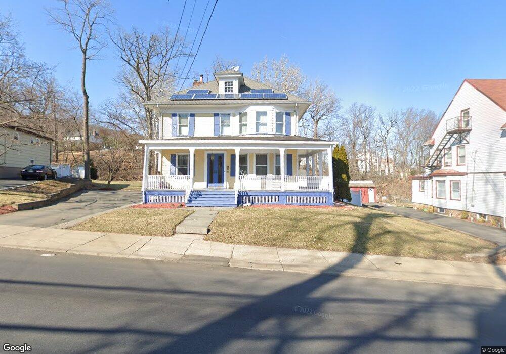
45 Pompton Rd Haledon, NJ 07508
Estimated Value: $628,582 - $709,000
Studio
--
Bath
2,093
Sq Ft
$314/Sq Ft
Est. Value
About This Home
This home is located at 45 Pompton Rd, Haledon, NJ 07508 and is currently estimated at $657,146, approximately $313 per square foot. 45 Pompton Rd is a home located in Passaic County with nearby schools including Haledon Public School, Manchester Reg High School, and Gilmore Memorial Christian Academy.
Ownership History
Date
Name
Owned For
Owner Type
Purchase Details
Closed on
Nov 19, 1998
Sold by
Soto Raymond
Bought by
Saling Joseph and Saling Carol
Current Estimated Value
Home Financials for this Owner
Home Financials are based on the most recent Mortgage that was taken out on this home.
Original Mortgage
$166,250
Outstanding Balance
$36,959
Interest Rate
6.8%
Estimated Equity
$620,187
Purchase Details
Closed on
Feb 9, 1996
Sold by
Ordini Frank
Bought by
Soto Raymond
Home Financials for this Owner
Home Financials are based on the most recent Mortgage that was taken out on this home.
Original Mortgage
$150,000
Interest Rate
7%
Create a Home Valuation Report for This Property
The Home Valuation Report is an in-depth analysis detailing your home's value as well as a comparison with similar homes in the area
Home Values in the Area
Average Home Value in this Area
Purchase History
| Date | Buyer | Sale Price | Title Company |
|---|---|---|---|
| Saling Joseph | $175,000 | -- | |
| Soto Raymond | $158,000 | -- |
Source: Public Records
Mortgage History
| Date | Status | Borrower | Loan Amount |
|---|---|---|---|
| Open | Saling Joseph | $166,250 | |
| Previous Owner | Soto Raymond | $150,000 |
Source: Public Records
Tax History
| Year | Tax Paid | Tax Assessment Tax Assessment Total Assessment is a certain percentage of the fair market value that is determined by local assessors to be the total taxable value of land and additions on the property. | Land | Improvement |
|---|---|---|---|---|
| 2025 | $13,849 | $262,300 | $109,900 | $152,400 |
| 2024 | $13,621 | $262,300 | $109,900 | $152,400 |
Source: Public Records
Map
Nearby Homes
- 64 John Ryle Ave
- 421 Morrissee Ave
- 420 Morrissee Ave
- 001 Grand Summit Ave
- 30 Woodside Ave
- 67 Sherwood Ave
- 384 Morrissee Ave
- 8 Zabriskie St
- 329 Van Dyke Ave
- 15 E Barbour St
- 53 Barbour St
- 42 Lakeshore Dr
- 42 Lakeshore Dr Unit 2
- 224 Pompton Rd
- 81 Lakeshore Dr
- 96 N 15th St
- 15 Onyx Terrace
- 118 N 14th St
- 36 Clara St
- 226 Belmont Ave
- 41 Pompton Rd
- 483 Van Dyke Ave
- 55 Pompton Rd
- 486 Hobart Ave
- 479 Van Dyke Ave
- 482 Van Dyke Ave
- 57 Pompton Rd
- 482 Hobart Ave
- 27 Pompton Rd
- 475 Van Dyke Ave
- 478 Hobart Ave
- 28 Pompton Rd
- 67 Pompton Rd
- 478 Van Dyke Ave
- 473 Van Dyke Ave
- 23 Pompton Rd Unit BW
- 23 Pompton Rd Unit 1E
- 23 Pompton Rd Unit 3W
- 23 Pompton Rd
- 474 Hobart Ave
Your Personal Tour Guide
Ask me questions while you tour the home.