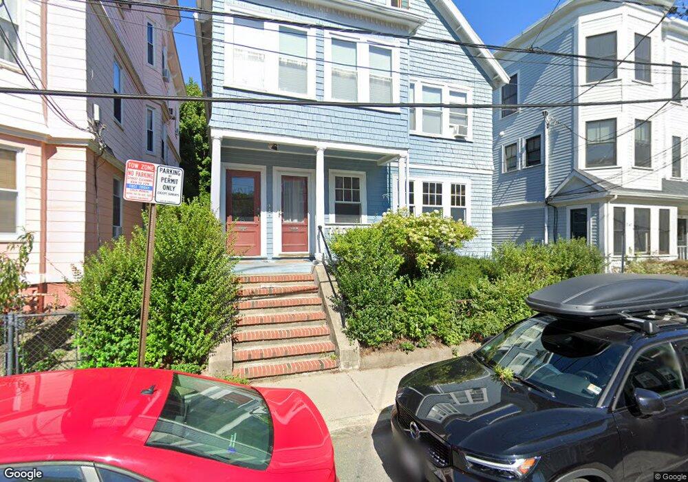
45 Prince St Unit 47 Cambridge, MA 02139
Cambridgeport NeighborhoodEstimated Value: $789,000 - $1,176,444
2
Beds
1
Bath
1,254
Sq Ft
$787/Sq Ft
Est. Value
About This Home
This home is located at 45 Prince St Unit 47, Cambridge, MA 02139 and is currently estimated at $987,361, approximately $787 per square foot. 45 Prince St Unit 47 is a home located in Middlesex County with nearby schools including Prospect Hill Academy Charter School and Boston University Academy.
Ownership History
Date
Name
Owned For
Owner Type
Purchase Details
Closed on
Jul 26, 2004
Sold by
Phillips Marilee K and Phillips Sarah T
Bought by
Kanapka Joseph D
Current Estimated Value
Purchase Details
Closed on
Jul 31, 1996
Sold by
Lischko Amy M
Bought by
Phillips Marilee
Purchase Details
Closed on
May 3, 1993
Sold by
Dime Sb Ny
Bought by
Lischko Amy M
Purchase Details
Closed on
Jan 28, 1993
Sold by
Barry John J
Bought by
Dime Sb Ny
Create a Home Valuation Report for This Property
The Home Valuation Report is an in-depth analysis detailing your home's value as well as a comparison with similar homes in the area
Home Values in the Area
Average Home Value in this Area
Purchase History
| Date | Buyer | Sale Price | Title Company |
|---|---|---|---|
| Kanapka Joseph D | $401,000 | -- | |
| Phillips Marilee | $155,000 | -- | |
| Lischko Amy M | $95,000 | -- | |
| Dime Sb Ny | $99,000 | -- |
Source: Public Records
Mortgage History
| Date | Status | Borrower | Loan Amount |
|---|---|---|---|
| Open | Dime Sb Ny | $276,000 | |
| Closed | Dime Sb Ny | $280,000 | |
| Closed | Dime Sb Ny | $299,500 |
Source: Public Records
Tax History Compared to Growth
Tax History
| Year | Tax Paid | Tax Assessment Tax Assessment Total Assessment is a certain percentage of the fair market value that is determined by local assessors to be the total taxable value of land and additions on the property. | Land | Improvement |
|---|---|---|---|---|
| 2025 | $6,151 | $968,600 | $0 | $968,600 |
| 2024 | $5,745 | $970,500 | $0 | $970,500 |
| 2023 | $5,425 | $925,800 | $0 | $925,800 |
| 2022 | $5,406 | $913,100 | $0 | $913,100 |
| 2021 | $5,264 | $899,800 | $0 | $899,800 |
| 2020 | $4,444 | $772,800 | $0 | $772,800 |
| 2019 | $4,263 | $717,600 | $0 | $717,600 |
| 2018 | $2,058 | $659,500 | $0 | $659,500 |
| 2017 | $4,017 | $619,000 | $0 | $619,000 |
| 2016 | $3,584 | $512,700 | $0 | $512,700 |
| 2015 | $3,548 | $453,700 | $0 | $453,700 |
| 2014 | $3,502 | $417,900 | $0 | $417,900 |
Source: Public Records
Map
Nearby Homes
- 214 Allston St
- 174 Hamilton St
- 1 Jay St
- 161 Hamilton St
- 131 Erie St Unit 3
- 131 Erie St
- 2 Hingham St
- 300 Franklin St Unit 5
- 300 Franklin St Unit 1
- 300 Franklin St Unit 2
- 6-8 Watson St Unit 8
- 8 Watson St Unit 8
- 260 Sidney St Unit 3R
- 127 Auburn St
- 129 Auburn St
- 515 Franklin St Unit 4
- 863 Massachusetts Ave Unit 25
- 950 Massachusetts Ave Unit 418
- 950 Massachusetts Ave Unit 504
- 950 Massachusetts Ave Unit 417
- 45 Prince St Unit 47
- 45 Prince St Unit 47
- 45 Prince St Unit 1
- 45 Prince St
- 57 Prince St
- 47 Prince St Unit 2
- 45-47 Prince St Unit 3
- 53 Prince St Unit 3
- 53 Prince St Unit 2
- 51 Prince St Unit 3
- 51 Prince St Unit 2
- 55 Prince St
- 49 Prince St
- 49 Prince St Unit 1,49
- 51 Prince St
- 55 Prince St Unit 1
- 41 Prince St Unit 3
- 41 Prince St Unit 2
- 41 Prince St Unit 1
- 39 Prince St Unit 3