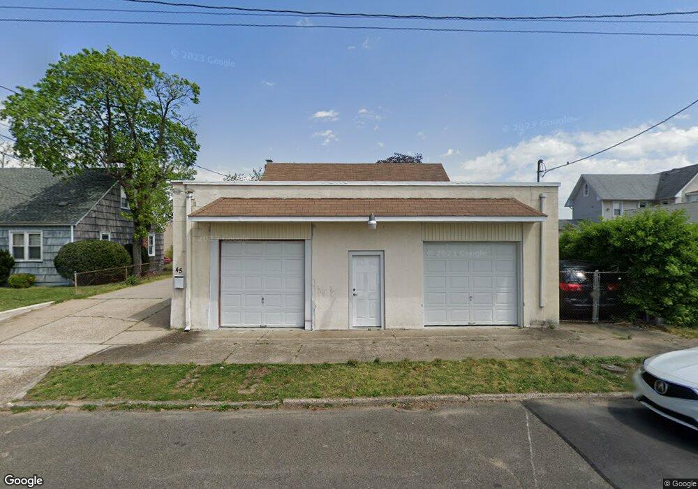
45 Pulaski Ave Riverside, NJ 08075
Riverside Township NeighborhoodEstimated Value: $297,000 - $409,000
--
Bed
--
Bath
1,417
Sq Ft
$243/Sq Ft
Est. Value
About This Home
This home is located at 45 Pulaski Ave, Riverside, NJ 08075 and is currently estimated at $344,363, approximately $243 per square foot. 45 Pulaski Ave is a home located in Burlington County with nearby schools including Riverside Elementary School, Riverside Middle School, and Riverside High School.
Ownership History
Date
Name
Owned For
Owner Type
Purchase Details
Closed on
Jul 9, 2007
Sold by
Conard George F and Conard Sharon Ann
Bought by
Da Costa Jose
Current Estimated Value
Home Financials for this Owner
Home Financials are based on the most recent Mortgage that was taken out on this home.
Original Mortgage
$157,500
Outstanding Balance
$98,340
Interest Rate
6.48%
Mortgage Type
Purchase Money Mortgage
Estimated Equity
$246,023
Purchase Details
Closed on
Sep 23, 2004
Sold by
Harding Robert N and Harding Joyce A
Bought by
Conrad George F and Conrad Sharon Ann
Home Financials for this Owner
Home Financials are based on the most recent Mortgage that was taken out on this home.
Original Mortgage
$108,000
Interest Rate
5.84%
Mortgage Type
Purchase Money Mortgage
Create a Home Valuation Report for This Property
The Home Valuation Report is an in-depth analysis detailing your home's value as well as a comparison with similar homes in the area
Home Values in the Area
Average Home Value in this Area
Purchase History
| Date | Buyer | Sale Price | Title Company |
|---|---|---|---|
| Da Costa Jose | $175,000 | None Available | |
| Conrad George F | $135,000 | Integrity Title Agency Inc |
Source: Public Records
Mortgage History
| Date | Status | Borrower | Loan Amount |
|---|---|---|---|
| Open | Da Costa Jose | $157,500 | |
| Previous Owner | Conrad George F | $108,000 |
Source: Public Records
Tax History Compared to Growth
Tax History
| Year | Tax Paid | Tax Assessment Tax Assessment Total Assessment is a certain percentage of the fair market value that is determined by local assessors to be the total taxable value of land and additions on the property. | Land | Improvement |
|---|---|---|---|---|
| 2025 | $7,026 | $171,200 | $42,900 | $128,300 |
| 2024 | $6,846 | $171,200 | $42,900 | $128,300 |
| 2023 | $6,846 | $171,200 | $42,900 | $128,300 |
| 2022 | $6,704 | $171,200 | $42,900 | $128,300 |
| 2021 | $6,632 | $171,200 | $42,900 | $128,300 |
| 2020 | $6,516 | $171,200 | $42,900 | $128,300 |
| 2019 | $6,417 | $171,200 | $42,900 | $128,300 |
| 2018 | $5,837 | $156,700 | $38,600 | $118,100 |
| 2017 | $5,680 | $156,700 | $38,600 | $118,100 |
| 2016 | $5,469 | $156,700 | $38,600 | $118,100 |
| 2015 | $5,364 | $156,700 | $38,600 | $118,100 |
| 2014 | $5,126 | $156,700 | $38,600 | $118,100 |
Source: Public Records
Map
Nearby Homes
- 18A Stewart Ave
- 117 S Chester Ave
- 116 Rancocas Ave
- 131 Lippincott Ave
- 133 Heulings Ave
- 18 Alden Ave
- 32 Alden Ave
- 114 Delaware Ave
- 227 Heulings Ave
- 629 Polk St
- 415 S Chester Ave
- 212 Madison St
- 300-302 Madison St
- 318 Chestnut St
- 423 Delaware Ave
- 0 Delaware Ave Unit NJBL2090486
- 304 Clay St
- 528 S Fairview St
- 702 Delaware Ave
- 14 Grant St
- 49 Pulaski Ave
- 437 Saint Mihiel Dr
- 430 Lincoln Ave
- 101 Pulaski Ave
- 426 Lincoln Ave
- 431 Saint Mihiel Dr Unit 102
- 424 Lincoln Ave
- 424 Apt B Lincoln Ave
- 46 Pulaski Ave
- 600 Lincoln Ave
- 613 Saint Mihiel Dr Unit 1
- 613 Saint Mihiel Dr
- 111 Pulaski Ave
- 100 Pulaski Ave
- 10 Pulaski Ave
- 103 Pulaski Ave
- 429 Saint Mihiel Dr Unit 40
- 604 Lincoln Ave Unit 606
- 603 Lincoln Ave
- 106 Pulaski Ave