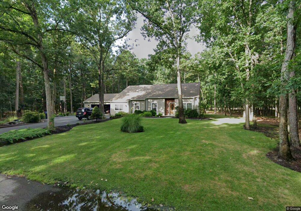
45 Red Oak Dr Tabernacle, NJ 08088
Estimated Value: $543,860 - $619,000
Studio
--
Bath
2,550
Sq Ft
$229/Sq Ft
Est. Value
About This Home
This home is located at 45 Red Oak Dr, Tabernacle, NJ 08088 and is currently estimated at $582,715, approximately $228 per square foot. 45 Red Oak Dr is a home located in Burlington County with nearby schools including Haines Memorial 6th Grade Center, Medford Township Memorial School, and Shawnee High School.
Ownership History
Date
Name
Owned For
Owner Type
Purchase Details
Closed on
Aug 15, 2005
Sold by
Gauntt Ronald L and Gauntt Karen G
Bought by
Pesarchick Steven J and Pesarchick Deborah
Current Estimated Value
Home Financials for this Owner
Home Financials are based on the most recent Mortgage that was taken out on this home.
Original Mortgage
$292,800
Outstanding Balance
$156,373
Interest Rate
5.92%
Mortgage Type
Fannie Mae Freddie Mac
Estimated Equity
$426,342
Create a Home Valuation Report for This Property
The Home Valuation Report is an in-depth analysis detailing your home's value as well as a comparison with similar homes in the area
Home Values in the Area
Average Home Value in this Area
Purchase History
| Date | Buyer | Sale Price | Title Company |
|---|---|---|---|
| Pesarchick Steven J | $366,000 | Ashlin Title Agency Inc |
Source: Public Records
Mortgage History
| Date | Status | Borrower | Loan Amount |
|---|---|---|---|
| Open | Pesarchick Steven J | $292,800 |
Source: Public Records
Tax History
| Year | Tax Paid | Tax Assessment Tax Assessment Total Assessment is a certain percentage of the fair market value that is determined by local assessors to be the total taxable value of land and additions on the property. | Land | Improvement |
|---|---|---|---|---|
| 2025 | $8,760 | $264,500 | $77,500 | $187,000 |
| 2024 | $8,025 | $264,500 | $77,500 | $187,000 |
| 2023 | $8,025 | $264,500 | $77,500 | $187,000 |
| 2022 | $7,782 | $264,500 | $77,500 | $187,000 |
| 2021 | $7,919 | $264,500 | $77,500 | $187,000 |
| 2020 | $8,022 | $264,500 | $77,500 | $187,000 |
| 2019 | $7,782 | $264,500 | $77,500 | $187,000 |
| 2018 | $7,639 | $264,500 | $77,500 | $187,000 |
| 2017 | $7,591 | $264,500 | $77,500 | $187,000 |
| 2016 | $7,356 | $264,500 | $77,500 | $187,000 |
| 2015 | $7,292 | $264,500 | $77,500 | $187,000 |
| 2014 | $7,004 | $264,500 | $77,500 | $187,000 |
Source: Public Records
Map
Nearby Homes
- 49 Magnolia Ln
- 10 Cutts Dr
- 43 Woodside Dr
- 326 Pricketts Mill Rd
- 52 Summit Dr
- 18 Forest Ln
- 45 Lakeview Dr
- 6 Horseshoe Ct
- 1533 Route 206
- 26 Glen Lake Dr
- 26 Tuckerton Rd
- 579 and 583 Tabernacle Rd
- 73 Flyatt Rd
- 32 Constitution Dr
- 5 Liberty Cir
- 114 Headwater Dr
- 1414 Stokes Rd
- 419 Oakshade Rd
- 19 Grande Blvd
- 12 Pendleton Ct
- 00 Eydon Ct
- 00 Kendal Dr
- 00 Route 70
- 0 Bilston Dr Unit 1000332269
- 00000 Langport Dr
- 5 a-b-c Stokes Rd
- 000 Hidden Creek Ct
- 0 Wharton Rd Unit 1007167930
- 000 Lake Dr
- 00 Broadview Dr
- L:17 01 Hawkin Rd
- 000 Derby Ct
- 000 Keswick Path
- 00000 Keswick Path
- 0 Langport Dr Unit 7062579
- 0 Langport Dr Unit 7057905
- 0 Doddington Blvd Unit 6277726
- 0 Doddington Blvd Unit 6277695
- 0 Doddington Blvd Unit 6277657
- 0 Doddington Blvd Unit 6277675