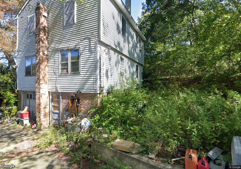
45 Route 2 Preston, CT 06365
Estimated Value: $306,323 - $422,000
3
Beds
2
Baths
1,378
Sq Ft
$258/Sq Ft
Est. Value
About This Home
This home is located at 45 Route 2, Preston, CT 06365 and is currently estimated at $355,581, approximately $258 per square foot. 45 Route 2 is a home located in New London County with nearby schools including Integrated Day Charter School, St. Joseph School, and St. Patrick Cathedral School.
Create a Home Valuation Report for This Property
The Home Valuation Report is an in-depth analysis detailing your home's value as well as a comparison with similar homes in the area
Home Values in the Area
Average Home Value in this Area
Tax History Compared to Growth
Tax History
| Year | Tax Paid | Tax Assessment Tax Assessment Total Assessment is a certain percentage of the fair market value that is determined by local assessors to be the total taxable value of land and additions on the property. | Land | Improvement |
|---|---|---|---|---|
| 2024 | $3,013 | $128,940 | $35,280 | $93,660 |
| 2023 | $2,959 | $128,940 | $35,280 | $93,660 |
| 2022 | $2,685 | $96,300 | $37,900 | $58,400 |
| 2021 | $2,594 | $96,300 | $37,900 | $58,400 |
| 2020 | $2,590 | $96,300 | $37,900 | $58,400 |
| 2019 | $2,545 | $96,300 | $37,900 | $58,400 |
| 2018 | $2,507 | $96,300 | $37,900 | $58,400 |
| 2017 | $2,369 | $98,700 | $33,600 | $65,100 |
| 2016 | $2,344 | $98,700 | $33,600 | $65,100 |
| 2015 | $2,270 | $98,700 | $33,600 | $65,100 |
| 2014 | $2,284 | $98,700 | $33,600 | $65,100 |
Source: Public Records
Map
Nearby Homes
- 105 Stonington Rd
- 278 Palmer Street Extension
- 21 Stonington Rd
- 3 Webster Dr
- 67 Corning Rd Unit 3
- 67 Corning Rd Unit 22
- 146 Route 2
- 40 Hammond Ave
- 168 Corning Rd
- 41 Palmer St Unit 22
- 79 Hamilton Ave
- 490 E Main St
- 478 E Main St
- 39 Tanner Ave
- 296 Hamilton Ave Unit 7
- 296 Hamilton Ave Unit 30
- 59 Harris Fuller Rd
- 445 E Main St
- 243 N Main St
- 98 N Main St