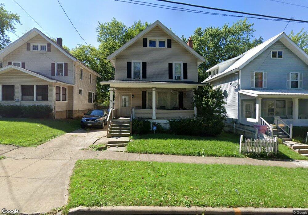
45 Rowland Ave Mansfield, OH 44903
Estimated Value: $72,000 - $91,000
3
Beds
2
Baths
1,634
Sq Ft
$52/Sq Ft
Est. Value
About This Home
This home is located at 45 Rowland Ave, Mansfield, OH 44903 and is currently estimated at $84,303, approximately $51 per square foot. 45 Rowland Ave is a home located in Richland County with nearby schools including Goal Digital Academy, Mansfield Elective Academy, and St. Peter's High School/Junior High.
Ownership History
Date
Name
Owned For
Owner Type
Purchase Details
Closed on
May 30, 2007
Sold by
Smith Sylvia J
Bought by
Wellington Takiyah M
Current Estimated Value
Home Financials for this Owner
Home Financials are based on the most recent Mortgage that was taken out on this home.
Original Mortgage
$48,415
Outstanding Balance
$29,673
Interest Rate
6.22%
Mortgage Type
Purchase Money Mortgage
Estimated Equity
$54,630
Purchase Details
Closed on
Apr 1, 1991
Sold by
Smith Adrian P
Bought by
Smith Sylvia J
Create a Home Valuation Report for This Property
The Home Valuation Report is an in-depth analysis detailing your home's value as well as a comparison with similar homes in the area
Home Values in the Area
Average Home Value in this Area
Purchase History
| Date | Buyer | Sale Price | Title Company |
|---|---|---|---|
| Wellington Takiyah M | $53,000 | Southern Title | |
| Smith Sylvia J | -- | -- |
Source: Public Records
Mortgage History
| Date | Status | Borrower | Loan Amount |
|---|---|---|---|
| Open | Wellington Takiyah M | $48,415 |
Source: Public Records
Tax History Compared to Growth
Tax History
| Year | Tax Paid | Tax Assessment Tax Assessment Total Assessment is a certain percentage of the fair market value that is determined by local assessors to be the total taxable value of land and additions on the property. | Land | Improvement |
|---|---|---|---|---|
| 2024 | $722 | $15,430 | $1,180 | $14,250 |
| 2023 | $722 | $15,430 | $1,180 | $14,250 |
| 2022 | $631 | $11,290 | $1,140 | $10,150 |
| 2021 | $635 | $11,290 | $1,140 | $10,150 |
| 2020 | $650 | $11,290 | $1,140 | $10,150 |
| 2019 | $720 | $11,290 | $1,140 | $10,150 |
| 2018 | $710 | $11,290 | $1,140 | $10,150 |
| 2017 | $725 | $11,290 | $1,140 | $10,150 |
| 2016 | $759 | $12,030 | $2,400 | $9,630 |
| 2015 | $759 | $12,030 | $2,400 | $9,630 |
| 2014 | $716 | $12,030 | $2,400 | $9,630 |
| 2012 | $287 | $12,670 | $2,530 | $10,140 |
Source: Public Records
Map
Nearby Homes
- 80 Rowland Ave
- 96 Helen Ave
- 38 Baldwin Ave
- 24 Stewart Ave S
- 37 Baldwin Ave
- 76 Bartley Ave
- 21 Glenwood Blvd
- 120 Gettings Place
- 88 Sherman Ave
- 611 Park Ave W
- 116 Penn Ave
- 406 Sherman Place
- 71 Glenwood Blvd
- 41 Parkwood Blvd
- 126 Dawson Ave
- 114 Vennum Ave
- 132 Sycamore St
- 118 Lind Ave
- 118 Parkwood Blvd
- 237 Helen Ave
- 47 Rowland Ave
- 41 Rowland Ave
- 507 W 3rd St
- 40 Rowland Ave
- 37 Rowland Ave
- 511 W 3rd St
- 31 Rowland Ave
- 50 Rowland Ave
- 50 Rowland Ave Unit 50.5 Rowland
- 50 Rowland Ave Unit 50 Rowland
- 59 Rowland Ave
- 36 Rowland Ave
- 42 Rowland Ave
- 46 Rowland Ave
- 38 Rowland Ave Unit 40
- 52 Rowland Ave Unit 56
- 500 Bissman Ct
- 63 Rowland Ave
- 497 Bissman Ct
- 508 Bissman Ct