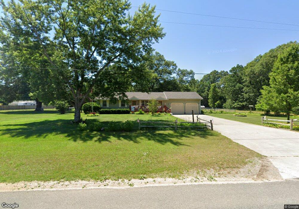
45 S Walker Rd Muskegon, MI 49442
Estimated Value: $295,000 - $402,000
3
Beds
3
Baths
1,422
Sq Ft
$231/Sq Ft
Est. Value
About This Home
This home is located at 45 S Walker Rd, Muskegon, MI 49442 and is currently estimated at $328,193, approximately $230 per square foot. 45 S Walker Rd is a home located in Muskegon County with nearby schools including Orchard View Early Elementary School, Cardinal Elementary School, and Orchard View Middle School.
Ownership History
Date
Name
Owned For
Owner Type
Purchase Details
Closed on
Mar 14, 2024
Sold by
Grant Brenda M
Bought by
Grant Brenda M and Brenda M Grant Trust
Current Estimated Value
Purchase Details
Closed on
Jan 15, 2016
Sold by
Grant Keith W
Bought by
Grant Brenda M
Purchase Details
Closed on
Dec 4, 2006
Sold by
Grant Keith W and Grant Brenda M
Bought by
Grant Keith and Grant Brenda
Home Financials for this Owner
Home Financials are based on the most recent Mortgage that was taken out on this home.
Original Mortgage
$115,000
Interest Rate
6.47%
Mortgage Type
New Conventional
Create a Home Valuation Report for This Property
The Home Valuation Report is an in-depth analysis detailing your home's value as well as a comparison with similar homes in the area
Home Values in the Area
Average Home Value in this Area
Purchase History
| Date | Buyer | Sale Price | Title Company |
|---|---|---|---|
| Grant Brenda M | -- | None Listed On Document | |
| Grant Brenda M | -- | None Available | |
| Grant Keith | -- | Harbor Title |
Source: Public Records
Mortgage History
| Date | Status | Borrower | Loan Amount |
|---|---|---|---|
| Previous Owner | Grant Keith | $115,000 |
Source: Public Records
Tax History Compared to Growth
Tax History
| Year | Tax Paid | Tax Assessment Tax Assessment Total Assessment is a certain percentage of the fair market value that is determined by local assessors to be the total taxable value of land and additions on the property. | Land | Improvement |
|---|---|---|---|---|
| 2025 | $2,956 | $140,100 | $0 | $0 |
| 2024 | $878 | $132,000 | $0 | $0 |
| 2023 | $840 | $116,400 | $0 | $0 |
| 2022 | $2,700 | $100,500 | $0 | $0 |
| 2021 | $2,629 | $91,800 | $0 | $0 |
| 2020 | $2,604 | $86,000 | $0 | $0 |
| 2019 | $2,577 | $81,000 | $0 | $0 |
| 2018 | $2,434 | $75,500 | $0 | $0 |
| 2017 | $2,384 | $74,200 | $0 | $0 |
| 2016 | $716 | $67,500 | $0 | $0 |
| 2015 | -- | $64,000 | $0 | $0 |
| 2014 | -- | $63,200 | $0 | $0 |
| 2013 | -- | $59,600 | $0 | $0 |
Source: Public Records
Map
Nearby Homes
- 123 Darwin Dr
- 16 S Densmore St
- 2770 Macarthur Rd
- 3110 Meyers Dr
- 30 S Sheridan Dr
- 3077 Macarthur Rd
- 328 Hazelwood Ct
- 2756 Marquette Ave
- VL Hazelwood Ct
- 3172 Hall Rd
- 415 S Densmore St
- 470 S Sheridan Dr
- 2369 James Ave
- 110 Willow Wood Dr
- 2034 Kristin Ct
- 2010 Kristin Ct
- 2022 Kristin Ct
- 3486 Polonaise Dr
- 687 S Sheridan Dr
- 640 West St