45 Sassafrass Way Unit 202 Carrollton, GA 30116
Estimated payment $4,261/month
Total Views
14,815
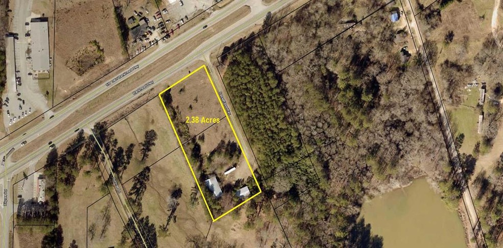
2.38
Acres
$327,731
Price per Acre
103,673
Sq Ft Lot
Highlights
- 2.38 Acre Lot
- Central Elementary School Rated A
- Gentle Sloping Lot
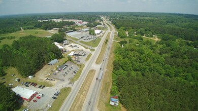
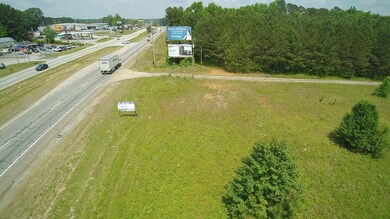
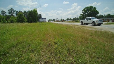
About This Lot
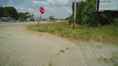
Prime Road Frontage, Approx. 2.38 Acres in the City Limits. All Utilities are Available. More Land is Available to Increase the Property. This is Available upon Request.
Listing Agent
Metro West Realty Brokerage Phone: 7708360042 License #202437 Listed on: 05/27/2021
Property Details
Property Type
- Land
Est. Annual Taxes
- $1,707
Lot Details
- 2.38 Acre Lot
- Property fronts a highway
- Gentle Sloping Lot
- Zoning described as Commercial
Schools
- Carrollton City Elementary And Middle School
- Carrollton City High School
Utilities
- Phone Available
Listing and Financial Details
- Tax Lot 202
- Assessor Parcel Number C05 0310068
Map
Create a Home Valuation Report for This Property
The Home Valuation Report is an in-depth analysis detailing your home's value as well as a comparison with similar homes in the area
Home Values in the Area
Average Home Value in this Area
Tax History
| Year | Tax Paid | Tax Assessment Tax Assessment Total Assessment is a certain percentage of the fair market value that is determined by local assessors to be the total taxable value of land and additions on the property. | Land | Improvement |
|---|---|---|---|---|
| 2024 | $1,707 | $62,482 | $13,620 | $48,862 |
| 2023 | $1,707 | $46,889 | $13,620 | $33,269 |
| 2022 | $1,111 | $38,049 | $13,620 | $24,429 |
| 2021 | $1,111 | $38,049 | $13,620 | $24,429 |
| 2020 | $1,112 | $38,049 | $13,620 | $24,429 |
| 2019 | $1,122 | $38,049 | $13,620 | $24,429 |
| 2018 | $1,079 | $36,058 | $13,620 | $22,438 |
| 2017 | $1,085 | $36,058 | $13,620 | $22,438 |
| 2016 | $1,515 | $50,074 | $30,800 | $19,274 |
| 2015 | $1,547 | $50,073 | $30,800 | $19,274 |
| 2014 | $1,553 | $50,074 | $30,800 | $19,274 |
Source: Public Records
Property History
| Date | Event | Price | List to Sale | Price per Sq Ft |
|---|---|---|---|---|
| 11/21/2025 11/21/25 | Price Changed | $780,000 | +7.6% | -- |
| 06/05/2025 06/05/25 | Price Changed | $725,000 | -3.3% | -- |
| 05/27/2021 05/27/21 | For Sale | $750,000 | -- | -- |
Source: West Metro Board of REALTORS®
Purchase History
| Date | Type | Sale Price | Title Company |
|---|---|---|---|
| Deed | $700 | -- | |
| Deed | $700 | -- | |
| Deed | $700 | -- |
Source: Public Records
Source: West Metro Board of REALTORS®
MLS Number: 140935
APN: C05-0310068
Nearby Homes
- 180 Sunrise Ln
- 180 Sunrise Ln Unit 183
- 1711B Bankhead Hwy
- 802 Folds Rd
- 211 Greystone Dr
- 912 Folds Rd
- 255 Morgan Rd
- 367 Frashier Rd
- 3 Burns Rd
- 2 Burns Rd
- 223 N Lakeshore Dr
- 00 Old Airport Rd
- 0 Carroll Cir- Lots 4-8 Unit 148012
- 231 N Lakeshore Dr
- The McGinnis Plan at Morgan Landing
- 204 Burns Rd
- 206 Asher Dr
- 105 Providence Ct
- 150 Cedar Park Way
- 0 Old Airport Rd Unit 10599783
- 162 Poplar Point Dr
- 717 Burns Rd
- 25 Quail Trail Unit 29
- 95 Quail Hollow Dr
- 200 Bledsoe St
- 2325 Shady Grove Rd Unit A
- 2325 Shady Grove Rd Unit B
- 300 Bledsoe St
- 107 Robinson Ave
- 124-125 Williams St
- 250 Northwinds Blvd
- 545 Spring St
- 45 Pleasure Dr
- 130 Waverly Way
- 1126 Maple St
- 123 Beulah Church Rd
- 114 Danny Dr
- 333 Foster St
- 1205 Maple St
- 201 Hays Mill Rd
