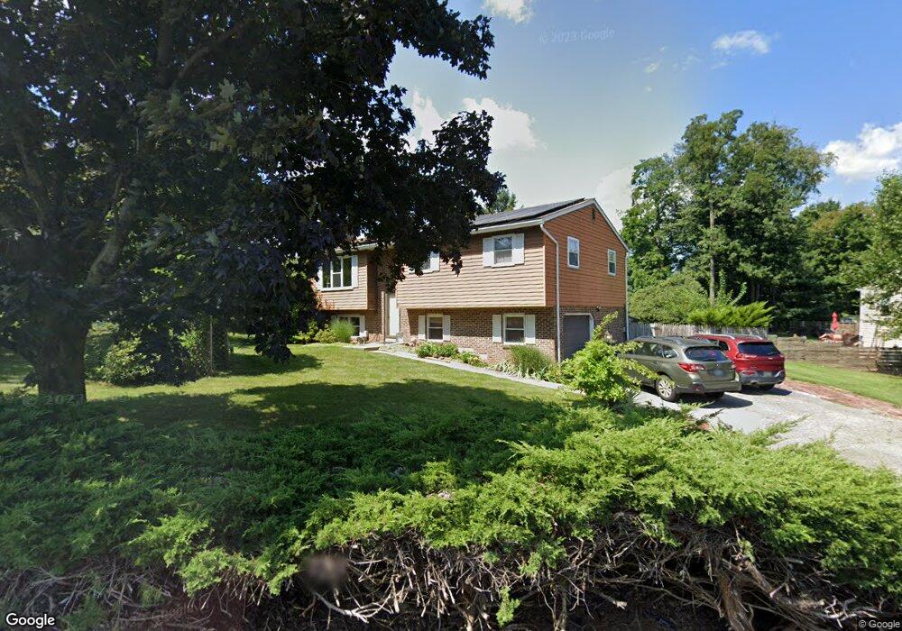
45 Shamrock Ln Etters, PA 17319
Estimated Value: $258,000 - $345,000
3
Beds
2
Baths
1,836
Sq Ft
$167/Sq Ft
Est. Value
About This Home
This home is located at 45 Shamrock Ln, Etters, PA 17319 and is currently estimated at $306,709, approximately $167 per square foot. 45 Shamrock Ln is a home located in York County with nearby schools including Red Mill Elementary School, Crossroads Middle School, and Red Land Senior High School.
Ownership History
Date
Name
Owned For
Owner Type
Purchase Details
Closed on
Aug 27, 2007
Sold by
Laird Cheryl A
Bought by
Quigley Thomas W and Quigley Ann L
Current Estimated Value
Home Financials for this Owner
Home Financials are based on the most recent Mortgage that was taken out on this home.
Original Mortgage
$168,667
Outstanding Balance
$107,932
Interest Rate
6.78%
Mortgage Type
FHA
Estimated Equity
$198,777
Purchase Details
Closed on
Aug 12, 2003
Sold by
Laird Cheryl A and Laird Heath
Bought by
Laird Cheryl A
Purchase Details
Closed on
Mar 28, 2001
Sold by
Pupek George D and Pupek Sherry A
Bought by
Pupek Sherry A
Home Financials for this Owner
Home Financials are based on the most recent Mortgage that was taken out on this home.
Original Mortgage
$82,900
Interest Rate
6.85%
Create a Home Valuation Report for This Property
The Home Valuation Report is an in-depth analysis detailing your home's value as well as a comparison with similar homes in the area
Home Values in the Area
Average Home Value in this Area
Purchase History
| Date | Buyer | Sale Price | Title Company |
|---|---|---|---|
| Quigley Thomas W | $170,000 | None Available | |
| Laird Cheryl A | -- | -- | |
| Pupek Sherry A | -- | -- |
Source: Public Records
Mortgage History
| Date | Status | Borrower | Loan Amount |
|---|---|---|---|
| Open | Quigley Thomas W | $168,667 | |
| Previous Owner | Pupek Sherry A | $82,900 |
Source: Public Records
Tax History Compared to Growth
Tax History
| Year | Tax Paid | Tax Assessment Tax Assessment Total Assessment is a certain percentage of the fair market value that is determined by local assessors to be the total taxable value of land and additions on the property. | Land | Improvement |
|---|---|---|---|---|
| 2025 | $3,550 | $128,140 | $32,470 | $95,670 |
| 2024 | $4,640 | $128,140 | $32,470 | $95,670 |
| 2023 | $3,173 | $128,140 | $32,470 | $95,670 |
| 2022 | $3,163 | $128,140 | $32,470 | $95,670 |
| 2021 | $2,981 | $128,140 | $32,470 | $95,670 |
| 2020 | $2,946 | $128,140 | $32,470 | $95,670 |
| 2019 | $2,871 | $128,140 | $32,470 | $95,670 |
| 2018 | $2,848 | $128,140 | $32,470 | $95,670 |
| 2017 | $2,771 | $128,140 | $32,470 | $95,670 |
| 2016 | $0 | $128,140 | $32,470 | $95,670 |
| 2015 | -- | $128,140 | $32,470 | $95,670 |
| 2014 | -- | $128,140 | $32,470 | $95,670 |
Source: Public Records
Map
Nearby Homes
- 321 Juniper Dr
- 300 Juniper Dr
- 30 Highland Cir
- 244 Juniper Dr
- 200 Juniper Dr
- 25 Mulligan Dr
- 25 Killinger Rd
- 10 Fargreen Ct Unit 1E
- 60 S Ben Hogan Dr
- 28 White Dogwood Dr
- 60 Red Barberry Dr
- 300 Valley Rd
- 73 Rose of Sharon Dr
- 0 Vista Cir
- 45 Red Barberry Dr
- 2 Russian Olive Dr
- 24 Rose of Sharon Dr
- 322 Valley Rd
- Lot 48 Scarlet Oak Dr
- Lot 29 Scarlet Oak Dr
- 35 Shamrock Ln
- 45 Burning Brush Cir
- 35 Burning Brush Cir
- 25 Shamrock Ln
- 50 Burning Brush Cir
- 40 Shamrock Ln
- 55 Burning Brush Cir
- 30 Burning Brush Cir
- 25 Burning Brush Cir
- 30 Shamrock Ln
- 65 Sugar Maple Dr
- 75 Sugar Maple Dr
- 15 Shamrock Ln
- 55 Sugar Maple Dr
- 65 Burning Brush Cir
- 85 Sugar Maple Dr
- 60 Burning Brush Cir
- 20 Shamrock Ln
- 20 Burning Brush Cir
- 45 Sugar Maple Dr