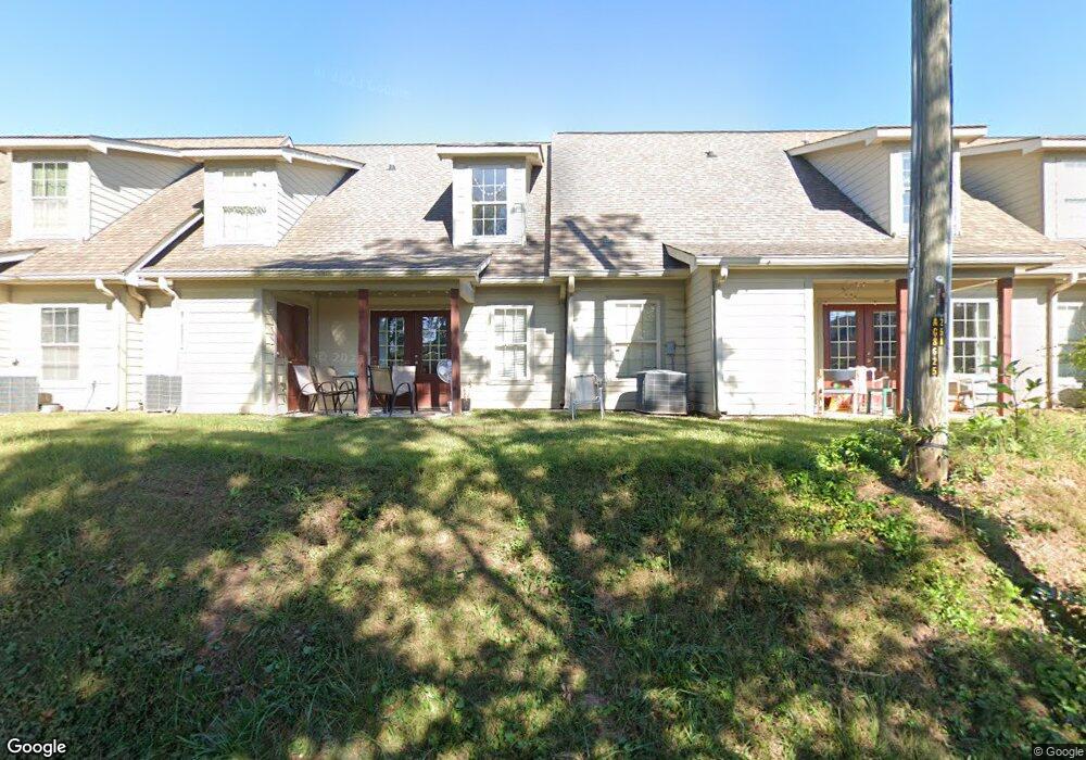
45 Sims Ct Dahlonega, GA 30533
Estimated Value: $231,000 - $407,000
4
Beds
2
Baths
2,128
Sq Ft
$152/Sq Ft
Est. Value
About This Home
This home is located at 45 Sims Ct, Dahlonega, GA 30533 and is currently estimated at $323,994, approximately $152 per square foot. 45 Sims Ct is a home located in Lumpkin County with nearby schools including Clay County Middle School and Lumpkin County High School.
Ownership History
Date
Name
Owned For
Owner Type
Purchase Details
Closed on
Sep 22, 2021
Sold by
Patriot Home Buyers
Bought by
Organ John and Organ Norvel
Current Estimated Value
Home Financials for this Owner
Home Financials are based on the most recent Mortgage that was taken out on this home.
Original Mortgage
$140,000
Interest Rate
2.8%
Mortgage Type
New Conventional
Purchase Details
Closed on
Dec 3, 2001
Sold by
Costello Aligene A
Bought by
Costello Aligene A
Purchase Details
Closed on
Sep 28, 1993
Sold by
Thomas J
Bought by
Costello Aligene A
Create a Home Valuation Report for This Property
The Home Valuation Report is an in-depth analysis detailing your home's value as well as a comparison with similar homes in the area
Home Values in the Area
Average Home Value in this Area
Purchase History
| Date | Buyer | Sale Price | Title Company |
|---|---|---|---|
| Organ John | $190,000 | -- | |
| Patriot Homes Buyers | $175,000 | -- | |
| Costello Aligene A | -- | -- | |
| Costello Aligene A | $22,000 | -- |
Source: Public Records
Mortgage History
| Date | Status | Borrower | Loan Amount |
|---|---|---|---|
| Closed | Patriot Homes Buyers | $140,000 |
Source: Public Records
Tax History Compared to Growth
Tax History
| Year | Tax Paid | Tax Assessment Tax Assessment Total Assessment is a certain percentage of the fair market value that is determined by local assessors to be the total taxable value of land and additions on the property. | Land | Improvement |
|---|---|---|---|---|
| 2024 | $1,997 | $69,874 | $12,000 | $57,874 |
| 2023 | $2,816 | $97,703 | $12,000 | $85,703 |
| 2022 | $2,322 | $91,107 | $12,000 | $79,107 |
| 2021 | $2,291 | $70,224 | $12,000 | $58,224 |
| 2020 | $2,321 | $68,496 | $12,000 | $56,496 |
| 2019 | $2,333 | $68,496 | $12,000 | $56,496 |
| 2018 | $2,245 | $61,676 | $12,000 | $49,676 |
| 2017 | $2,232 | $60,294 | $12,000 | $48,294 |
| 2016 | $2,111 | $55,789 | $12,000 | $43,789 |
| 2015 | $1,846 | $55,789 | $12,000 | $43,789 |
| 2014 | $1,846 | $57,019 | $12,000 | $45,019 |
| 2013 | -- | $58,248 | $12,000 | $46,248 |
Source: Public Records
Map
Nearby Homes
- 95 Jones St
- 0 S Chestatee St Unit 10619536
- 399 N Chestatee St
- 315 Church St
- 168 W Main St
- 1392 S Chestatee St
- 502 Wimpy Mill Rd
- 329 Morrison Moore Pkwy E
- 6480A Highway 52
- 120 Riley Rd
- 94 Mountain View Dr
- 0 Highway 60 Unit 7241582
- 0 Highway 9 S Unit 10487179
- 0 Highway 9 S Unit 7548614
- 0 Calhoun Rd Unit 7643314
- 0 Calhoun Rd Unit 10598012
- 00 Calhoun Rd
- 97 Beaumont Dr
- 0 Alicia Ln
- 490 N Hall Rd
- 66 Wimpy Mill Rd
- 10 Hawkins St
- 22 Honeysuckle Ln
- 0 Boyd Cir Unit 7227942
- 0 Boyd Cir Unit A
- 119B Boyd Cir
- 119B Boyd Cir Unit 119B
- 0 Hawkins St Unit 10.6+/-AC 7499061
- 0 Hawkins St
- 154 Grove St N
- 74 Grove St N
- N N Grove St Unit B C D E F
- N N Grove St
- 174 Grove St N
- 119A Boyd Cir
- 119 Boyd Cir
- 119 Boyd Cir Unit D
- 119 Boyd Cir Unit J
- 119 Boyd Cir Unit I
- 119 Boyd Cir Unit H