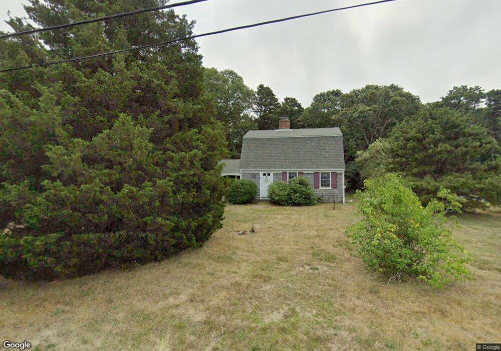
45 Sparrowhawk Ln Eastham, MA 02642
Estimated Value: $644,000 - $786,000
3
Beds
2
Baths
1,501
Sq Ft
$477/Sq Ft
Est. Value
About This Home
This home is located at 45 Sparrowhawk Ln, Eastham, MA 02642 and is currently estimated at $716,269, approximately $477 per square foot. 45 Sparrowhawk Ln is a home located in Barnstable County with nearby schools including Eastham Elementary School, Nauset Regional Middle School, and Nauset Regional High School.
Ownership History
Date
Name
Owned For
Owner Type
Purchase Details
Closed on
Dec 29, 2016
Sold by
Sittard Paul A
Bought by
Ln Sittard Sparrowhawk
Current Estimated Value
Purchase Details
Closed on
Dec 3, 1993
Sold by
Cheney G William and Tolisano Jana M
Bought by
Sittand Allan E and Sittand Dorothy L
Home Financials for this Owner
Home Financials are based on the most recent Mortgage that was taken out on this home.
Original Mortgage
$98,000
Interest Rate
6.69%
Mortgage Type
Purchase Money Mortgage
Create a Home Valuation Report for This Property
The Home Valuation Report is an in-depth analysis detailing your home's value as well as a comparison with similar homes in the area
Home Values in the Area
Average Home Value in this Area
Purchase History
| Date | Buyer | Sale Price | Title Company |
|---|---|---|---|
| Ln Sittard Sparrowhawk | -- | -- | |
| Sittand Allan E | $122,500 | -- |
Source: Public Records
Mortgage History
| Date | Status | Borrower | Loan Amount |
|---|---|---|---|
| Previous Owner | Sittand Allan E | $98,000 |
Source: Public Records
Tax History Compared to Growth
Tax History
| Year | Tax Paid | Tax Assessment Tax Assessment Total Assessment is a certain percentage of the fair market value that is determined by local assessors to be the total taxable value of land and additions on the property. | Land | Improvement |
|---|---|---|---|---|
| 2025 | $4,302 | $558,000 | $266,700 | $291,300 |
| 2024 | $3,798 | $541,800 | $258,900 | $282,900 |
| 2023 | $3,495 | $482,800 | $239,700 | $243,100 |
| 2022 | $3,333 | $388,500 | $214,000 | $174,500 |
| 2021 | $3,241 | $353,100 | $194,500 | $158,600 |
| 2020 | $3,026 | $347,000 | $198,600 | $148,400 |
| 2019 | $2,780 | $337,000 | $192,800 | $144,200 |
| 2018 | $2,733 | $327,300 | $187,200 | $140,100 |
| 2017 | $2,534 | $320,800 | $183,500 | $137,300 |
| 2016 | $2,423 | $325,700 | $183,500 | $142,200 |
| 2015 | $2,235 | $314,800 | $179,900 | $134,900 |
Source: Public Records
Map
Nearby Homes
- 115 Sparrowhawk Ln
- 10 Hoyer Ln Unit A
- 390 Brackett Rd
- 72 Dory Ln
- 1895 Nauset Rd
- 35 Old County Rd Unit 1
- 95 Toland Dr
- 160 Toland Dr
- 100 Thoreau Dr
- 5470 State Hwy
- 255 Massasoit Rd
- 495 Aspinet Rd
- 10 Bradford Ln
- 50 Silver Oak Rd
- 125 Wamsutta Rd
- 100 Gigi Ln
- 1285 Massasoit Rd
- 60 Briggs Field Rd
- 30 Mayflower Rd
- 1460 Massasoit Rd
- 65 Sparrowhawk Ln
- 65 Sparrow Hawk Ln
- 25 Sparrowhawk Ln
- 30 Sparrowhawk Ln
- 50 Sparrowhawk Ln
- 1185 Old Orchard Rd
- 80 Sparrowhawk Ln
- 95 Sparrowhawk Ln
- 2425 Nauset Rd
- 1180 Old Orchard Rd
- 1165 Old Orchard Rd
- 2345 Nauset Rd
- 100 Sparrowhawk Ln
- 1160 Old Orchard Rd
- 2390 Nauset Rd
- 2455 Nauset Rd
- 2350 Nauset Rd
- 60 Wonderstrand Way
- 130 Sparrowhawk Ln
- 30 Wonderstrand Way