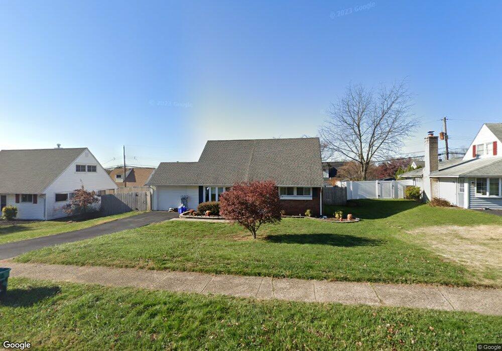
45 Towpath Rd Levittown, PA 19056
Estimated Value: $398,387 - $429,000
3
Beds
2
Baths
1,275
Sq Ft
$326/Sq Ft
Est. Value
About This Home
This home is located at 45 Towpath Rd, Levittown, PA 19056 and is currently estimated at $415,347, approximately $325 per square foot. 45 Towpath Rd is a home located in Bucks County with nearby schools including Pearl S. Buck Elementary School, Maple Point Middle School, and Neshaminy High School.
Ownership History
Date
Name
Owned For
Owner Type
Purchase Details
Closed on
Jul 29, 2009
Sold by
Harris Angela M
Bought by
Modes Karen
Current Estimated Value
Home Financials for this Owner
Home Financials are based on the most recent Mortgage that was taken out on this home.
Original Mortgage
$150,000
Outstanding Balance
$98,893
Interest Rate
5.43%
Mortgage Type
New Conventional
Estimated Equity
$316,454
Create a Home Valuation Report for This Property
The Home Valuation Report is an in-depth analysis detailing your home's value as well as a comparison with similar homes in the area
Home Values in the Area
Average Home Value in this Area
Purchase History
| Date | Buyer | Sale Price | Title Company |
|---|---|---|---|
| Modes Karen | $245,000 | None Available |
Source: Public Records
Mortgage History
| Date | Status | Borrower | Loan Amount |
|---|---|---|---|
| Open | Modes Karen | $150,000 |
Source: Public Records
Tax History Compared to Growth
Tax History
| Year | Tax Paid | Tax Assessment Tax Assessment Total Assessment is a certain percentage of the fair market value that is determined by local assessors to be the total taxable value of land and additions on the property. | Land | Improvement |
|---|---|---|---|---|
| 2025 | $4,093 | $18,800 | $4,320 | $14,480 |
| 2024 | $4,093 | $18,800 | $4,320 | $14,480 |
| 2023 | $4,028 | $18,800 | $4,320 | $14,480 |
| 2022 | $3,922 | $18,800 | $4,320 | $14,480 |
| 2021 | $3,922 | $18,800 | $4,320 | $14,480 |
| 2020 | $3,875 | $18,800 | $4,320 | $14,480 |
| 2019 | $3,789 | $18,800 | $4,320 | $14,480 |
| 2018 | $3,719 | $18,800 | $4,320 | $14,480 |
| 2017 | $3,624 | $18,800 | $4,320 | $14,480 |
| 2016 | $3,624 | $18,800 | $4,320 | $14,480 |
| 2015 | $3,813 | $18,800 | $4,320 | $14,480 |
| 2014 | $3,813 | $18,800 | $4,320 | $14,480 |
Source: Public Records
Map
Nearby Homes