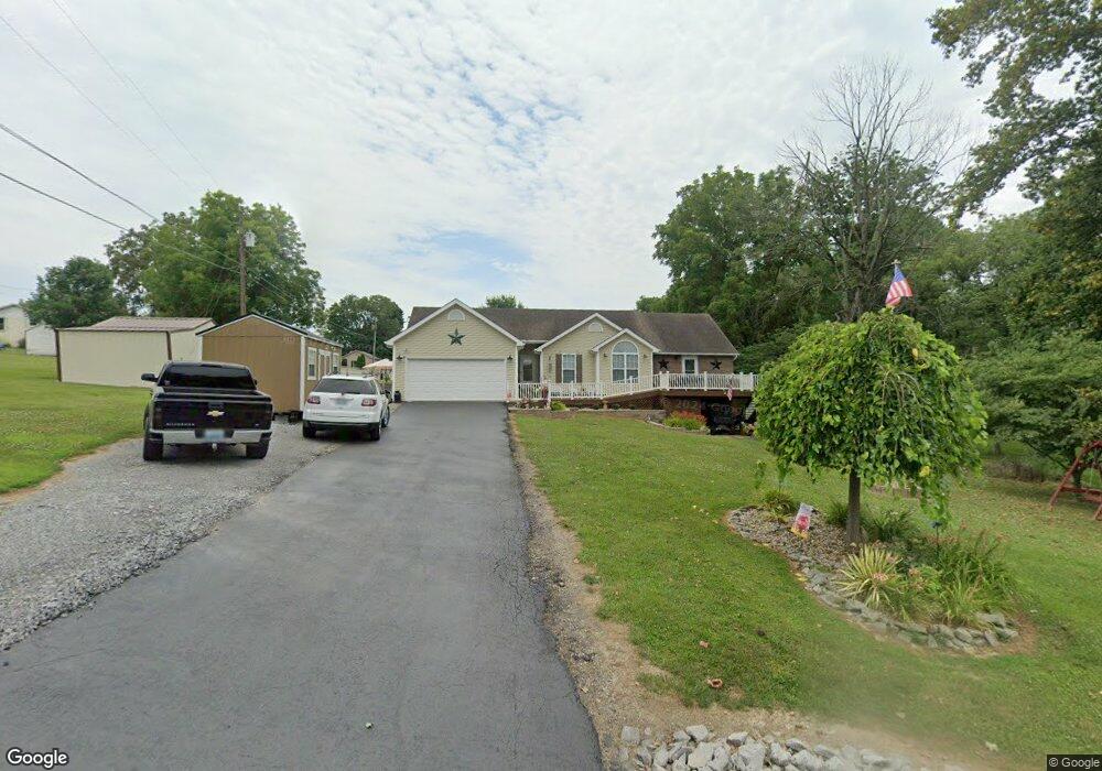
45 Willies Dr Columbia, KY 42728
Estimated Value: $192,000 - $257,000
3
Beds
2
Baths
1,100
Sq Ft
$197/Sq Ft
Est. Value
About This Home
This home is located at 45 Willies Dr, Columbia, KY 42728 and is currently estimated at $217,063, approximately $197 per square foot. 45 Willies Dr is a home located in Adair County with nearby schools including Colonel William Casey Elementary School, Adair County Elementary School, and Adair County Middle School.
Ownership History
Date
Name
Owned For
Owner Type
Purchase Details
Closed on
Mar 28, 2022
Sold by
Sneed and Amanda
Bought by
Pearson Ashley M
Current Estimated Value
Purchase Details
Closed on
Jan 7, 2021
Sold by
Sneed Charlene and Sneed Randall
Bought by
Sneed Randall and Sneed Amanda
Purchase Details
Closed on
Dec 4, 2019
Sold by
Egbert Edythe A
Bought by
Sneed Randall Clayton and Sneed Amanda
Home Financials for this Owner
Home Financials are based on the most recent Mortgage that was taken out on this home.
Original Mortgage
$138,446
Interest Rate
3.7%
Mortgage Type
FHA
Purchase Details
Closed on
Jul 24, 2008
Sold by
Karnes Lilburn Wayne and Karnes Martha Jane
Bought by
Willis Bobby W and Egbert Edythe A
Create a Home Valuation Report for This Property
The Home Valuation Report is an in-depth analysis detailing your home's value as well as a comparison with similar homes in the area
Home Values in the Area
Average Home Value in this Area
Purchase History
| Date | Buyer | Sale Price | Title Company |
|---|---|---|---|
| Pearson Ashley M | $118,500 | None Listed On Document | |
| Sneed Randall | $5,000 | None Available | |
| Sneed Randall Clayton | $141,000 | None Available | |
| Willis Bobby W | $78,000 | None Available |
Source: Public Records
Mortgage History
| Date | Status | Borrower | Loan Amount |
|---|---|---|---|
| Previous Owner | Sneed Randall Clayton | $138,446 |
Source: Public Records
Tax History Compared to Growth
Tax History
| Year | Tax Paid | Tax Assessment Tax Assessment Total Assessment is a certain percentage of the fair market value that is determined by local assessors to be the total taxable value of land and additions on the property. | Land | Improvement |
|---|---|---|---|---|
| 2024 | $1,597 | $141,000 | $11,000 | $130,000 |
| 2023 | $1,624 | $141,000 | $11,000 | $130,000 |
| 2022 | $1,590 | $141,000 | $11,000 | $130,000 |
| 2021 | $1,625 | $141,000 | $11,000 | $130,000 |
| 2020 | $1,598 | $141,000 | $11,000 | $130,000 |
| 2019 | $436 | $78,000 | $78,000 | $0 |
| 2018 | $459 | $78,000 | $78,000 | $0 |
| 2017 | $457 | $78,000 | $78,000 | $0 |
| 2016 | $453 | $78,000 | $78,000 | $0 |
| 2015 | $725 | $78,000 | $78,000 | $0 |
| 2013 | $725 | $78,000 | $78,000 | $0 |
Source: Public Records
Map
Nearby Homes
- 1692 Liberty Rd
- 3424 Russell Springs Rd
- 775 Conover Ln
- 751 Conover Ln
- 188 Royal Oaks Rd
- 178 Royal Oaks Rd
- 12460 Liberty Rd
- 2009 Liberty Rd
- 198 New Concord Rd
- 310 Adair Ave
- 110 College Park
- 106 College Park
- 406 Oak St
- 431 Wain St
- 425 Wain St
- 603 Jamestown St
- 601 Jamestown St
- 202 E Guardian St
- 401 Tutt St Unit Tract 2
- 401 Tutt St
