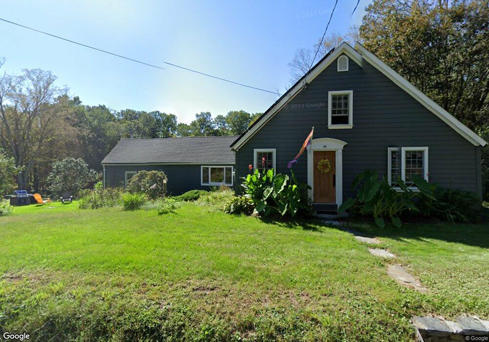
45 Wormwood Hill Rd Mansfield Center, CT 06250
Estimated Value: $367,556 - $418,000
4
Beds
2
Baths
1,613
Sq Ft
$251/Sq Ft
Est. Value
About This Home
This home is located at 45 Wormwood Hill Rd, Mansfield Center, CT 06250 and is currently estimated at $404,389, approximately $250 per square foot. 45 Wormwood Hill Rd is a home located in Tolland County with nearby schools including Mansfield Elementary School, Mansfield Middle School, and E.O. Smith High School.
Ownership History
Date
Name
Owned For
Owner Type
Purchase Details
Closed on
Apr 26, 1999
Sold by
Knipper Michael and Knipper Morysal
Bought by
Wells Simon and Wells Cynthia
Current Estimated Value
Purchase Details
Closed on
Jul 29, 1996
Sold by
Solli George and Solli Carol
Bought by
Knipper Michael and Knipper Marysal
Create a Home Valuation Report for This Property
The Home Valuation Report is an in-depth analysis detailing your home's value as well as a comparison with similar homes in the area
Home Values in the Area
Average Home Value in this Area
Purchase History
| Date | Buyer | Sale Price | Title Company |
|---|---|---|---|
| Wells Simon | $120,000 | -- | |
| Wells Simon | $120,000 | -- | |
| Knipper Michael | $95,000 | -- | |
| Knipper Michael | $95,000 | -- |
Source: Public Records
Mortgage History
| Date | Status | Borrower | Loan Amount |
|---|---|---|---|
| Closed | Knipper Michael | $30,000 | |
| Open | Knipper Michael | $130,000 |
Source: Public Records
Tax History Compared to Growth
Tax History
| Year | Tax Paid | Tax Assessment Tax Assessment Total Assessment is a certain percentage of the fair market value that is determined by local assessors to be the total taxable value of land and additions on the property. | Land | Improvement |
|---|---|---|---|---|
| 2025 | $4,060 | $203,000 | $60,100 | $142,900 |
| 2024 | $4,920 | $161,200 | $56,400 | $104,800 |
| 2023 | $5,081 | $161,200 | $56,400 | $104,800 |
| 2022 | $4,897 | $161,200 | $56,400 | $104,800 |
| 2021 | $5,058 | $161,200 | $56,400 | $104,800 |
| 2020 | $5,058 | $161,200 | $56,400 | $104,800 |
| 2019 | $4,465 | $142,300 | $59,300 | $83,000 |
| 2018 | $4,394 | $142,300 | $59,300 | $83,000 |
| 2017 | $4,359 | $142,300 | $59,300 | $83,000 |
| 2016 | $4,068 | $142,300 | $59,300 | $83,000 |
| 2015 | $4,068 | $136,200 | $59,300 | $76,900 |
| 2014 | $4,402 | $157,500 | $64,400 | $93,100 |
Source: Public Records
Map
Nearby Homes
- 368 Warrenville Rd
- 241 Wormwood Hill Rd
- 67 Mulberry Rd
- 934 Storrs Rd
- 412 Storrs Rd
- 408 Storrs Rd
- 69 N Bedlam Rd
- 985 Storrs Rd
- 124 Spring Hill Rd
- 140 Federal Rd
- 48 Monticello Ln
- 0 Mansfield City Rd Unit LOT 2
- 283 Tower Hill Rd
- 39 Jacobs Hill Rd
- 0 Hampton Rd Unit 170523717
- 17 Jacqueline Ln
- 29 Stone Gate Dr
- 685 Wormwood Hill Rd
- 144 Phoenixville Rd
- 34 Pond Way
- 31 Wormwood Hill Rd
- 40 Wormwood Hill Rd
- 50 Wormwood Hill Rd
- 27 Wormwood Hill Rd
- 58 Wormwood Hill Rd
- 28 Wormwood Hill Rd
- 21 Wormwood Hill Rd
- 267 Warrenville Rd
- 63 Wormwood Hill Rd
- 12 Wormwood Hill Rd
- 8 Wormwood Hill Rd
- 250 Warrenville Rd
- 7 Wormwood Hill Rd
- 72 Wormwood Hill Rd
- 9 Wormwood Hill Rd
- 6 Wormwood Hill Rd
- 59 Wormwood Hill Rd
- 91 Wormwood Hill Rd
- 268 Warrenville Rd
- 256 Warrenville Rd