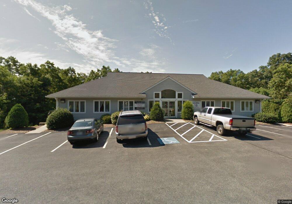
450 Chauncy St Unit 5 Mansfield, MA 02048
Estimated Value: $202,357
--
Bed
--
Bath
1,092
Sq Ft
$185/Sq Ft
Est. Value
About This Home
This home is located at 450 Chauncy St Unit 5, Mansfield, MA 02048 and is currently estimated at $202,357, approximately $185 per square foot. 450 Chauncy St Unit 5 is a home located in Bristol County with nearby schools including Everett W. Robinson Elementary School, Jordan/Jackson Elementary School, and Harold L. Qualters Middle School.
Ownership History
Date
Name
Owned For
Owner Type
Purchase Details
Closed on
Dec 11, 2002
Sold by
Abbott Geraldine A
Bought by
Pickett & Barrett Llc
Current Estimated Value
Home Financials for this Owner
Home Financials are based on the most recent Mortgage that was taken out on this home.
Original Mortgage
$323,000
Outstanding Balance
$138,045
Interest Rate
6.17%
Mortgage Type
Commercial
Estimated Equity
$64,312
Create a Home Valuation Report for This Property
The Home Valuation Report is an in-depth analysis detailing your home's value as well as a comparison with similar homes in the area
Home Values in the Area
Average Home Value in this Area
Purchase History
| Date | Buyer | Sale Price | Title Company |
|---|---|---|---|
| Pickett & Barrett Llc | $260,000 | -- | |
| Pickett & Barrett Llc | $260,000 | -- |
Source: Public Records
Mortgage History
| Date | Status | Borrower | Loan Amount |
|---|---|---|---|
| Open | Pickett & Barrett Llc | $323,000 | |
| Closed | Pickett & Barrett Llc | $323,000 |
Source: Public Records
Tax History Compared to Growth
Tax History
| Year | Tax Paid | Tax Assessment Tax Assessment Total Assessment is a certain percentage of the fair market value that is determined by local assessors to be the total taxable value of land and additions on the property. | Land | Improvement |
|---|---|---|---|---|
| 2025 | $3,304 | $164,800 | $0 | $164,800 |
| 2024 | $3,143 | $164,800 | $0 | $164,800 |
| 2023 | $3,052 | $164,800 | $0 | $164,800 |
| 2022 | $3,013 | $159,600 | $0 | $159,600 |
| 2021 | $3,353 | $148,500 | $0 | $148,500 |
| 2020 | $3,002 | $139,000 | $0 | $139,000 |
| 2019 | $2,841 | $139,000 | $0 | $139,000 |
| 2018 | $2,977 | $139,000 | $0 | $139,000 |
| 2017 | $2,791 | $139,000 | $0 | $139,000 |
| 2016 | $2,894 | $140,600 | $0 | $140,600 |
| 2015 | $2,976 | $143,400 | $0 | $143,400 |
Source: Public Records
Map
Nearby Homes
- 132 S High St
- 115 S High St
- 16 Bradner St
- 450 West St
- 356 Central St
- 150 Rumford Ave Unit 222
- 60 King St
- 241-243 N Main St
- 22 Pleasant St Unit B
- 22 Pleasant St Unit A
- 28 Angell St
- 28 Court St
- 28 Court St Unit 4
- 38 Court St
- 16 East St Unit 2
- 76 Samoset Ave
- 21 East St Unit 1D
- 99 Pleasant St
- 72 Court St Unit B
- 82 Brook St
- 450 Chauncy St Unit 4&5
- 450 Chauncy St Unit Suite 2
- 450 Chauncy St Unit 4
- 450 Chauncy St Unit 3
- 450 Chauncy St
- 450 Chauncy St Unit 1-5
- 450 Chauncy St Unit 1-6
- 454 Chauncy St
- 480 Chauncy St
- 472 Chauncy St Unit 480
- 472 Chauncy St
- 204 Green St
- 475 Chauncy St
- 143 S High St
- 202 Green St
- 144 S High St
- 206 Old Green St
- 210 Old Green St
- 212 Old Green St
- 137 S High St