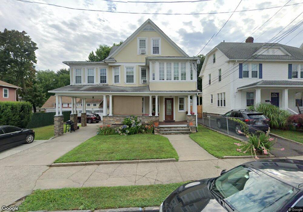
450 Davidson St Unit 452 Bridgeport, CT 06605
Black Rock NeighborhoodEstimated Value: $598,974 - $831,000
6
Beds
5
Baths
3,310
Sq Ft
$215/Sq Ft
Est. Value
About This Home
This home is located at 450 Davidson St Unit 452, Bridgeport, CT 06605 and is currently estimated at $710,994, approximately $214 per square foot. 450 Davidson St Unit 452 is a home located in Fairfield County with nearby schools including Holland Hill Elementary, Fairfield Ludlowe High School, and St. Ann Campus - Catholic Academy of Bridgeport.
Ownership History
Date
Name
Owned For
Owner Type
Purchase Details
Closed on
Apr 18, 2016
Sold by
Davidson Partners Llc
Bought by
Hannema Tracey
Current Estimated Value
Purchase Details
Closed on
Mar 10, 2005
Sold by
Soracco Joseph
Bought by
Hannema Tracy
Home Financials for this Owner
Home Financials are based on the most recent Mortgage that was taken out on this home.
Original Mortgage
$316,960
Interest Rate
5.64%
Create a Home Valuation Report for This Property
The Home Valuation Report is an in-depth analysis detailing your home's value as well as a comparison with similar homes in the area
Home Values in the Area
Average Home Value in this Area
Purchase History
| Date | Buyer | Sale Price | Title Company |
|---|---|---|---|
| Hannema Tracey | -- | -- | |
| Hannema Tracey | -- | -- | |
| Hannema Tracy | $396,200 | -- | |
| Hannema Tracy | $396,200 | -- |
Source: Public Records
Mortgage History
| Date | Status | Borrower | Loan Amount |
|---|---|---|---|
| Previous Owner | Hannema Tracy | $316,960 | |
| Previous Owner | Hannema Tracy | $157,500 |
Source: Public Records
Tax History Compared to Growth
Tax History
| Year | Tax Paid | Tax Assessment Tax Assessment Total Assessment is a certain percentage of the fair market value that is determined by local assessors to be the total taxable value of land and additions on the property. | Land | Improvement |
|---|---|---|---|---|
| 2025 | $10,747 | $247,350 | $102,200 | $145,150 |
| 2024 | $10,747 | $247,350 | $102,200 | $145,150 |
| 2023 | $10,747 | $247,350 | $102,200 | $145,150 |
| 2022 | $10,747 | $247,350 | $102,200 | $145,150 |
| 2021 | $10,747 | $247,350 | $102,200 | $145,150 |
| 2020 | $10,772 | $199,520 | $63,410 | $136,110 |
| 2019 | $10,772 | $199,520 | $63,410 | $136,110 |
| 2018 | $10,848 | $199,520 | $63,410 | $136,110 |
| 2017 | $10,848 | $199,520 | $63,410 | $136,110 |
| 2016 | $10,848 | $199,520 | $63,410 | $136,110 |
| 2015 | $9,709 | $230,070 | $53,540 | $176,530 |
| 2014 | $9,709 | $230,070 | $53,540 | $176,530 |
Source: Public Records
Map
Nearby Homes
- 3250 Fairfield Ave Unit 302
- 105 Fox St Unit 107
- 165 Bennett St
- 132 Gilman St
- 855 Brewster St Unit 857
- 39 Jetland Place Unit 41
- 554 Brewster St Unit 4
- 37 Rowsley St Unit 6
- 26 Rowsley St Unit 3
- 75 Homestead Ave Unit 77
- 167 Scofield Ave
- 317 Brewster St
- 361 Riverside Dr
- 2180 Kings Hwy Unit 1
- 82 Waldorf Ave
- 188 Monroe St Unit 190
- 274 High St
- 31 Whittier St
- 25 Whittier St
- 15 Barton Rd
- 450 Davidson St Unit 1st Floor
- 450 Davidson St Unit 2ND F
- 450 Davidson St Unit 3RD F
- 450 Davidson St Unit 1ST F
- 444 Davidson St
- 478 Davidson St
- 434 Davidson St
- 430 Davidson St Unit 434
- 135 Morehouse St
- 121 Morehouse St
- 151 Morehouse St
- 635 Canfield Ave Unit 641
- 424 Davidson St Unit 428
- 435 Davidson St Unit 1
- 435 Davidson St Unit 1st Flr
- 451 Davidson St Unit 453
- 461 Davidson St
- 641 Canfield Ave Unit 6005
- 111 Morehouse St Unit 113
- 443 Davidson St Unit 445