B
Seller's Agent in 2018
Bonnie Hoffman
Mountain Vista Real Estate, LLC
Estimated Value: $367,000 - $504,000
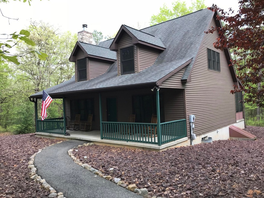
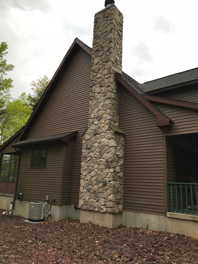
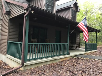
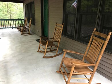
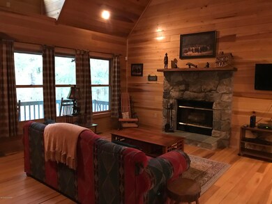
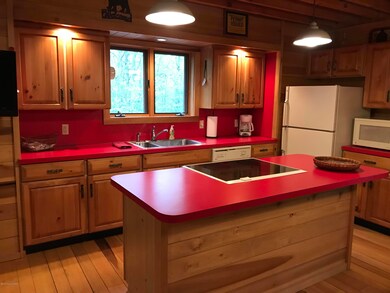
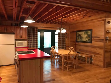
Very lovely ''cabin'' in the woods! This is a must see. The home has cathedral ceiling, wood burning stone fireplace, all wood ceilings, floors and walls (except partial walls and floors in bathrooms), open concept living rm, dining rm. and kitchen with appliances opening to a 33.11 x 7.9 screened rear concrete porch! Very nice. The home features 2 1st level bedrooms and full bath, open staircase that leads to loft (family rm.) master bedroom and master bath. You will love the front porch (the whole width of the house to enjoy nature at it's best). This beautiful property has forced hot air heat, central air, full basement with walk out and ideal landscaping for easy care), paved driveway and parking area. Gently used -one owner. Close to Lehigh Gorge State park & other local amenities.
Last Agent to Sell the Property
Bonnie Hoffman
Mountain Vista Real Estate, LLC License #RM423495 Listed on: 05/15/2018
Last Buyer's Agent
Bonnie Hoffman
Mountain Vista Real Estate, LLC License #RM423495 Listed on: 05/15/2018
| Date | Buyer | Sale Price | Title Company |
|---|---|---|---|
| Gable Michael Lee | $380,000 | Lighthouse Abstract Ltd | |
| Mclaughlin David | $285,000 | None Available | |
| Schultz Wayne M | -- | None Available |
| Date | Status | Borrower | Loan Amount |
|---|---|---|---|
| Open | Gable Michael Lee | $304,000 | |
| Previous Owner | Mclaughlin David | $213,750 |
| Date | Event | Price | List to Sale | Price per Sq Ft |
|---|---|---|---|---|
| 07/06/2018 07/06/18 | Sold | $285,000 | 0.0% | $169 / Sq Ft |
| 05/19/2018 05/19/18 | Pending | -- | -- | -- |
| 05/15/2018 05/15/18 | For Sale | $285,000 | -- | $169 / Sq Ft |
| Year | Tax Paid | Tax Assessment Tax Assessment Total Assessment is a certain percentage of the fair market value that is determined by local assessors to be the total taxable value of land and additions on the property. | Land | Improvement |
|---|---|---|---|---|
| 2025 | $4,365 | $55,000 | $10,350 | $44,650 |
| 2024 | $4,200 | $55,000 | $10,350 | $44,650 |
| 2023 | $4,124 | $55,000 | $10,350 | $44,650 |
| 2022 | $3,689 | $50,000 | $10,350 | $39,650 |
| 2021 | $3,689 | $50,000 | $10,350 | $39,650 |
| 2020 | $3,561 | $50,000 | $10,350 | $39,650 |
| 2019 | $3,461 | $50,000 | $10,350 | $39,650 |
| 2018 | $3,384 | $50,000 | $10,350 | $39,650 |
| 2017 | $3,284 | $50,000 | $10,350 | $39,650 |
| 2016 | -- | $50,000 | $10,350 | $39,650 |
| 2015 | -- | $50,000 | $10,350 | $39,650 |
| 2014 | -- | $50,000 | $10,350 | $39,650 |
B
Seller's Agent in 2018
Bonnie Hoffman
Mountain Vista Real Estate, LLC
Source: Pocono Mountains Association of REALTORS®
MLS Number: PM-57524
APN: 82F-16-A22
Disclaimer: Certain information contained herein is derived from information provided by parties other than Homes.com. All information provided is deemed reliable, but is not guaranteed to be accurate and should be independently verified.
![]() The data relating to real estate for sale on this web site includes listings held by MLS-IDX Participants of the Internet Data Exchange program of the Multiple Listing Service of the Pocono Mountains Association of Realtors®. Listings marked with the Internet Data Exchange logo are not necessarilty the listings of the owner of this web site. All listing data is the copyrighted property of the aforesaid Associations and its MLS-IDX Participants with all rights reserved. The information contained herein is believed to be accurate, but no warranty as such is expressed or implied.
The data relating to real estate for sale on this web site includes listings held by MLS-IDX Participants of the Internet Data Exchange program of the Multiple Listing Service of the Pocono Mountains Association of Realtors®. Listings marked with the Internet Data Exchange logo are not necessarilty the listings of the owner of this web site. All listing data is the copyrighted property of the aforesaid Associations and its MLS-IDX Participants with all rights reserved. The information contained herein is believed to be accurate, but no warranty as such is expressed or implied.
