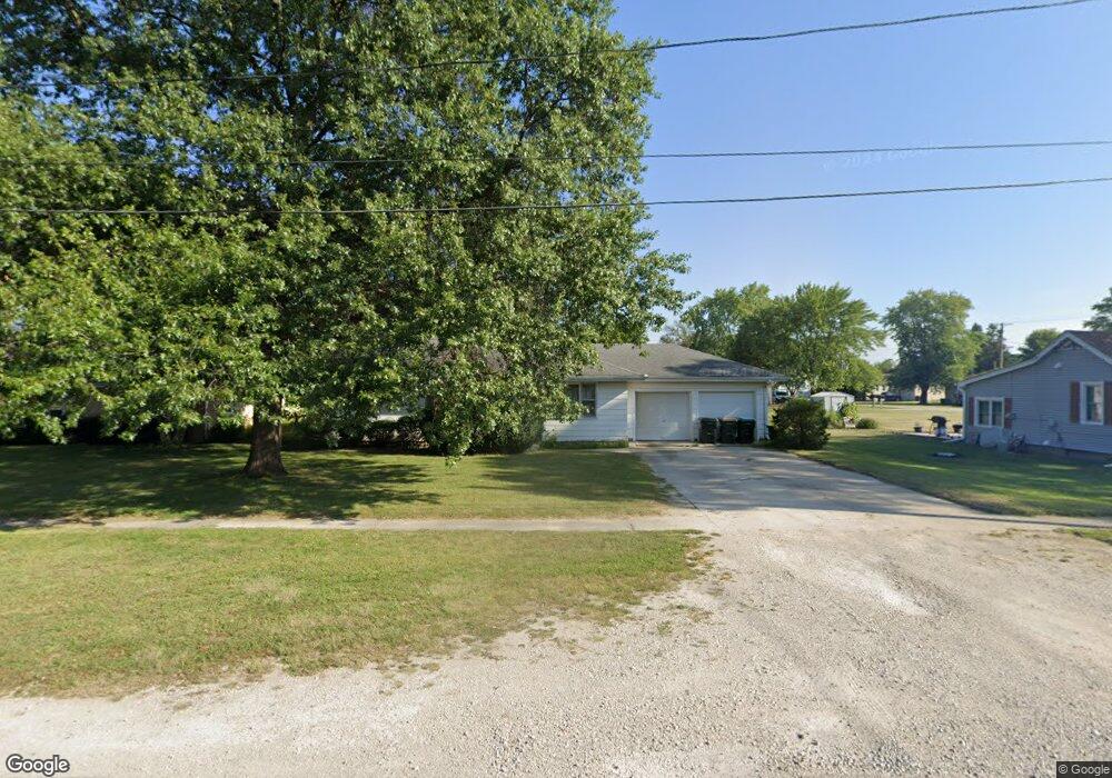
450 E 2nd St Coal City, IL 60416
Estimated Value: $171,000 - $211,717
Studio
--
Bath
1,092
Sq Ft
$167/Sq Ft
Est. Value
About This Home
This home is located at 450 E 2nd St, Coal City, IL 60416 and is currently estimated at $182,429, approximately $167 per square foot. 450 E 2nd St is a home with nearby schools including Coal City Intermediate School, Coal City Elementary School, and Coal City Middle School.
Ownership History
Date
Name
Owned For
Owner Type
Purchase Details
Closed on
Mar 26, 2025
Sold by
Baudino Catherine
Bought by
Nelson Daniel A and Nelson Kathleen A
Current Estimated Value
Home Financials for this Owner
Home Financials are based on the most recent Mortgage that was taken out on this home.
Original Mortgage
$100,000
Outstanding Balance
$92,725
Interest Rate
5.79%
Mortgage Type
New Conventional
Estimated Equity
$89,704
Create a Home Valuation Report for This Property
The Home Valuation Report is an in-depth analysis detailing your home's value as well as a comparison with similar homes in the area
Home Values in the Area
Average Home Value in this Area
Purchase History
| Date | Buyer | Sale Price | Title Company |
|---|---|---|---|
| Nelson Daniel A | $165,000 | Fidelity National Title |
Source: Public Records
Mortgage History
| Date | Status | Borrower | Loan Amount |
|---|---|---|---|
| Open | Nelson Daniel A | $100,000 |
Source: Public Records
Tax History
| Year | Tax Paid | Tax Assessment Tax Assessment Total Assessment is a certain percentage of the fair market value that is determined by local assessors to be the total taxable value of land and additions on the property. | Land | Improvement |
|---|---|---|---|---|
| 2024 | $4,948 | $67,417 | $14,865 | $52,552 |
| 2023 | $4,629 | $63,072 | $13,907 | $49,165 |
| 2022 | $3,555 | $59,084 | $13,028 | $46,056 |
| 2021 | $3,358 | $55,845 | $12,314 | $43,531 |
| 2020 | $3,271 | $54,724 | $12,067 | $42,657 |
| 2019 | $3,007 | $51,626 | $11,384 | $40,242 |
| 2018 | $2,972 | $51,723 | $11,405 | $40,318 |
| 2017 | $2,767 | $49,854 | $10,993 | $38,861 |
| 2016 | $2,719 | $49,492 | $10,913 | $38,579 |
| 2015 | $2,466 | $47,855 | $10,552 | $37,303 |
| 2014 | $2,419 | $47,092 | $10,384 | $36,708 |
| 2013 | $2,440 | $47,980 | $10,580 | $37,400 |
Source: Public Records
Map
Nearby Homes
- 390 N Washington St
- 230 E Big Timber Dr
- Lot 4 Mcardle Rd
- 955 E 4th St
- 145 S Primrose Dr
- 105 W Oak St
- 1005 Foxgrove Dr
- 1060 Regent Ct
- 0 E Division St Unit MRD12083414
- 380 S Marguerite St
- 485 Trotter Dr
- 80 E Spring Rd
- 2035 Amber Ln
- 847 Covey Ln
- 903 Springhill Dr
- 00 S Will Rd
- 70 S Will Rd
- 2615 E Girot Ln
- 1070 Farmstone Dr
- 1170 Farmstone Dr
Your Personal Tour Guide
Ask me questions while you tour the home.