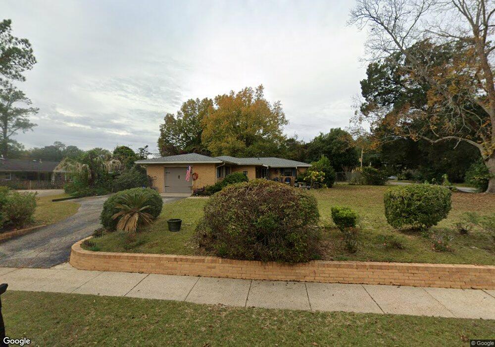
450 E Richardson Dr Mobile, AL 36606
Brookwood NeighborhoodEstimated Value: $176,337 - $215,000
Studio
1
Bath
1,708
Sq Ft
$112/Sq Ft
Est. Value
About This Home
This home is located at 450 E Richardson Dr, Mobile, AL 36606 and is currently estimated at $191,084, approximately $111 per square foot. 450 E Richardson Dr is a home located in Mobile County with nearby schools including Morningside Elementary School, Williamson High School, and St. Pius Catholic School.
Ownership History
Date
Name
Owned For
Owner Type
Purchase Details
Closed on
Dec 12, 2007
Sold by
Hilyer Alton S and Hilyer Belinda J
Bought by
Smith Samuel W and Smith Kay S
Current Estimated Value
Home Financials for this Owner
Home Financials are based on the most recent Mortgage that was taken out on this home.
Original Mortgage
$114,800
Outstanding Balance
$71,369
Interest Rate
6.22%
Mortgage Type
Unknown
Estimated Equity
$119,715
Purchase Details
Closed on
Sep 15, 2006
Sold by
Hilyer Alton S
Bought by
Hilyer Alton S and Hilyer Belinda J
Create a Home Valuation Report for This Property
The Home Valuation Report is an in-depth analysis detailing your home's value as well as a comparison with similar homes in the area
Home Values in the Area
Average Home Value in this Area
Purchase History
| Date | Buyer | Sale Price | Title Company |
|---|---|---|---|
| Smith Samuel W | -- | None Available | |
| Hilyer Alton S | -- | None Available |
Source: Public Records
Mortgage History
| Date | Status | Borrower | Loan Amount |
|---|---|---|---|
| Open | Smith Samuel W | $114,800 |
Source: Public Records
Tax History
| Year | Tax Paid | Tax Assessment Tax Assessment Total Assessment is a certain percentage of the fair market value that is determined by local assessors to be the total taxable value of land and additions on the property. | Land | Improvement |
|---|---|---|---|---|
| 2025 | $832 | $14,790 | $2,800 | $11,990 |
| 2024 | $832 | $13,080 | $2,500 | $10,580 |
| 2023 | $775 | $11,540 | $2,500 | $9,040 |
| 2022 | $667 | $11,540 | $2,500 | $9,040 |
| 2021 | $644 | $11,190 | $2,500 | $8,690 |
| 2020 | $644 | $11,190 | $2,500 | $8,690 |
| 2019 | $648 | $11,240 | $2,630 | $8,610 |
| 2018 | $648 | $11,260 | $0 | $0 |
| 2017 | $656 | $11,380 | $0 | $0 |
| 2016 | $771 | $13,200 | $0 | $0 |
| 2013 | $823 | $13,720 | $0 | $0 |
Source: Public Records
Map
Nearby Homes
- 420 S Sage Ave Unit 1
- 450 Magnolia Rd
- 552 Magnolia Rd
- 367 S Sage Ave
- 421 Pennington Cir
- 504 W Barksdale Dr
- 369 Coventry Way
- 361 Coventry Way
- 2768 Brookwood Dr
- 3014 Farcott St
- 3021 Louise Dr N
- 2755 Kreitner St
- 2901 Grant St Unit 903
- 2901 Grant St Unit 902
- 2901 Grant St Unit 304
- 2901 Grant St Unit 601
- 868 Grant Park Dr
- 324 Hadrian St
- 422 Durande Dr
- 255 Berkley Ct
- 2907 Cottage Hill Rd
- 2800 N Rosswood Dr
- 2804 N Rosswood Dr
- 451 E Richardson Dr
- 2809 Cottage Hill Rd
- 2914 Cottage Hill Rd
- 2916 Cottage Hill Rd
- 455 E Richardson Dr
- 2912 Cottage Hill Rd
- 2920 Cottage Hill Rd
- 2910 Cottage Hill Rd
- 459 E Richardson Dr
- 2808 N Rosswood Dr
- 2813 Cottage Hill Rd
- 500 E Richardson Dr
- 501 E Richardson Dr
- 2906 Cottage Hill Rd
- 2810 N Rosswood Dr
- 2805 N Rosswood Dr
- 420 S Sage Ave
Your Personal Tour Guide
Ask me questions while you tour the home.