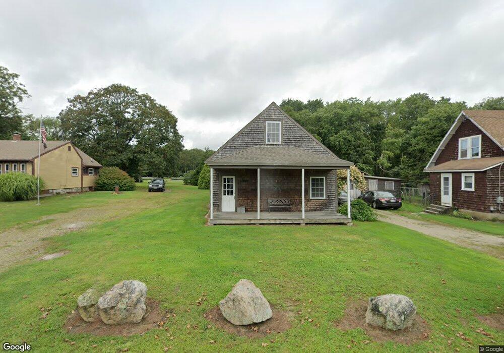
450 Hixbridge Rd Westport, MA 02790
Estimated Value: $497,000 - $994,000
2
Beds
--
Bath
1,625
Sq Ft
$412/Sq Ft
Est. Value
About This Home
This home is located at 450 Hixbridge Rd, Westport, MA 02790 and is currently estimated at $669,076, approximately $411 per square foot. 450 Hixbridge Rd is a home located in Bristol County with nearby schools including Alice A. Macomber Primary School, Westport Elementary School, and Westport Middle-High School.
Ownership History
Date
Name
Owned For
Owner Type
Purchase Details
Closed on
May 24, 2016
Sold by
Sylvan Nt
Bought by
Sylvan Lands T
Current Estimated Value
Purchase Details
Closed on
Oct 13, 2000
Sold by
Brown Robert E and Brown Pamela G
Bought by
Vansloun Slyvia M and Titus David B
Create a Home Valuation Report for This Property
The Home Valuation Report is an in-depth analysis detailing your home's value as well as a comparison with similar homes in the area
Home Values in the Area
Average Home Value in this Area
Purchase History
| Date | Buyer | Sale Price | Title Company |
|---|---|---|---|
| Sylvan Lands T | -- | -- | |
| Vansloun Slyvia M | $185,000 | -- |
Source: Public Records
Mortgage History
| Date | Status | Borrower | Loan Amount |
|---|---|---|---|
| Previous Owner | Vansloun Slyvia M | $118,600 | |
| Previous Owner | Vansloun Slyvia M | $32,000 |
Source: Public Records
Tax History Compared to Growth
Tax History
| Year | Tax Paid | Tax Assessment Tax Assessment Total Assessment is a certain percentage of the fair market value that is determined by local assessors to be the total taxable value of land and additions on the property. | Land | Improvement |
|---|---|---|---|---|
| 2025 | $3,178 | $426,600 | $204,900 | $221,700 |
| 2024 | $3,163 | $409,200 | $190,000 | $219,200 |
| 2023 | $2,951 | $361,600 | $160,200 | $201,400 |
| 2022 | $2,898 | $341,700 | $160,200 | $181,500 |
| 2021 | $2,912 | $337,800 | $145,800 | $192,000 |
| 2020 | $2,799 | $332,000 | $140,000 | $192,000 |
| 2019 | $2,604 | $314,900 | $133,900 | $181,000 |
| 2018 | $2,344 | $286,900 | $131,500 | $155,400 |
| 2017 | $2,285 | $286,700 | $134,000 | $152,700 |
| 2016 | $2,307 | $291,700 | $139,000 | $152,700 |
| 2015 | $2,201 | $277,600 | $141,500 | $136,100 |
Source: Public Records
Map
Nearby Homes
- 225 Hixbridge Rd
- 920 Drift Rd
- 73 White Oak Run
- 99 Sylvia Ln
- 2 Slades Farm Ln
- 837 Main Rd
- 8 Village Way
- 7 Village Way
- 15 Village Way
- 101 Adamsville Rd
- 118 Charlotte White Rd Extension
- 1346 Main Rd Unit B
- 0 Hidden Glen Ln
- 8 Strawberry Ln
- 1580 Main Rd
- 47 Fallon Dr
- Lot 0 Marcotte
- 1702J Drift Rd
- 1702 Drift Rd
- Lot 2E Horseneck Rd
- 458 Hixbridge Rd
- 0-7 Horseneck Rd
- 442 Hixbridge Rd
- Lot 3 Horseneck Rd
- 438 Hixbridge Rd
- Lot 00 Pine Hill Rd
- 00 Pine Hill Rd
- 434 Hix Bridge
- Lot 0 Hix Bridge Rd
- 434 Hixbridge Rd
- 47 Horseneck Rd
- 83 Horseneck Rd
- 426 Hixbridge Rd
- 473 Hixbridge Rd
- 494 Hixbridge Rd
- 12 Horseneck Rd
- 20 Horseneck Rd
- 408 Hixbridge Rd
- 408 Hixbridge Rd Unit WINTER RENT
- 417A Hixbridge Rd