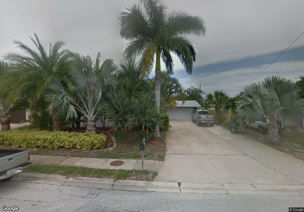
450 Laurel St Satellite Beach, FL 32937
Estimated Value: $425,000 - $664,000
3
Beds
2
Baths
1,644
Sq Ft
$306/Sq Ft
Est. Value
About This Home
This home is located at 450 Laurel St, Satellite Beach, FL 32937 and is currently estimated at $503,875, approximately $306 per square foot. 450 Laurel St is a home located in Brevard County with nearby schools including Surfside Elementary School, Satellite Senior High School, and DeLaura Middle School.
Ownership History
Date
Name
Owned For
Owner Type
Purchase Details
Closed on
Nov 20, 2025
Sold by
Kimball Matthew J
Bought by
Kimball Matthew J and Matthew J Kimball Revocable Trust
Current Estimated Value
Purchase Details
Closed on
Feb 18, 2021
Sold by
Aldridge Emily R
Bought by
Kane Timothy M and Kane Joan L
Purchase Details
Closed on
Sep 5, 2003
Sold by
Kimball Robert E and Kimball Darlene D
Bought by
Kimball Matthew J
Home Financials for this Owner
Home Financials are based on the most recent Mortgage that was taken out on this home.
Original Mortgage
$132,000
Interest Rate
6.28%
Purchase Details
Closed on
Apr 18, 2002
Sold by
Elizabeth Frommnann Ii Paul A and Elizabeth Frommnann
Bought by
Kimball Robert E and Kimball Darlene D
Home Financials for this Owner
Home Financials are based on the most recent Mortgage that was taken out on this home.
Original Mortgage
$120,600
Interest Rate
7.07%
Mortgage Type
Purchase Money Mortgage
Create a Home Valuation Report for This Property
The Home Valuation Report is an in-depth analysis detailing your home's value as well as a comparison with similar homes in the area
Home Values in the Area
Average Home Value in this Area
Purchase History
| Date | Buyer | Sale Price | Title Company |
|---|---|---|---|
| Kimball Matthew J | $100 | None Listed On Document | |
| Kane Timothy M | $312,000 | Atypical Title Llc | |
| Kimball Matthew J | $165,000 | Title Security & Escrow Of C | |
| Kimball Robert E | $134,000 | -- |
Source: Public Records
Mortgage History
| Date | Status | Borrower | Loan Amount |
|---|---|---|---|
| Previous Owner | Kimball Matthew J | $132,000 | |
| Previous Owner | Kimball Robert E | $120,600 |
Source: Public Records
Tax History
| Year | Tax Paid | Tax Assessment Tax Assessment Total Assessment is a certain percentage of the fair market value that is determined by local assessors to be the total taxable value of land and additions on the property. | Land | Improvement |
|---|---|---|---|---|
| 2025 | $2,102 | $146,170 | -- | -- |
| 2024 | $2,061 | $142,060 | -- | -- |
| 2023 | $2,061 | $137,930 | $0 | $0 |
| 2022 | $1,921 | $133,920 | $0 | $0 |
| 2021 | $1,965 | $130,020 | $0 | $0 |
| 2020 | $1,955 | $128,230 | $0 | $0 |
| 2019 | $1,935 | $125,350 | $0 | $0 |
| 2018 | $1,931 | $123,020 | $0 | $0 |
| 2017 | $1,779 | $120,490 | $0 | $0 |
| 2016 | $1,779 | $118,020 | $85,000 | $33,020 |
| 2015 | $1,819 | $117,200 | $75,000 | $42,200 |
| 2014 | $1,818 | $116,270 | $70,000 | $46,270 |
Source: Public Records
Map
Nearby Homes
- 445 Saint Johns Dr
- 458 Saint Johns Dr
- 368 Ocean Spray Ave
- 366 Ocean Spray Ave
- 360 Cassia Blvd
- 380 Cherry Ct
- 485 Temple St
- 405 Hawthorne Ct
- 165 Island View Dr
- 509 W Amherst Cir
- 350 Thyme St
- 1341 S Patrick Dr
- 0000 Cassia Blvd
- 240 Greenway Ave
- 560 Glenwood Ave
- 435 Desoto Pkwy
- 550 Temple St
- 115 Island View Dr
- 358 Desoto Pkwy
- 270 Cinnamon Dr
- 460 Laurel St
- 440 Laurel St
- 430 Laurel St
- 455 Rosedale Dr
- 432 Saint Johns Dr
- 450 Rosedale Dr
- 438 Saint Johns Dr
- 428 Saint Johns Dr
- 442 Saint Johns Dr
- 420 Laurel St
- 445 Rosedale Dr
- 455 Laurel Ct
- 446 Rosedale Dr
- 448 Saint Johns Dr
- 422 Saint Johns Dr
- 435 Rosedale Dr
- 441 Saint Johns Dr
- 444 Rosedale Dr
- 410 Laurel St
- 454 Laurel Ct
Your Personal Tour Guide
Ask me questions while you tour the home.