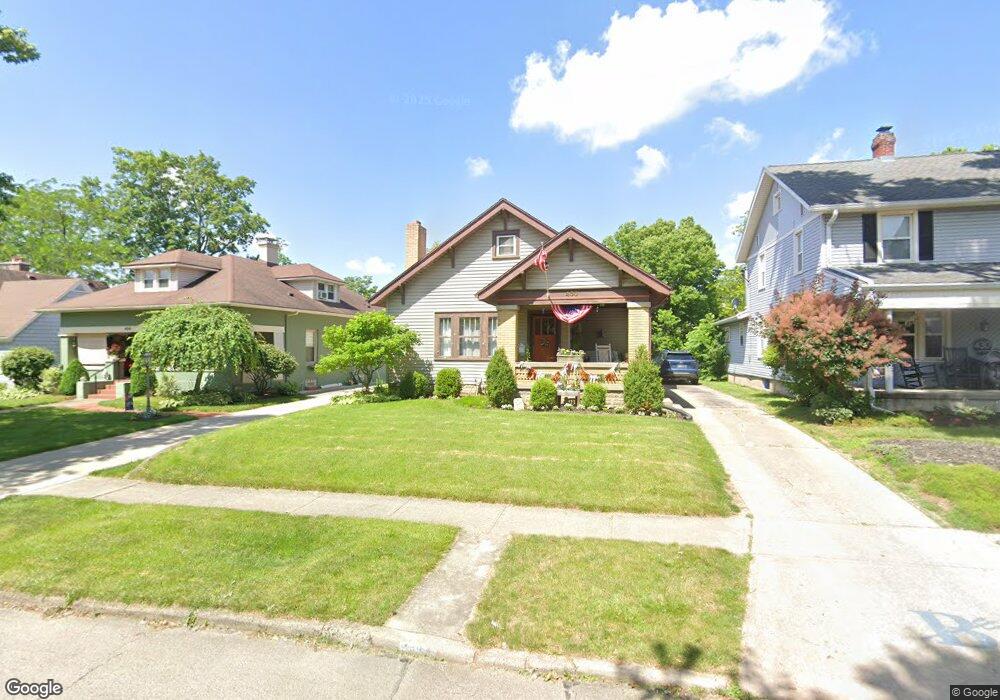
450 Maple St Brookville, OH 45309
Estimated Value: $177,000 - $203,000
2
Beds
1
Bath
1,040
Sq Ft
$186/Sq Ft
Est. Value
About This Home
This home is located at 450 Maple St, Brookville, OH 45309 and is currently estimated at $193,484, approximately $186 per square foot. 450 Maple St is a home located in Montgomery County with nearby schools including Brookville Elementary School, Brookville Intermediate School, and Brookville High School.
Ownership History
Date
Name
Owned For
Owner Type
Purchase Details
Closed on
May 13, 2005
Sold by
Hemmerick Thomas R and Hemmerick Tonja R
Bought by
Stephan Rodney L and Stephan Lucinda S
Current Estimated Value
Home Financials for this Owner
Home Financials are based on the most recent Mortgage that was taken out on this home.
Original Mortgage
$108,000
Interest Rate
6%
Mortgage Type
Purchase Money Mortgage
Create a Home Valuation Report for This Property
The Home Valuation Report is an in-depth analysis detailing your home's value as well as a comparison with similar homes in the area
Home Values in the Area
Average Home Value in this Area
Purchase History
| Date | Buyer | Sale Price | Title Company |
|---|---|---|---|
| Stephan Rodney L | $135,000 | None Available |
Source: Public Records
Mortgage History
| Date | Status | Borrower | Loan Amount |
|---|---|---|---|
| Closed | Stephan Rodney L | $108,000 |
Source: Public Records
Tax History Compared to Growth
Tax History
| Year | Tax Paid | Tax Assessment Tax Assessment Total Assessment is a certain percentage of the fair market value that is determined by local assessors to be the total taxable value of land and additions on the property. | Land | Improvement |
|---|---|---|---|---|
| 2024 | $2,628 | $54,670 | $14,800 | $39,870 |
| 2023 | $2,628 | $54,670 | $14,800 | $39,870 |
| 2022 | $2,268 | $36,680 | $9,930 | $26,750 |
| 2021 | $2,278 | $36,680 | $9,930 | $26,750 |
| 2020 | $2,281 | $36,680 | $9,930 | $26,750 |
| 2019 | $2,291 | $33,750 | $9,930 | $23,820 |
| 2018 | $2,303 | $33,750 | $9,930 | $23,820 |
| 2017 | $2,296 | $33,750 | $9,930 | $23,820 |
| 2016 | $2,176 | $32,160 | $9,930 | $22,230 |
| 2015 | $2,142 | $32,160 | $9,930 | $22,230 |
| 2014 | $2,142 | $32,160 | $9,930 | $22,230 |
| 2012 | -- | $32,620 | $9,610 | $23,010 |
Source: Public Records
Map
Nearby Homes
- 4 E Mckinley St
- 401 Harper Creek Dr
- Norway Plan at Harper Creek
- Palmetto Plan at Harper Creek
- Aspen II Plan at Harper Creek
- Empress Plan at Harper Creek
- Bradford Plan at Harper Creek
- Spruce Plan at Harper Creek
- Ironwood Plan at Harper Creek
- Juniper Plan at Harper Creek
- Chestnut Plan at Harper Creek
- Cooper Plan at Harper Creek
- 214 Hay Ave
- Chestnut Plan at Evergreen Trace
- Palmetto Plan at Evergreen Trace
- Aspen II Plan at Evergreen Trace
- Empress Plan at Evergreen Trace
- Ashton Plan at Evergreen Trace
- Norway Plan at Evergreen Trace
- Bradford Plan at Evergreen Trace
- 430 Maple St
- 456 Maple St
- 428 Maple St
- 458 Maple St
- 325 S Wolf Creek St
- 422 Maple St
- 319 S Wolf Creek St
- 0 Westbrook Rd Unit 399808
- 0 Westbrook Rd Unit 418863
- 0 Westbrook Rd Unit 440834
- 0 Westbrook Rd Unit 485576
- 0 Westbrook Rd Unit 486702
- 0 Westbrook Rd Unit 737580
- 0 Westbrook Rd Unit 898277
- 0 Westbrook Rd Unit 563146
- 0 Westbrook Rd Unit 516361
- 0 Westbrook Rd Unit 526515
- 0 Westbrook Rd Unit 830888
- 0 Westbrook Rd Unit 827321
- 000 Westbrook Rd