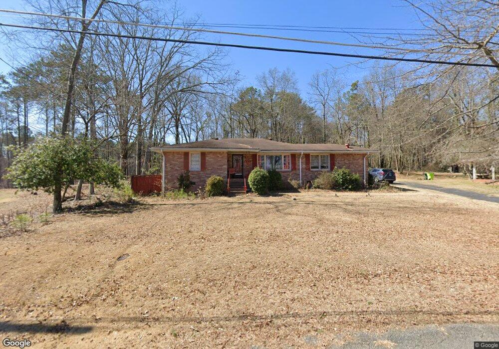
450 Nash Cir SW Mableton, GA 30126
Estimated Value: $255,000 - $330,000
3
Beds
3
Baths
1,436
Sq Ft
$197/Sq Ft
Est. Value
About This Home
This home is located at 450 Nash Cir SW, Mableton, GA 30126 and is currently estimated at $283,114, approximately $197 per square foot. 450 Nash Cir SW is a home located in Cobb County with nearby schools including Clay-Harmony Leland Elementary School, Lindley Middle School, and Pebblebrook High School.
Ownership History
Date
Name
Owned For
Owner Type
Purchase Details
Closed on
May 9, 2018
Sold by
Jones Betty J
Bought by
Croft Pamela
Current Estimated Value
Purchase Details
Closed on
Feb 15, 2000
Sold by
Livingston Alice R
Bought by
Jones Andrew W
Home Financials for this Owner
Home Financials are based on the most recent Mortgage that was taken out on this home.
Original Mortgage
$99,900
Interest Rate
8.37%
Mortgage Type
New Conventional
Create a Home Valuation Report for This Property
The Home Valuation Report is an in-depth analysis detailing your home's value as well as a comparison with similar homes in the area
Home Values in the Area
Average Home Value in this Area
Purchase History
| Date | Buyer | Sale Price | Title Company |
|---|---|---|---|
| Croft Pamela | -- | -- | |
| Jones Andrew W | $103,000 | -- |
Source: Public Records
Mortgage History
| Date | Status | Borrower | Loan Amount |
|---|---|---|---|
| Previous Owner | Jones Andrew W | $99,900 |
Source: Public Records
Tax History Compared to Growth
Tax History
| Year | Tax Paid | Tax Assessment Tax Assessment Total Assessment is a certain percentage of the fair market value that is determined by local assessors to be the total taxable value of land and additions on the property. | Land | Improvement |
|---|---|---|---|---|
| 2025 | $940 | $113,404 | $20,000 | $93,404 |
| 2024 | $846 | $81,316 | $10,000 | $71,316 |
| 2023 | $2,452 | $81,316 | $10,000 | $71,316 |
| 2022 | $2,468 | $81,316 | $10,000 | $71,316 |
| 2021 | $1,037 | $34,160 | $7,200 | $26,960 |
| 2020 | $1,037 | $34,160 | $7,200 | $26,960 |
| 2019 | $1,037 | $34,160 | $7,200 | $26,960 |
| 2018 | $1,037 | $34,160 | $7,200 | $26,960 |
| 2017 | $948 | $32,960 | $6,000 | $26,960 |
| 2016 | $948 | $32,960 | $6,000 | $26,960 |
| 2015 | $927 | $31,460 | $6,000 | $25,460 |
| 2014 | $935 | $31,460 | $0 | $0 |
Source: Public Records
Map
Nearby Homes
- 364 Waterbluff Dr SW
- 6365 Susan Dr SW
- 368 Waterbluff Dr SW
- 365 Waterbluff Dr SW
- 369 Waterbluff Dr SW
- 373 Waterbluff Dr SW
- 377 Waterbluff Dr SW
- 361 Gordon Valley Ln SW
- 6511 Gordon Hills Dr SW
- 6650 Valley Hill Dr SW
- 496 Elizabeth Ln SW
- 6649 Valley Hill Dr SW
- 537 Elizabeth Ln SW
- 317 Community Dr SW
- 6264 Godfrey Dr SW
- 6722 Armonia Dr
- 6714 Armonia Dr
- 6696 Armonia Dr
- 6500 Dodgen Rd SW
- 6692 Armonia Dr
- 440 Nash Cir SW
- 460 Nash Cir SW
- 411 Nash Cir SW
- 430 Nash Cir SW
- 470 Nash Cir SW Unit 30
- 470 Nash Cir SW
- 6512 Mitchell Ln SW
- 6420 Susan Dr SW
- 6522 Mitchell Ln SW
- 420 Nash Cir SW
- 6513 Mitchell Ln SW
- 480 Nash Cir SW
- 6532 Mitchell Ln SW
- 6440 Susan Dr SW
- 6520 Valley Hill Dr SW
- 6533 Mitchell Ln SW
- 6386 Susan Dr SW
- 6530 Valley Hill Dr SW
- 6443 Factory Shoals Rd SW
- 6542 Mitchell Ln SW