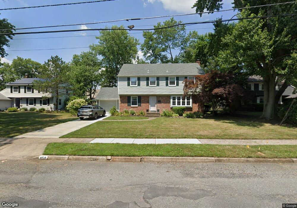
450 Wayland Rd Cherry Hill, NJ 08034
Estimated Value: $459,538 - $615,000
--
Bed
--
Bath
2,320
Sq Ft
$245/Sq Ft
Est. Value
About This Home
This home is located at 450 Wayland Rd, Cherry Hill, NJ 08034 and is currently estimated at $568,385, approximately $244 per square foot. 450 Wayland Rd is a home located in Camden County with nearby schools including A. Russell Knight Elementary School, John A Carusi Middle School, and Cherry Hill High-West High School.
Ownership History
Date
Name
Owned For
Owner Type
Purchase Details
Closed on
Dec 27, 1993
Sold by
Higginbotham Lois
Bought by
Crivaro Mark and Crivaro Ann
Current Estimated Value
Home Financials for this Owner
Home Financials are based on the most recent Mortgage that was taken out on this home.
Original Mortgage
$105,000
Interest Rate
7%
Create a Home Valuation Report for This Property
The Home Valuation Report is an in-depth analysis detailing your home's value as well as a comparison with similar homes in the area
Home Values in the Area
Average Home Value in this Area
Purchase History
| Date | Buyer | Sale Price | Title Company |
|---|---|---|---|
| Crivaro Mark | $145,000 | -- |
Source: Public Records
Mortgage History
| Date | Status | Borrower | Loan Amount |
|---|---|---|---|
| Closed | Crivaro Mark | $105,000 |
Source: Public Records
Tax History Compared to Growth
Tax History
| Year | Tax Paid | Tax Assessment Tax Assessment Total Assessment is a certain percentage of the fair market value that is determined by local assessors to be the total taxable value of land and additions on the property. | Land | Improvement |
|---|---|---|---|---|
| 2025 | $10,314 | $231,300 | $70,900 | $160,400 |
| 2024 | $9,719 | $231,300 | $70,900 | $160,400 |
| 2023 | $9,719 | $231,300 | $70,900 | $160,400 |
| 2022 | $9,451 | $231,300 | $70,900 | $160,400 |
| 2021 | $9,481 | $231,300 | $70,900 | $160,400 |
| 2020 | $9,365 | $231,300 | $70,900 | $160,400 |
| 2019 | $9,361 | $231,300 | $70,900 | $160,400 |
| 2018 | $9,335 | $231,300 | $70,900 | $160,400 |
| 2017 | $9,208 | $231,300 | $70,900 | $160,400 |
| 2016 | $9,085 | $231,300 | $70,900 | $160,400 |
| 2015 | $8,942 | $231,300 | $70,900 | $160,400 |
| 2014 | $8,843 | $231,300 | $70,900 | $160,400 |
Source: Public Records
Map
Nearby Homes
- 110 Barclay Ln
- 217 Redstone Ridge
- 1111 Barclay Towers
- 205 E Tampa Ave
- 1007 Chelten Pkwy
- 917 Deland Ave
- 916 Edgemoor Rd
- 1217 Forge Rd
- 1216 Wyndmoor Rd
- 111 W Miami Ave
- 130 Pearl Croft Rd
- 4514 Champions Run Unit 4514
- 115 Edison Rd
- 124 Edison Rd
- 306 Cambridge Rd
- 147 Greenvale Rd
- 19 Montana Ave
- 225 Cambridge Rd
- 16 Churchill Rd
- 222 Belle Arbor Dr
- 460 Wayland Rd
- 440 Wayland Rd
- 430 Wayland Rd
- 470 Wayland Rd
- 445 Wayland Rd
- 585 Pelham Rd
- 420 Wayland Rd
- 435 Wayland Rd
- 413A Route 70 E
- 413 Route 70 E
- 560 Pelham Rd
- 2 Wayland Rd
- 409 Marlton Pike E
- 425 Wayland Rd
- 410 Wayland Rd
- 575 Pelham Rd
- 550 Pelham Rd
- 415 Wayland Rd
- 106 Sharrowvale Rd
- 104 Sharrowvale Rd