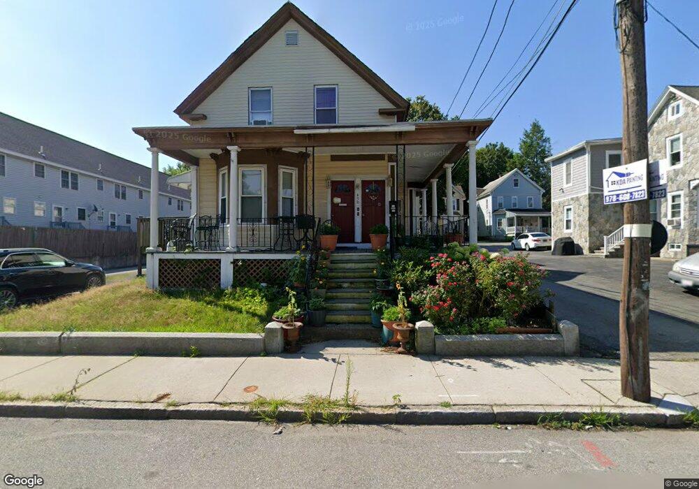
450 Westford St Unit B Lowell, MA 01851
Highlands NeighborhoodEstimated Value: $270,000 - $340,142
3
Beds
1
Bath
1,025
Sq Ft
$297/Sq Ft
Est. Value
About This Home
This home is located at 450 Westford St Unit B, Lowell, MA 01851 and is currently estimated at $304,786, approximately $297 per square foot. 450 Westford St Unit B is a home located in Middlesex County with nearby schools including Charles W. Morey Elementary School, Abraham Lincoln Elementary School, and Dr. Gertrude Bailey Elementary School.
Ownership History
Date
Name
Owned For
Owner Type
Purchase Details
Closed on
Nov 19, 2018
Sold by
Peou Bopha
Bought by
Thou Angelar S and Kong Omeng S
Current Estimated Value
Home Financials for this Owner
Home Financials are based on the most recent Mortgage that was taken out on this home.
Original Mortgage
$120,000
Outstanding Balance
$105,300
Interest Rate
4.7%
Mortgage Type
New Conventional
Estimated Equity
$199,486
Purchase Details
Closed on
Mar 12, 2012
Sold by
Ngor Cheang K
Bought by
Peou Bopha
Purchase Details
Closed on
Jun 7, 2011
Sold by
Fnma
Bought by
Ngor Cheang K
Purchase Details
Closed on
Jun 24, 2010
Sold by
Skaff George
Bought by
Federal National Mortgage Association
Purchase Details
Closed on
Feb 16, 2007
Sold by
Mcmahon Brian
Bought by
Skaff George
Create a Home Valuation Report for This Property
The Home Valuation Report is an in-depth analysis detailing your home's value as well as a comparison with similar homes in the area
Home Values in the Area
Average Home Value in this Area
Purchase History
| Date | Buyer | Sale Price | Title Company |
|---|---|---|---|
| Thou Angelar S | $170,000 | -- | |
| Peou Bopha | -- | -- | |
| Ngor Cheang K | $42,000 | -- | |
| Federal National Mortgage Association | $131,369 | -- | |
| Skaff George | -- | -- |
Source: Public Records
Mortgage History
| Date | Status | Borrower | Loan Amount |
|---|---|---|---|
| Open | Thou Angelar S | $120,000 |
Source: Public Records
Tax History Compared to Growth
Tax History
| Year | Tax Paid | Tax Assessment Tax Assessment Total Assessment is a certain percentage of the fair market value that is determined by local assessors to be the total taxable value of land and additions on the property. | Land | Improvement |
|---|---|---|---|---|
| 2025 | $2,852 | $248,400 | $0 | $248,400 |
| 2024 | $2,692 | $226,000 | $0 | $226,000 |
| 2023 | $2,486 | $200,200 | $0 | $200,200 |
| 2022 | $2,255 | $186,400 | $0 | $186,400 |
| 2021 | $2,255 | $167,500 | $0 | $167,500 |
| 2020 | $2,168 | $162,300 | $0 | $162,300 |
| 2019 | $2,121 | $151,100 | $0 | $151,100 |
| 2018 | $2,035 | $139,100 | $0 | $139,100 |
| 2017 | $1,965 | $131,700 | $0 | $131,700 |
| 2016 | $1,692 | $111,600 | $0 | $111,600 |
| 2015 | $1,627 | $105,100 | $0 | $105,100 |
| 2013 | $1,798 | $119,800 | $0 | $119,800 |
Source: Public Records
Map
Nearby Homes
- 18 Edson St
- 312 Wilder St
- 90 Belmont St
- 337 Stevens St Unit D
- 17 Oakland St
- 41 Coral St
- 613 School St
- 1149 Middlesex St
- 30 Livingston Ave
- 1280 Middlesex St
- 984 Middlesex St
- 11 Columbus Ave
- 987 Middlesex St
- 1311 Middlesex St
- 15 Sayles St
- 15 Barclay St
- 173 Westford St
- 60 Liberty St Unit 3
- 42 Branch St
- 27 Bellevue St
- 450 Westford St Unit C
- 450 Westford St Unit A
- 450 Westford St
- 450 Westford St Unit 1
- 450 Westford St Unit 2
- 450 Westford St Unit 3
- 452 Westford St
- 446 Westford St Unit 6
- 446 Westford St Unit 1
- 446 Westford St Unit 4
- 446 Westford St Unit 3
- 446 Westford St Unit 5
- 446 Westford St Unit 2
- 446 Westford St
- 454 Westford St
- 454 Westford St Unit 2
- 10 Wesley St
- 9 Wesley St
- 438 Westford St Unit 5/1
- 438 Westford St Unit 6/1