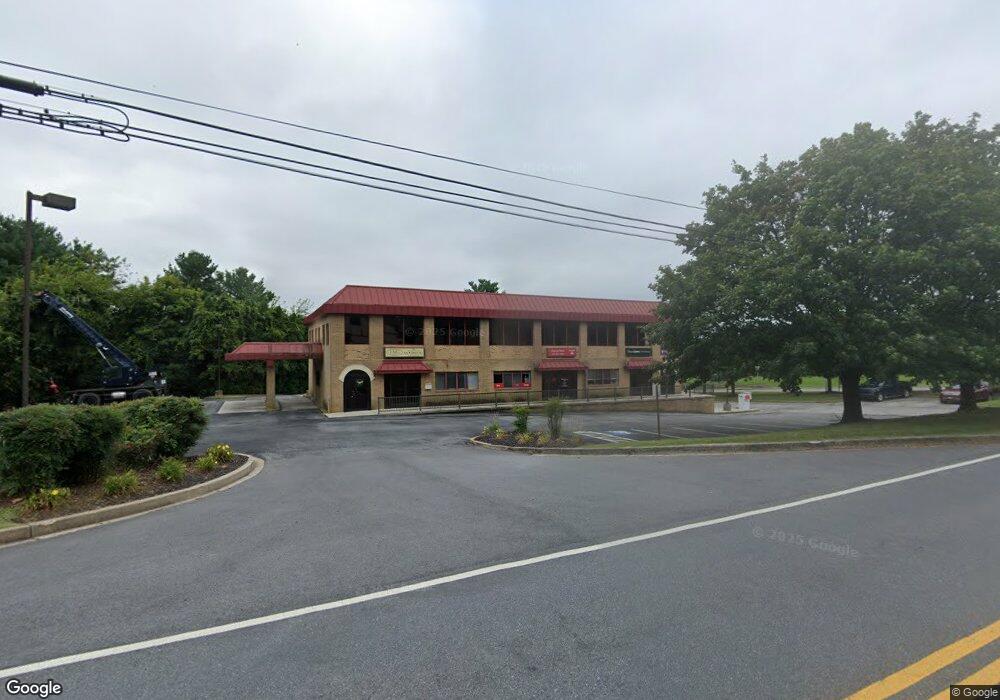
4500 Black Rock Rd Hampstead, MD 21074
Estimated Value: $1,088,500
--
Bed
--
Bath
14,810
Sq Ft
$73/Sq Ft
Est. Value
About This Home
This home is located at 4500 Black Rock Rd, Hampstead, MD 21074 and is currently estimated at $1,088,500, approximately $73 per square foot. 4500 Black Rock Rd is a home located in Carroll County with nearby schools including Spring Garden Elementary School, Shiloh Middle School, and Manchester Valley High School.
Ownership History
Date
Name
Owned For
Owner Type
Purchase Details
Closed on
Aug 23, 2023
Sold by
Black Rock Road 4500 Land Trust
Bought by
Eight And Sand Llc
Current Estimated Value
Home Financials for this Owner
Home Financials are based on the most recent Mortgage that was taken out on this home.
Original Mortgage
$650,000
Outstanding Balance
$635,189
Interest Rate
6.81%
Mortgage Type
New Conventional
Estimated Equity
$453,311
Purchase Details
Closed on
May 21, 2020
Sold by
Hcg Properties Llc
Bought by
The Black Rock Road 4500 Land Trusts
Purchase Details
Closed on
Dec 21, 2007
Sold by
Dingus Joseph Wayne
Bought by
Hcg Properties Llc
Home Financials for this Owner
Home Financials are based on the most recent Mortgage that was taken out on this home.
Original Mortgage
$1,160,000
Interest Rate
6.3%
Purchase Details
Closed on
Dec 5, 2007
Sold by
Dingus Joseph Wayne
Bought by
Hcg Properties Llc
Home Financials for this Owner
Home Financials are based on the most recent Mortgage that was taken out on this home.
Original Mortgage
$1,160,000
Interest Rate
6.3%
Purchase Details
Closed on
Jun 25, 1999
Sold by
Dingus Joseph Wayne
Bought by
Dingus Joseph Wayne and Dingus Iva N
Purchase Details
Closed on
Sep 14, 1990
Sold by
Dingus Joseph
Bought by
Dingus Joseph Wayne
Create a Home Valuation Report for This Property
The Home Valuation Report is an in-depth analysis detailing your home's value as well as a comparison with similar homes in the area
Home Values in the Area
Average Home Value in this Area
Purchase History
| Date | Buyer | Sale Price | Title Company |
|---|---|---|---|
| Eight And Sand Llc | $1,000,000 | Certified Title | |
| The Black Rock Road 4500 Land Trusts | $550,000 | Sage Title Group Llc | |
| Hcg Properties Llc | $1,450,000 | -- | |
| Hcg Properties Llc | $1,450,000 | -- | |
| Dingus Joseph Wayne | -- | -- | |
| Dingus Joseph Wayne | $872,000 | -- |
Source: Public Records
Mortgage History
| Date | Status | Borrower | Loan Amount |
|---|---|---|---|
| Open | Eight And Sand Llc | $650,000 | |
| Previous Owner | Hcg Properties Llc | $1,160,000 | |
| Previous Owner | Hcg Properties Llc | $1,160,000 |
Source: Public Records
Tax History Compared to Growth
Tax History
| Year | Tax Paid | Tax Assessment Tax Assessment Total Assessment is a certain percentage of the fair market value that is determined by local assessors to be the total taxable value of land and additions on the property. | Land | Improvement |
|---|---|---|---|---|
| 2025 | $10,397 | $1,109,500 | $135,700 | $973,800 |
| 2024 | $10,397 | $923,133 | $0 | $0 |
| 2023 | $8,310 | $736,767 | $0 | $0 |
| 2022 | $6,223 | $550,400 | $135,700 | $414,700 |
| 2021 | $12,679 | $550,400 | $135,700 | $414,700 |
| 2020 | $6,223 | $1,193,400 | $229,300 | $964,100 |
| 2019 | $13,040 | $1,280,900 | $229,300 | $1,051,600 |
| 2018 | $12,781 | $1,194,500 | $0 | $0 |
| 2017 | $11,501 | $1,108,100 | $0 | $0 |
| 2016 | -- | $1,021,700 | $0 | $0 |
| 2015 | -- | $1,021,700 | $0 | $0 |
| 2014 | -- | $1,021,700 | $0 | $0 |
Source: Public Records
Map
Nearby Homes
- 1124 Cedarbrook Rd
- 1208 Wynside Ln
- 1003 Scarlet Oak Ct Unit 1A
- 4240 Crystal Ct Unit 3D
- 4138 Hillcrest Ave
- 4230 Crystal Ct Unit 3C
- 4703 Barbed Ct
- 1330 N Main St
- 613 Hanover Pike
- 920 N Houcksville Rd
- 0 Hanover Pike Unit MDCR2024542
- 1151 Caton Rd
- 4150 Sommerfield Dr
- 4131 Shanelle Ct
- 1410 N Main St
- 1368 Lare St
- 3836 Dakota Rd
- 1175 Caton Rd
- 0 Trenton Mill Rd Unit MDBC2117946
- 3820 Sunnyfield Ct Unit 3C
- 4506 Black Rock Rd
- 4515 Lower Beckleysville Rd
- 4516 Lower Beckleysville Rd
- 4508 Black Rock Rd
- 4519 Black Rock Rd
- 4517 Lower Beckleysville Rd
- 1104 Cedarbrook Rd
- 4506 Lower Beckleysville Rd Unit D,G,H,I,J,K
- 4506 Lower Beckleysville Rd
- 1102 Cedarbrook Rd
- 1106 Cedarbrook Rd
- 4519 Lower Beckleysville Rd
- 1108 Cedarbrook Rd
- 1101 Cedarbrook Rd
- 0 Black Rock Rd Unit 1007822700
- 0 Black Rock Rd Unit 1007174814
- 0 Black Rock Rd Unit MDCR182462
- 0 Black Rock Rd Unit 1000868120
- 0 Black Rock Rd Unit 1004638414
- 4550 Legion Ln