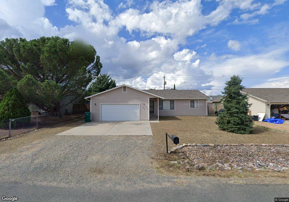
4500 N Miner Rd Prescott Valley, AZ 86314
Estimated Value: $345,323 - $418,000
--
Bed
--
Bath
1,428
Sq Ft
$267/Sq Ft
Est. Value
About This Home
This home is located at 4500 N Miner Rd, Prescott Valley, AZ 86314 and is currently estimated at $381,831, approximately $267 per square foot. 4500 N Miner Rd is a home located in Yavapai County with nearby schools including Granville Elementary School, Bradshaw Mountain Middle School, and Bradshaw Mountain High School.
Ownership History
Date
Name
Owned For
Owner Type
Purchase Details
Closed on
Apr 5, 2010
Sold by
Rana Enterprises Llc
Bought by
4500 Miner Road Llc
Current Estimated Value
Purchase Details
Closed on
Sep 8, 2009
Sold by
Atchison Patricia T and Atchison Family Trust
Bought by
Rana Enterprises Llc
Purchase Details
Closed on
Jan 11, 2002
Sold by
Leland Joel
Bought by
Leland Nancy S
Create a Home Valuation Report for This Property
The Home Valuation Report is an in-depth analysis detailing your home's value as well as a comparison with similar homes in the area
Home Values in the Area
Average Home Value in this Area
Purchase History
| Date | Buyer | Sale Price | Title Company |
|---|---|---|---|
| 4500 Miner Road Llc | -- | None Available | |
| Rana Enterprises Llc | -- | None Available | |
| Leland Nancy S | -- | Chicago Title Insurance Co |
Source: Public Records
Tax History Compared to Growth
Tax History
| Year | Tax Paid | Tax Assessment Tax Assessment Total Assessment is a certain percentage of the fair market value that is determined by local assessors to be the total taxable value of land and additions on the property. | Land | Improvement |
|---|---|---|---|---|
| 2026 | $1,589 | $31,404 | -- | -- |
| 2024 | $1,473 | $32,806 | -- | -- |
| 2023 | $1,473 | $27,024 | $4,168 | $22,856 |
| 2022 | $1,450 | $21,992 | $2,868 | $19,124 |
| 2021 | $1,488 | $20,329 | $2,883 | $17,446 |
| 2020 | $1,436 | $0 | $0 | $0 |
| 2019 | $1,417 | $0 | $0 | $0 |
| 2018 | $1,355 | $0 | $0 | $0 |
| 2017 | $1,329 | $0 | $0 | $0 |
| 2016 | $1,286 | $0 | $0 | $0 |
| 2015 | -- | $0 | $0 | $0 |
| 2014 | -- | $0 | $0 | $0 |
Source: Public Records
Map
Nearby Homes
- 4441 N Tonto Way
- 7316 Spouse Dr
- 7869 E Spouse Dr
- 7940 E Loos Dr
- 7764 E Cocopah Dr
- 4500 N Phillip Dr Unit 4
- 4461 N Phillip Dr
- 38-A1 N Norman Rd
- 4881 N Tonto Way
- 4148 N Jay Ct
- 7959 E Las Flores Ave
- 4921 N Miner Rd
- 3981 N Robert Rd
- 4112 N Edith Ct
- 4400 N Verde Vista Dr
- 4096 N Jay Ct
- 4801 N Calle Santa Cruz
- 4650 N Calle Santa Cruz
- 4351 N Verde Vista Dr
- 4350 N Verde Vista Dr
- 4516 N Miner Rd
- 4486 N Miner Rd
- 4486 N Miner Rd Unit 3
- 4501 N Tonto Way
- 4481 N Tonto Way
- 4472 N Miner Rd
- 4472 N Miner Rd Unit 3
- 4501 N Miner Rd
- 4455 N Miner
- 4517 N Tonto Way
- 4530 N Miner Rd
- 4517 N Miner Rd Unit 2
- 4517 N Miner Rd
- 4483 N Miner Rd
- 4461 N Tonto Way Unit 19
- 4461 N Tonto Way
- 4458 N Miner Rd
- 4531 N Miner Rd
- 4500 N Sauter Dr W
- 4533 N Tonto Way