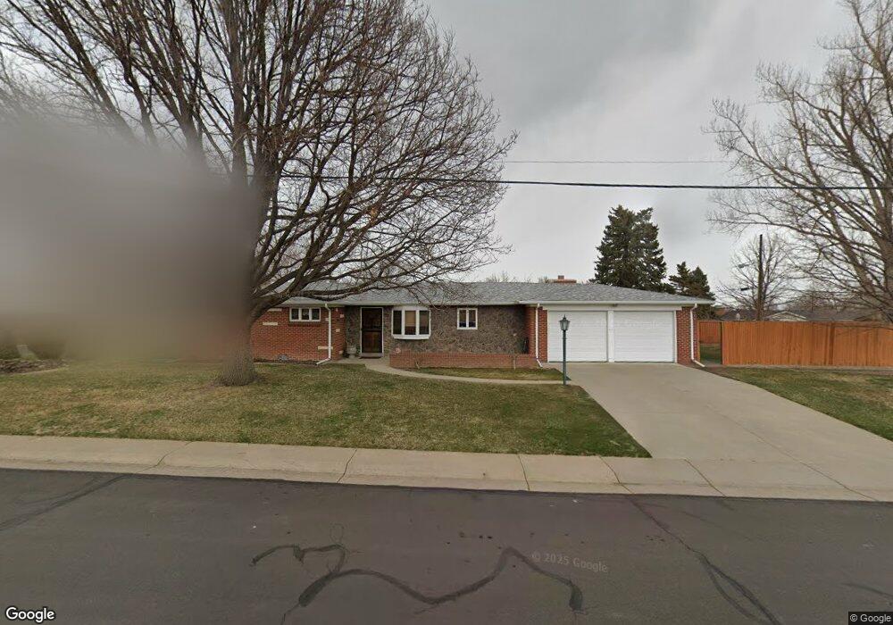
4500 Quay St Wheat Ridge, CO 80033
Barths NeighborhoodEstimated Value: $531,000 - $693,000
3
Beds
2
Baths
1,569
Sq Ft
$395/Sq Ft
Est. Value
About This Home
This home is located at 4500 Quay St, Wheat Ridge, CO 80033 and is currently estimated at $620,009, approximately $395 per square foot. 4500 Quay St is a home located in Jefferson County with nearby schools including Stevens Elementary School, Everitt Middle School, and Wheat Ridge High School.
Ownership History
Date
Name
Owned For
Owner Type
Purchase Details
Closed on
Jan 31, 2025
Sold by
Macri Deborah Ann
Bought by
Macri Trust
Current Estimated Value
Purchase Details
Closed on
Nov 28, 2016
Sold by
Mancinelli Stephen M
Bought by
Stephen Michael Mancinelli Living Trust
Purchase Details
Closed on
Nov 23, 2016
Sold by
Mancinelli Ralph Fred and Mancinelli Rosemary Lee
Bought by
Mancinelli Stephen M and Macri Deborah A
Purchase Details
Closed on
May 14, 2009
Sold by
Mancinelli Ralph Fred and Mancinelli Rosemary Lee
Bought by
Macri Deborah Ann and Mancinelli Stephen Michael
Create a Home Valuation Report for This Property
The Home Valuation Report is an in-depth analysis detailing your home's value as well as a comparison with similar homes in the area
Home Values in the Area
Average Home Value in this Area
Purchase History
| Date | Buyer | Sale Price | Title Company |
|---|---|---|---|
| Macri Trust | -- | None Listed On Document | |
| Stephen Michael Mancinelli Living Trust | -- | None Available | |
| Mancinelli Stephen M | -- | None Available | |
| Macri Deborah Ann | -- | None Available | |
| Mancinelli Ralph Fred | -- | None Available |
Source: Public Records
Tax History Compared to Growth
Tax History
| Year | Tax Paid | Tax Assessment Tax Assessment Total Assessment is a certain percentage of the fair market value that is determined by local assessors to be the total taxable value of land and additions on the property. | Land | Improvement |
|---|---|---|---|---|
| 2024 | $3,407 | $38,963 | $17,431 | $21,532 |
| 2023 | $3,407 | $38,963 | $17,431 | $21,532 |
| 2022 | $2,789 | $31,332 | $17,265 | $14,067 |
| 2021 | $2,828 | $32,233 | $17,762 | $14,471 |
| 2020 | $2,526 | $28,936 | $15,746 | $13,190 |
| 2019 | $2,492 | $28,936 | $15,746 | $13,190 |
| 2018 | $2,367 | $26,560 | $10,442 | $16,118 |
| 2017 | $2,137 | $26,560 | $10,442 | $16,118 |
| 2016 | $1,157 | $21,412 | $6,280 | $15,132 |
| 2015 | $586 | $21,412 | $6,280 | $15,132 |
| 2014 | $883 | $17,591 | $5,731 | $11,860 |
Source: Public Records
Map
Nearby Homes
- 4541 Reed St
- 7010 W 44th Ave
- 4420 Teller St
- 6920 W 47th Place
- 4730 Pierce St
- 4730 Otis St
- 6920 W 48th Ave Unit 6920
- 4635 Teller St
- 4125 Pierce St
- 4095 Quay St
- 7221 W 48th Ave
- 4014 Upham St
- 4026 Upham St
- 4024 Upham St
- 4008 Upham St
- 4711 Wadsworth Blvd
- 3830 Pierce St
- 4295 Harlan St
- 3820 Pierce St
- 3830 Otis St Unit 1-4