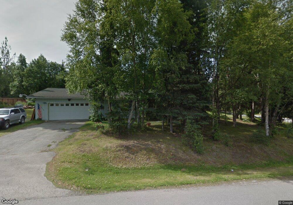
4500 Snowcup Cir Anchorage, AK 99516
Huffman-O'Malley NeighborhoodEstimated Value: $410,000 - $559,000
3
Beds
2
Baths
2,196
Sq Ft
$227/Sq Ft
Est. Value
About This Home
This home is located at 4500 Snowcup Cir, Anchorage, AK 99516 and is currently estimated at $499,316, approximately $227 per square foot. 4500 Snowcup Cir is a home with nearby schools including Huffman Elementary School, Goldenview Middle School, and South Anchorage High School.
Ownership History
Date
Name
Owned For
Owner Type
Purchase Details
Closed on
Aug 29, 1989
Sold by
Alaska Housing Finance Corp
Bought by
Backus Michael R and Backus Vicky
Current Estimated Value
Home Financials for this Owner
Home Financials are based on the most recent Mortgage that was taken out on this home.
Original Mortgage
$112,259
Interest Rate
10%
Mortgage Type
FHA
Create a Home Valuation Report for This Property
The Home Valuation Report is an in-depth analysis detailing your home's value as well as a comparison with similar homes in the area
Home Values in the Area
Average Home Value in this Area
Purchase History
| Date | Buyer | Sale Price | Title Company |
|---|---|---|---|
| Backus Michael R | -- | -- |
Source: Public Records
Mortgage History
| Date | Status | Borrower | Loan Amount |
|---|---|---|---|
| Closed | Backus Michael R | $112,259 |
Source: Public Records
Tax History
| Year | Tax Paid | Tax Assessment Tax Assessment Total Assessment is a certain percentage of the fair market value that is determined by local assessors to be the total taxable value of land and additions on the property. | Land | Improvement |
|---|---|---|---|---|
| 2025 | $3,536 | $480,700 | $112,100 | $368,600 |
| 2024 | $3,536 | $470,800 | $106,800 | $364,000 |
| 2023 | $6,673 | $431,900 | $102,700 | $329,200 |
| 2022 | $3,415 | $418,900 | $102,700 | $316,200 |
| 2021 | $6,403 | $381,800 | $102,700 | $279,100 |
| 2020 | $2,555 | $381,800 | $102,700 | $279,100 |
| 2019 | $2,659 | $376,700 | $102,700 | $274,000 |
| 2018 | $4,837 | $371,600 | $116,300 | $255,300 |
| 2017 | $5,096 | $365,700 | $116,300 | $249,400 |
| 2016 | $4,430 | $391,400 | $116,300 | $275,100 |
| 2015 | $4,430 | $378,400 | $112,300 | $266,100 |
| 2014 | $4,430 | $375,800 | $95,300 | $280,500 |
Source: Public Records
Map
Nearby Homes
- 0000 E 113th Ave
- 5345 Heritage Heights Dr
- 3641 E Klatt Rd
- L2 Totem Rd
- 6640 O'Malley Rd
- 0 Rd
- 11314 Cheri Ren Cir
- 3025 Huffman Rd
- 12850 Tara Ln
- 12201 Woodchase Cir
- 12241 Woodchase Cir
- 11254 Tulin Park Loop
- 3250 Legacy Dr
- 10996 Sky Ridge Dr
- 12113 Rolling Meadow Cir
- 11135 Red Sky Cir
- NHN Red Sky Cir
- 4905 de Armoun Rd
- 2640 E 112th Ave
- 3751 Eastwind Dr
- 4510 Snowcup Cir
- 11806 Wilderness Dr
- 4511 Snowcup Cir
- 11766 Wilderness Dr
- 4520 Snowcup Cir
- 11785 Wilderness Dr
- 11775 Wilderness Dr
- 11795 Wilderness Dr
- 11966 Wilderness Dr
- 4521 Snowcup Cir
- 11976 Wilderness Dr
- 11765 Wilderness Dr
- 11805 Wilderness Dr
- 11816 Wilderness Dr
- 11956 Wilderness Dr
- 11756 Wilderness Dr
- 11755 Wilderness Dr
- 4340 Sunstone Cir
- 11986 Wilderness Dr
- 4540 Snowcup Cir
Your Personal Tour Guide
Ask me questions while you tour the home.