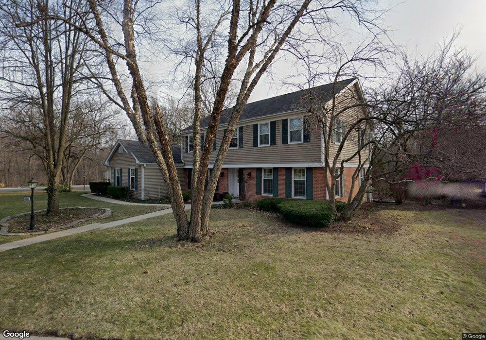
4501 Dawngate Ln Rolling Meadows, IL 60008
Creekside NeighborhoodEstimated Value: $701,898 - $798,000
4
Beds
3
Baths
3,109
Sq Ft
$239/Sq Ft
Est. Value
About This Home
This home is located at 4501 Dawngate Ln, Rolling Meadows, IL 60008 and is currently estimated at $741,725, approximately $238 per square foot. 4501 Dawngate Ln is a home located in Cook County with nearby schools including Central Road Elementary School, Plum Grove Jr High School, and William Fremd High School.
Ownership History
Date
Name
Owned For
Owner Type
Purchase Details
Closed on
May 12, 2010
Sold by
Martyn David G and Martyn Nancy L
Bought by
Dickinson Jeremy D and Dickinson Christine M
Current Estimated Value
Home Financials for this Owner
Home Financials are based on the most recent Mortgage that was taken out on this home.
Original Mortgage
$392,000
Outstanding Balance
$260,862
Interest Rate
5.14%
Mortgage Type
New Conventional
Estimated Equity
$480,863
Create a Home Valuation Report for This Property
The Home Valuation Report is an in-depth analysis detailing your home's value as well as a comparison with similar homes in the area
Home Values in the Area
Average Home Value in this Area
Purchase History
| Date | Buyer | Sale Price | Title Company |
|---|---|---|---|
| Dickinson Jeremy D | $490,000 | First American Title Ins Co |
Source: Public Records
Mortgage History
| Date | Status | Borrower | Loan Amount |
|---|---|---|---|
| Open | Dickinson Jeremy D | $392,000 |
Source: Public Records
Tax History
| Year | Tax Paid | Tax Assessment Tax Assessment Total Assessment is a certain percentage of the fair market value that is determined by local assessors to be the total taxable value of land and additions on the property. | Land | Improvement |
|---|---|---|---|---|
| 2025 | $14,815 | $63,000 | $8,670 | $54,330 |
| 2024 | $14,815 | $46,075 | $7,336 | $38,739 |
| 2023 | $14,232 | $50,240 | $7,336 | $42,904 |
| 2022 | $14,232 | $50,240 | $7,336 | $42,904 |
| 2021 | $13,422 | $42,591 | $4,668 | $37,923 |
| 2020 | $13,285 | $42,591 | $4,668 | $37,923 |
| 2019 | $13,353 | $47,588 | $4,668 | $42,920 |
| 2018 | $12,344 | $40,305 | $4,334 | $35,971 |
| 2017 | $12,111 | $40,305 | $4,334 | $35,971 |
| 2016 | $12,547 | $43,601 | $4,334 | $39,267 |
| 2015 | $12,237 | $40,128 | $4,001 | $36,127 |
| 2014 | $11,991 | $40,128 | $4,001 | $36,127 |
| 2013 | $13,281 | $45,282 | $4,001 | $41,281 |
Source: Public Records
Map
Nearby Homes
- 3000 California Ave
- 86 Brookdale Ln
- 3 Holyoke on Auburn
- 2650 Brookwood Way Dr Unit 313
- 2650 Brookwood Way Dr Unit 203
- 2650 Brookwood Way Dr Unit 108
- 4795 Woodcliff Ln
- 2600 Brookwood Way Dr Unit 316
- 3806 Ashley Ct
- 107 Chicory Ct
- 3107 Falcon Ct W
- 399 Knollwood Ct
- 2 Croydon on Duxbury
- 123 Honeysuckle Ct
- 2 Stuart on Oxford
- 112 Ironwood Ct
- 2401 Rohlwing Rd
- 4406 Euclid Ave Unit 2C
- 4704 Euclid Ave Unit 1B
- 4704 Euclid Ave Unit 47042D
- 4531 Dawngate Ln
- 155 E Kimberly Ave
- 4481 Dawngate Ln
- 3201 California Ave
- 3119 California Ct
- 4551 Dawngate Ln
- 3129 California Ct
- 123 E Kimberly Ave
- 4600 Mckone Ct
- 3139 California Ct
- 4471 Dawngate Ln Unit 2
- 3205 California Ave
- 4571 Dawngate Ln
- 4610 Mckone Ct
- 3143 California Ct
- 166 E Kimberly Ave
- 4470 Shady Ct
- 1735 S California Ave
- 95 E Kimberly Ave
- 4620 Mckone Ct
Your Personal Tour Guide
Ask me questions while you tour the home.