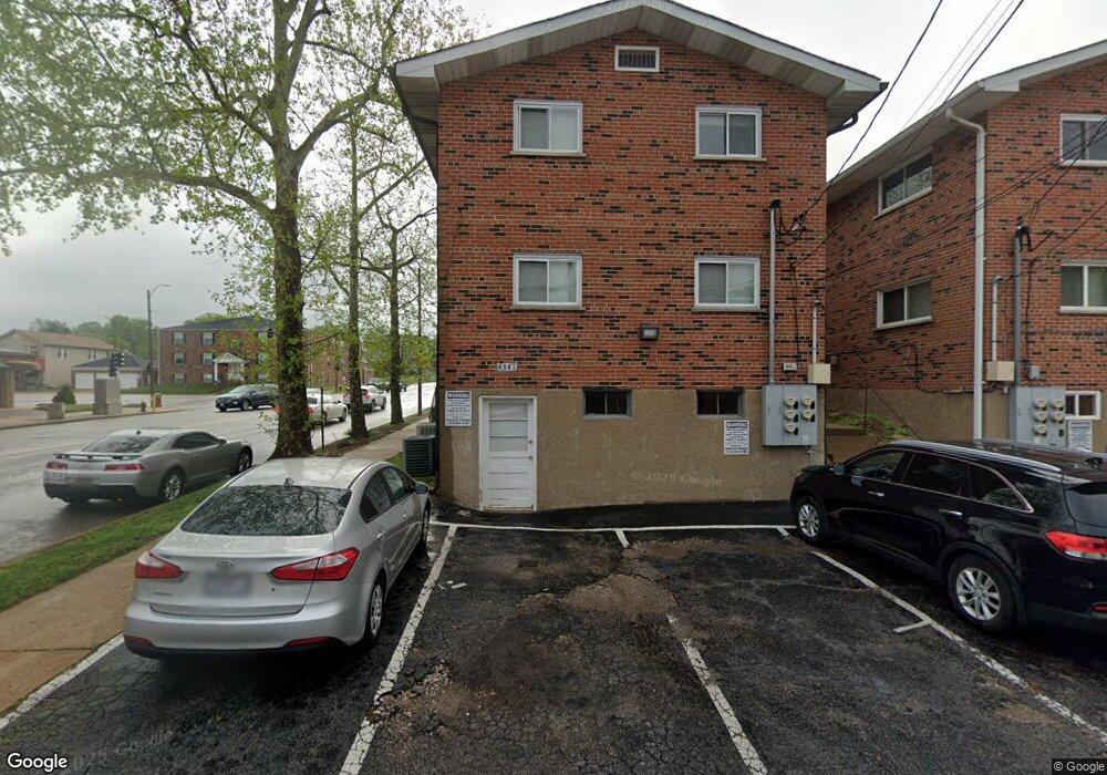
4501 Jamieson Ave Saint Louis, MO 63109
Lindenwood Park NeighborhoodEstimated Value: $402,000 - $529,000
Studio
4
Baths
3,376
Sq Ft
$137/Sq Ft
Est. Value
About This Home
This home is located at 4501 Jamieson Ave, Saint Louis, MO 63109 and is currently estimated at $462,000, approximately $136 per square foot. 4501 Jamieson Ave is a home located in St. Louis City with nearby schools including Mason Elementary School, Long International Middle School, and Roosevelt High School.
Ownership History
Date
Name
Owned For
Owner Type
Purchase Details
Closed on
Sep 4, 2007
Sold by
Marchetto Jacqueline L
Bought by
Three J Realty Llc
Current Estimated Value
Purchase Details
Closed on
Apr 13, 1998
Sold by
Ottenad Robert E
Bought by
Ottenad Robert E and Robert E Ottenad Revocable Trust
Create a Home Valuation Report for This Property
The Home Valuation Report is an in-depth analysis detailing your home's value as well as a comparison with similar homes in the area
Home Values in the Area
Average Home Value in this Area
Purchase History
| Date | Buyer | Sale Price | Title Company |
|---|---|---|---|
| Three J Realty Llc | -- | None Available | |
| Marchetto Jacqueline L | -- | None Available | |
| Ottenad Robert E | -- | -- |
Source: Public Records
Tax History
| Year | Tax Paid | Tax Assessment Tax Assessment Total Assessment is a certain percentage of the fair market value that is determined by local assessors to be the total taxable value of land and additions on the property. | Land | Improvement |
|---|---|---|---|---|
| 2025 | $3,765 | $55,110 | $2,770 | $52,340 |
| 2024 | $3,581 | $44,640 | $2,770 | $41,870 |
| 2023 | $3,581 | $44,640 | $2,770 | $41,870 |
| 2022 | $3,403 | $40,830 | $2,770 | $38,060 |
| 2021 | $3,398 | $40,830 | $2,770 | $38,060 |
| 2020 | $3,142 | $38,020 | $2,770 | $35,250 |
| 2019 | $3,131 | $38,020 | $2,770 | $35,250 |
| 2018 | $2,919 | $34,330 | $2,470 | $31,860 |
| 2017 | $2,869 | $34,330 | $2,470 | $31,860 |
| 2016 | $2,272 | $26,770 | $2,470 | $24,300 |
| 2015 | $2,060 | $26,770 | $2,470 | $24,300 |
| 2014 | $2,027 | $26,770 | $2,470 | $24,300 |
| 2013 | -- | $26,350 | $2,470 | $23,880 |
Source: Public Records
Map
Nearby Homes
- 6927-6931 Sutherland Ave
- 4313 Jamieson Ave
- 6732 Sutherland Ave
- 6962 Sutherland Ave
- 6709 Lansdowne Ave
- 3947 Jamieson Ave
- 6714 Bancroft Ave
- 6957 Chippewa St
- 6663 Devonshire Ave
- 6963 Chippewa St
- 4719 Jamieson Ave Unit 4
- 7048 Lansdowne Ave
- 6973 Winona Ave
- 7062 Sutherland Ave
- 6614 Devonshire Ave
- 3903 Prather Ave
- 6515 Devonshire Ave
- 3710 Berger Ave
- 6759 Delor St
- 6542 Lindenwood Place
- 4505 Jamieson Ave
- 4505 Jamieson Ave Unit A
- 4505 Jamieson Ave Unit B
- 4509 Jamieson Ave
- 6918 Lansdowne Ave
- 4515 Jamieson Ave
- 6915 Lansdowne Ave
- 4519 Jamieson Ave
- 4415 Jamieson Ave
- 6919 Plainview Ave
- 6923 Lansdowne Ave
- 4500 Jamieson Ave
- 4413 Jamieson Ave
- 4523 Jamieson Ave
- 4506 Jamieson Ave
- 6923 Plainview Ave
- 4510 Jamieson Ave
- 4510 Jamieson Ave
- 4510 Jamieson Ave Unit 1
- 4409 Jamieson Ave
Your Personal Tour Guide
Ask me questions while you tour the home.