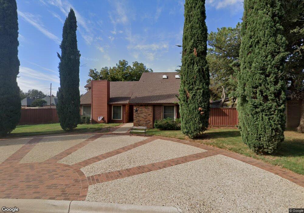
4501 Lennox Dr Midland, TX 79707
Skyline Terrace NeighborhoodEstimated Value: $436,000 - $469,803
4
Beds
3
Baths
3,078
Sq Ft
$147/Sq Ft
Est. Value
About This Home
This home is located at 4501 Lennox Dr, Midland, TX 79707 and is currently estimated at $453,451, approximately $147 per square foot. 4501 Lennox Dr is a home located in Midland County with nearby schools including Parker Elementary School, Alamo Junior High School, and Robert H. Goddard Junior High School.
Ownership History
Date
Name
Owned For
Owner Type
Purchase Details
Closed on
Jun 21, 2002
Sold by
Federal Home Loan Mortgage Cor
Bought by
Lathram Phillip D
Current Estimated Value
Purchase Details
Closed on
Apr 9, 2002
Sold by
Clardy Mark L
Bought by
Lathram Phillip D
Purchase Details
Closed on
Aug 21, 2000
Sold by
Nguyen Hai Hoang
Bought by
Lathram Phillip D
Purchase Details
Closed on
Jul 1, 1985
Bought by
Lathram Phillip D
Purchase Details
Closed on
Jan 10, 1985
Bought by
Lathram Phillip D
Create a Home Valuation Report for This Property
The Home Valuation Report is an in-depth analysis detailing your home's value as well as a comparison with similar homes in the area
Home Values in the Area
Average Home Value in this Area
Purchase History
| Date | Buyer | Sale Price | Title Company |
|---|---|---|---|
| Lathram Phillip D | -- | -- | |
| Lathram Phillip D | -- | -- | |
| Lathram Phillip D | -- | -- | |
| Lathram Phillip D | -- | -- | |
| Lathram Phillip D | -- | -- |
Source: Public Records
Tax History Compared to Growth
Tax History
| Year | Tax Paid | Tax Assessment Tax Assessment Total Assessment is a certain percentage of the fair market value that is determined by local assessors to be the total taxable value of land and additions on the property. | Land | Improvement |
|---|---|---|---|---|
| 2025 | $3,744 | $375,010 | $25,110 | $349,900 |
| 2024 | $3,751 | $388,210 | $25,110 | $363,100 |
| 2023 | $3,514 | $312,020 | $25,110 | $286,910 |
| 2022 | $4,649 | $297,540 | $25,110 | $272,430 |
| 2021 | $4,951 | $284,200 | $25,110 | $259,090 |
| 2020 | $4,202 | $278,720 | $25,110 | $253,610 |
| 2019 | $5,277 | $278,720 | $25,110 | $253,610 |
| 2018 | $5,270 | $271,020 | $25,110 | $245,910 |
| 2017 | $5,122 | $263,440 | $25,110 | $238,330 |
| 2016 | $5,039 | $258,670 | $25,110 | $233,560 |
| 2015 | -- | $258,670 | $25,110 | $233,560 |
| 2014 | -- | $249,360 | $25,110 | $224,250 |
Source: Public Records
Map
Nearby Homes
- 4502 Parkhurst Dr
- 4512 Norwood St
- 4000 W Loop 250 N
- 4505 Westminister Dr
- 3907 Westminister Dr
- 4500 Westminister Dr
- 4002 Crestwood Ave
- 4700 Boulder Dr Unit 710
- 4700 Boulder Dr Unit 611
- 4700 Boulder Dr Unit 103
- 4700 Boulder Dr Unit 303
- 4700 Boulder Dr Unit 1112
- 4700 Boulder Dr Unit 1504
- 4700 Boulder Dr Unit 1605
- 4700 Boulder Dr
- 4700 Boulder Dr Unit 1303
- 4700 Boulder Dr Unit 1601
- 4700 Boulder Dr Unit 902
- 4700 Boulder Dr Unit 1008
- 4003 Compton Dr
- 4503 Lennox Dr
- 4500 Parkhurst Dr
- 4405 Lennox Dr
- 4505 Lennox Dr
- 4500 Lennox Dr
- 4502 Lennox Dr
- 4408 Parkhurst Dr
- 4406 Lennox Dr
- 4507 Lennox Dr
- 4504 Lennox Dr
- 4403 Lennox Dr
- 4504 Parkhurst Dr
- 4406 Parkhurst Dr
- 4404 Lennox Dr
- 4506 Lennox Dr
- 4501 Stillmeadow Dr
- 4501 Parkhurst Dr
- 4503 Stillmeadow Dr
- 4404 Parkhurst Dr
- 4401 Lennox Dr