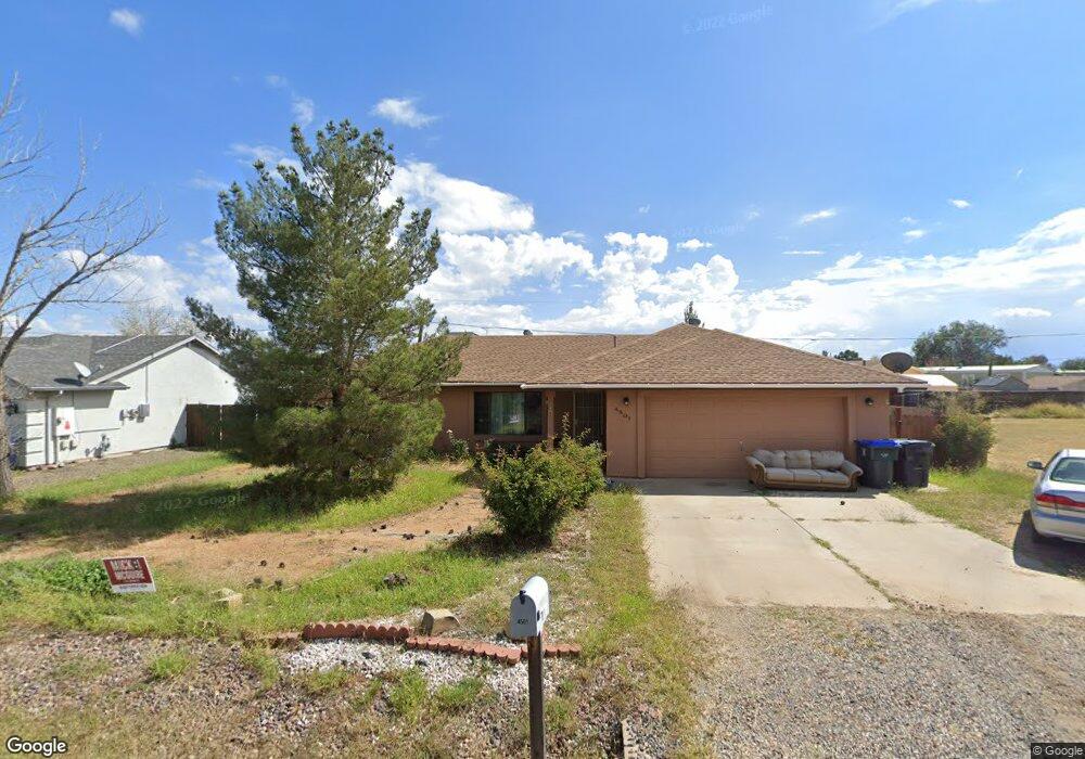
4501 N Preston Dr Unit 4 Prescott Valley, AZ 86314
Estimated Value: $363,000 - $389,000
3
Beds
2
Baths
1,414
Sq Ft
$267/Sq Ft
Est. Value
About This Home
This home is located at 4501 N Preston Dr Unit 4, Prescott Valley, AZ 86314 and is currently estimated at $378,238, approximately $267 per square foot. 4501 N Preston Dr Unit 4 is a home located in Yavapai County with nearby schools including Mountain View Elementary School, Glassford Hill Middle School, and Bradshaw Mountain High School.
Ownership History
Date
Name
Owned For
Owner Type
Purchase Details
Closed on
Feb 3, 2005
Sold by
Herrera Hugo C and Herrera Olga
Bought by
Desoto Augustin and Desoto Tammy R
Current Estimated Value
Home Financials for this Owner
Home Financials are based on the most recent Mortgage that was taken out on this home.
Original Mortgage
$133,600
Outstanding Balance
$67,280
Interest Rate
5.61%
Mortgage Type
New Conventional
Estimated Equity
$310,958
Purchase Details
Closed on
Feb 2, 1994
Sold by
Coffey William L and Coffey Joyce F
Bought by
Herrera Hugo C and Herrera Olga
Home Financials for this Owner
Home Financials are based on the most recent Mortgage that was taken out on this home.
Original Mortgage
$74,450
Interest Rate
8.6%
Mortgage Type
New Conventional
Purchase Details
Closed on
Nov 9, 1993
Sold by
Carter Bruce
Bought by
Coffey William L and Coffey Joyce F
Create a Home Valuation Report for This Property
The Home Valuation Report is an in-depth analysis detailing your home's value as well as a comparison with similar homes in the area
Home Values in the Area
Average Home Value in this Area
Purchase History
| Date | Buyer | Sale Price | Title Company |
|---|---|---|---|
| Desoto Augustin | $167,000 | Transnation Title | |
| Herrera Hugo C | $78,400 | Westitle Agency | |
| Coffey William L | $5,200 | First American Title | |
| Carter Bruce | $3,200 | First American Title |
Source: Public Records
Mortgage History
| Date | Status | Borrower | Loan Amount |
|---|---|---|---|
| Open | Desoto Augustin | $133,600 | |
| Previous Owner | Herrera Hugo C | $74,450 |
Source: Public Records
Tax History Compared to Growth
Tax History
| Year | Tax Paid | Tax Assessment Tax Assessment Total Assessment is a certain percentage of the fair market value that is determined by local assessors to be the total taxable value of land and additions on the property. | Land | Improvement |
|---|---|---|---|---|
| 2026 | $932 | $31,390 | -- | -- |
| 2024 | $844 | $32,596 | -- | -- |
| 2023 | $844 | $27,116 | $0 | $0 |
| 2022 | $829 | $22,083 | $2,868 | $19,215 |
| 2021 | $853 | $20,214 | $2,883 | $17,331 |
| 2020 | $807 | $0 | $0 | $0 |
| 2019 | $785 | $0 | $0 | $0 |
| 2018 | $734 | $0 | $0 | $0 |
| 2017 | $1,124 | $0 | $0 | $0 |
| 2016 | $1,086 | $0 | $0 | $0 |
| 2015 | $1,070 | $0 | $0 | $0 |
| 2014 | $1,012 | $0 | $0 | $0 |
Source: Public Records
Map
Nearby Homes
- 4395 N Katie Cir W
- 4461 N Phillip Dr
- 8591 E Tracy Dr
- 4471 N Romero Cir E Unit E
- 4327 N Romero Cir E
- 547 N Vermillion Dr
- 4420 N Katie Cir E
- 7316 Spouse Dr
- 4870 N Meixner Rd Unit 4
- 4895 N Arnold Dr
- 4441 N Tonto Way
- 38-A1 N Norman Rd
- 4365 N Tonto Way
- 4767 N Stallion Dr
- 8820 E Beaver Dr
- 8800 E Westward Way
- 4112 N Edith Ct
- 8428 E Manley Dr
- 0 E Lakeshore Dr Unit PAR1074038
- 4148 N Jay Ct
- 4501 N Preston Dr
- 4515 N Preston Dr
- 4490 N Katie Cir W
- 4490 N Katie Cir W Unit 5
- 4490 N Katie Cir W Unit 1
- 4480 N Katie Cir W Unit 5
- 4480 N Katie Cir W
- 4500 N Preston Dr
- 4529 N Preston Dr
- 4467 N Preston Dr
- 4514 N Preston Dr
- 4486 N Preston Dr
- 4460 N Katie Cir W
- 4504 N Katie Cir W Unit 5
- 4504 N Katie Cir W
- 4450 N Katie Cir W
- 4450 N Katie Cir W Unit 5
- 4530 N Preston Dr
- 4466 N Preston Dr