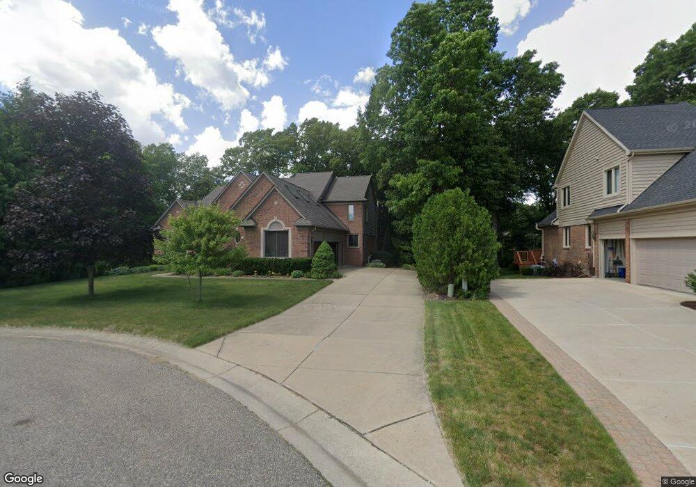
4501 Philip Commerce Township, MI 48382
Estimated Value: $620,583 - $721,000
4
Beds
3
Baths
3,189
Sq Ft
$210/Sq Ft
Est. Value
About This Home
This home is located at 4501 Philip, Commerce Township, MI 48382 and is currently estimated at $668,646, approximately $209 per square foot. 4501 Philip is a home located in Oakland County with nearby schools including Glengary Elementary School, Walled Lake Northern High School, and St. Matthew Lutheran School.
Ownership History
Date
Name
Owned For
Owner Type
Purchase Details
Closed on
Mar 25, 2010
Sold by
Gaa Llc
Bought by
Gary R Trzaskos Living Trust Uta
Current Estimated Value
Purchase Details
Closed on
Apr 28, 2009
Sold by
Cox Donald R and Cox Allison W
Bought by
Central Mortgage Company
Purchase Details
Closed on
Nov 13, 2002
Sold by
Cox Allison W
Bought by
Cox D
Home Financials for this Owner
Home Financials are based on the most recent Mortgage that was taken out on this home.
Original Mortgage
$304,950
Interest Rate
6.13%
Purchase Details
Closed on
Oct 4, 2002
Sold by
Italo American Building
Bought by
Cox Allison
Home Financials for this Owner
Home Financials are based on the most recent Mortgage that was taken out on this home.
Original Mortgage
$304,950
Interest Rate
6.13%
Purchase Details
Closed on
Nov 5, 1999
Sold by
Commerce Woods Dev Co
Bought by
Italo - American Building Corp
Create a Home Valuation Report for This Property
The Home Valuation Report is an in-depth analysis detailing your home's value as well as a comparison with similar homes in the area
Home Values in the Area
Average Home Value in this Area
Purchase History
| Date | Buyer | Sale Price | Title Company |
|---|---|---|---|
| Gary R Trzaskos Living Trust Uta | -- | None Available | |
| Central Mortgage Company | $457,933 | None Available | |
| Cox D | -- | -- | |
| Cox Allison | $440,000 | -- | |
| Italo - American Building Corp | $76,500 | -- |
Source: Public Records
Mortgage History
| Date | Status | Borrower | Loan Amount |
|---|---|---|---|
| Previous Owner | Cox D | $304,950 | |
| Previous Owner | Cox Allison | $300,000 |
Source: Public Records
Tax History
| Year | Tax Paid | Tax Assessment Tax Assessment Total Assessment is a certain percentage of the fair market value that is determined by local assessors to be the total taxable value of land and additions on the property. | Land | Improvement |
|---|---|---|---|---|
| 2025 | $5,686 | $288,220 | $0 | $0 |
| 2024 | $3,532 | $275,230 | $0 | $0 |
| 2023 | $3,330 | $255,010 | $0 | $0 |
| 2022 | $5,081 | $227,320 | $0 | $0 |
| 2021 | $4,989 | $218,880 | $0 | $0 |
| 2020 | $3,291 | $203,160 | $0 | $0 |
| 2019 | $4,757 | $194,150 | $0 | $0 |
| 2018 | $4,730 | $188,470 | $0 | $0 |
| 2017 | $4,660 | $188,470 | $0 | $0 |
| 2016 | $4,601 | $183,570 | $0 | $0 |
| 2015 | -- | $172,830 | $0 | $0 |
| 2014 | -- | $160,800 | $0 | $0 |
| 2011 | -- | $134,410 | $0 | $0 |
Source: Public Records
Map
Nearby Homes
- 1089 Penarth St
- 00 S Lot 77 80
- 000 Midwood Lot 74 80
- 2028 Applebrook Dr
- 1735 Wickham
- 0 E Commerce Rd Unit 20250020519
- 1555 Wandrei Ct
- 4950 Whitlow Ct
- 945 N Commerce Rd
- 5020 Whitlow Ct
- 716 Commercial St
- 4975 Comstock St
- 0000 Knob Hill Dr
- 900 Polvadera St
- 5 Benstein
- 4659 Camelina St
- 3870 Benstein Rd
- 3857 Ellisia Rd
- 0000 Ellisia Rd
- 3871 Cheryl Dr
- 4499 Philip
- 4511 Philip
- 4602 Benstein Rd Unit 12
- 4602 Benstein Rd
- 4521 Philip
- 4612 Benstein Rd
- 4622 Benstein Rd Unit 10
- 4622 Benstein Rd
- 4622 Benstein Rd Unit 2171 10
- 4489 Philip
- 4488 Philip
- 4531 Philip
- 4630 Benstein Rd
- 4616 Benstein Rd Unit 13
- 4606 Benstein Rd
- 4626 Benstein Rd
- 4640 Benstein Rd
- 4656 Benstein Rd
- 4676 Benstein Rd
- 4479 Philip
Your Personal Tour Guide
Ask me questions while you tour the home.