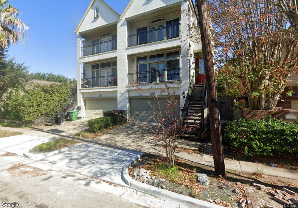
4503 Woodhead St Unit A Houston, TX 77098
Montrose NeighborhoodEstimated Value: $476,679 - $970,000
3
Beds
3
Baths
2,373
Sq Ft
$260/Sq Ft
Est. Value
About This Home
This home is located at 4503 Woodhead St Unit A, Houston, TX 77098 and is currently estimated at $617,920, approximately $260 per square foot. 4503 Woodhead St Unit A is a home located in Harris County with nearby schools including Poe Elementary School, Lanier Middle School, and Lamar High School.
Ownership History
Date
Name
Owned For
Owner Type
Purchase Details
Closed on
Aug 29, 2022
Sold by
Yeh Kevin D
Bought by
Brightwater Advisors Llc
Current Estimated Value
Purchase Details
Closed on
Jun 26, 2009
Sold by
Dishop Megan
Bought by
Yeb Kevin D
Home Financials for this Owner
Home Financials are based on the most recent Mortgage that was taken out on this home.
Original Mortgage
$332,666
Interest Rate
4.83%
Mortgage Type
Purchase Money Mortgage
Create a Home Valuation Report for This Property
The Home Valuation Report is an in-depth analysis detailing your home's value as well as a comparison with similar homes in the area
Home Values in the Area
Average Home Value in this Area
Purchase History
| Date | Buyer | Sale Price | Title Company |
|---|---|---|---|
| Brightwater Advisors Llc | -- | Stewart Title | |
| Yeb Kevin D | -- | Old Republic Title Company O |
Source: Public Records
Mortgage History
| Date | Status | Borrower | Loan Amount |
|---|---|---|---|
| Previous Owner | Yeb Kevin D | $332,666 |
Source: Public Records
Tax History Compared to Growth
Tax History
| Year | Tax Paid | Tax Assessment Tax Assessment Total Assessment is a certain percentage of the fair market value that is determined by local assessors to be the total taxable value of land and additions on the property. | Land | Improvement |
|---|---|---|---|---|
| 2025 | $9,299 | $431,251 | $118,125 | $313,126 |
| 2024 | $9,299 | $444,446 | $118,125 | $326,321 |
| 2023 | $9,299 | $400,000 | $118,125 | $281,875 |
| 2022 | $9,722 | $441,512 | $118,125 | $323,387 |
| 2021 | $9,543 | $409,452 | $105,000 | $304,452 |
| 2020 | $10,361 | $427,846 | $105,000 | $322,846 |
| 2019 | $10,431 | $412,225 | $105,000 | $307,225 |
| 2018 | $8,513 | $433,291 | $105,000 | $328,291 |
| 2017 | $11,498 | $433,291 | $105,000 | $328,291 |
| 2016 | $11,172 | $421,017 | $105,000 | $316,017 |
| 2015 | $7,392 | $421,017 | $105,000 | $316,017 |
| 2014 | $7,392 | $393,547 | $91,875 | $301,672 |
Source: Public Records
Map
Nearby Homes
- 1802 Portsmouth St
- 1655 Castle Ct
- 1826 Portsmouth St
- 1658 Norfolk St
- 4509 Hazard St
- 1849 Portsmouth St
- 1656 Norfolk St
- 1652 Norfolk St
- 1741 Banks St
- 1637 Castle Ct
- 1819 Banks St
- 1635 Castle Ct
- 1656 Banks St
- 1721 Colquitt St
- 1925 Lexington St
- 1619 Norfolk St
- 1624 Vassar St
- 1723 Milford St
- 1818 Colquitt St
- 1614 Norfolk St Unit C
- 4503 Woodhead St
- 4503 Woodhead St Unit B
- 4503A Woodhead St
- 4507 Woodhead St
- 4511 Woodhead St
- 1745 Norfolk St
- 1751 Norfolk St
- 1743 Norfolk St
- 1750 Lexington St
- 1750 Lexington St Unit 2
- 1750 Lexington St Unit UPSTAIR
- 1801 Norfolk St
- 1741 Norfolk St
- 1740B Lexington St
- 1740 Lexington St
- 1740 Lexington St Unit B
- 1807 Norfolk St
- 1808 Lexington St
- 1735 Norfolk St
- 1733 Norfolk St