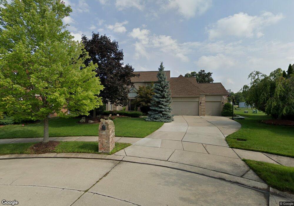
45032 Thornhill Ct Canton, MI 48188
Estimated Value: $540,000 - $610,000
--
Bed
2
Baths
2,498
Sq Ft
$230/Sq Ft
Est. Value
About This Home
This home is located at 45032 Thornhill Ct, Canton, MI 48188 and is currently estimated at $573,661, approximately $229 per square foot. 45032 Thornhill Ct is a home located in Wayne County with nearby schools including Bentley Elementary School, Canton High School, and Plymouth High School.
Ownership History
Date
Name
Owned For
Owner Type
Purchase Details
Closed on
Jul 2, 2003
Sold by
Spiteri Diane M and Spiteri Steven M
Bought by
Spiteri Steven M
Current Estimated Value
Home Financials for this Owner
Home Financials are based on the most recent Mortgage that was taken out on this home.
Original Mortgage
$142,750
Outstanding Balance
$61,147
Interest Rate
5.36%
Mortgage Type
Stand Alone First
Estimated Equity
$512,514
Purchase Details
Closed on
Apr 19, 2001
Sold by
Cramer Brian J
Bought by
Spiteri Steven M
Purchase Details
Closed on
Jun 17, 1994
Sold by
A & H Building Co
Bought by
Cramer Brian J and Cramer Kimberly M
Create a Home Valuation Report for This Property
The Home Valuation Report is an in-depth analysis detailing your home's value as well as a comparison with similar homes in the area
Home Values in the Area
Average Home Value in this Area
Purchase History
| Date | Buyer | Sale Price | Title Company |
|---|---|---|---|
| Spiteri Steven M | -- | -- | |
| Spiteri Steven M | $337,450 | -- | |
| Cramer Brian J | $211,974 | -- |
Source: Public Records
Mortgage History
| Date | Status | Borrower | Loan Amount |
|---|---|---|---|
| Open | Spiteri Steven M | $142,750 |
Source: Public Records
Tax History Compared to Growth
Tax History
| Year | Tax Paid | Tax Assessment Tax Assessment Total Assessment is a certain percentage of the fair market value that is determined by local assessors to be the total taxable value of land and additions on the property. | Land | Improvement |
|---|---|---|---|---|
| 2025 | $3,232 | $263,300 | $0 | $0 |
| 2024 | $3,232 | $238,800 | $0 | $0 |
| 2023 | $3,082 | $222,200 | $0 | $0 |
| 2022 | $6,671 | $200,300 | $0 | $0 |
| 2021 | $6,473 | $195,400 | $0 | $0 |
| 2020 | $6,393 | $188,500 | $0 | $0 |
| 2019 | $6,277 | $182,570 | $0 | $0 |
| 2018 | $2,619 | $167,580 | $0 | $0 |
| 2017 | $6,330 | $163,200 | $0 | $0 |
| 2016 | $5,701 | $157,900 | $0 | $0 |
| 2015 | $14,391 | $152,620 | $0 | $0 |
| 2013 | $14,052 | $146,480 | $0 | $0 |
| 2010 | -- | $131,150 | $68,056 | $63,094 |
Source: Public Records
Map
Nearby Homes
- 45242 Thornhill Rd
- 45030 Glengarry Rd
- 43871 Yorktown St
- 45400 William Ct
- 1619 Nowland Ct
- 43661 Antietam Ct
- 43592 Champlain Ct
- 550 Cherry Grove Rd Unit 111
- 46509 Killarney Cir
- 2210 Woodmont Dr W
- 43664 Appomattox Ct
- 44322 Vassar St
- 46502 Killarney Cir Unit 191
- 278 Cornell St
- 288 Edington Cir Unit 61
- 1937 S Cavalier Dr
- 46449 Killarney Ct Unit Bldg-Unit160
- 43450 Fredericksburg St
- 1831 N Arbor Way Dr Unit 18
- 227 Edington Cir
- 45050 Thornhill Ct
- 45002 Thornhill Ct
- 45070 Thornhill Ct
- 45029 Lothrop Ct
- 45001 Thornhill Ct
- 45051 Lothrop Ct
- 45003 Lothrop Ct
- 45027 Thornhill Ct
- 45049 Thornhill Ct
- 45071 Lothrop Ct
- 45069 Thornhill Ct
- 45091 Lothrop Ct
- 0 Lothrop Ct
- 45108 Thornhill Ct
- 1100 S Sheldon Rd
- 45089 Thornhill Ct
- 45004 Lothrop Ct
- 44557 Fenwick Dr
- 44525 Fenwick Dr
- 45109 Lothrop Ct