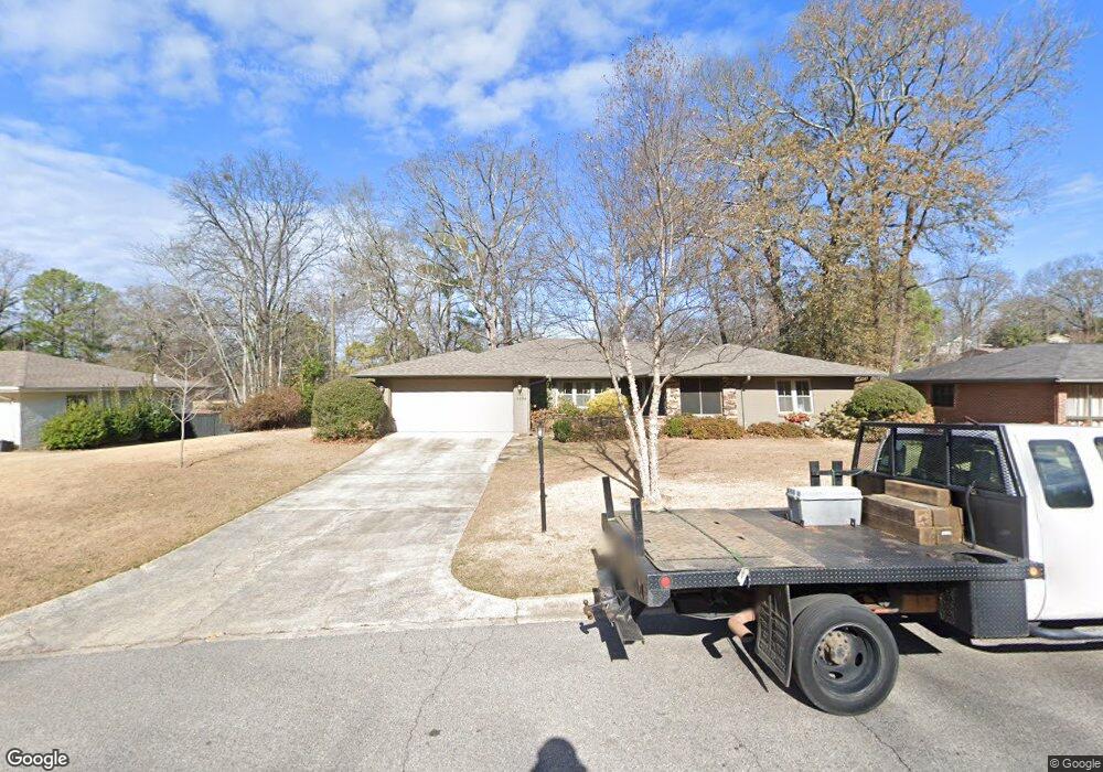
4504 Linwood Dr Birmingham, AL 35222
Forest Park NeighborhoodEstimated Value: $634,340 - $781,000
5
Beds
4
Baths
3,081
Sq Ft
$228/Sq Ft
Est. Value
About This Home
This home is located at 4504 Linwood Dr, Birmingham, AL 35222 and is currently estimated at $703,835, approximately $228 per square foot. 4504 Linwood Dr is a home located in Jefferson County with nearby schools including Avondale Elementary School, W.E. Putnam Middle School Magnet, and Woodlawn High School-Magnet.
Ownership History
Date
Name
Owned For
Owner Type
Purchase Details
Closed on
May 25, 2021
Sold by
Fausel Todd C
Bought by
Martin Mindy and Martin Charles
Current Estimated Value
Home Financials for this Owner
Home Financials are based on the most recent Mortgage that was taken out on this home.
Original Mortgage
$355,000
Outstanding Balance
$322,107
Interest Rate
2.9%
Mortgage Type
New Conventional
Estimated Equity
$363,014
Purchase Details
Closed on
Oct 26, 2001
Sold by
Rees Mable R
Bought by
Deason Deborah Michelle
Home Financials for this Owner
Home Financials are based on the most recent Mortgage that was taken out on this home.
Original Mortgage
$116,000
Interest Rate
6.85%
Create a Home Valuation Report for This Property
The Home Valuation Report is an in-depth analysis detailing your home's value as well as a comparison with similar homes in the area
Home Values in the Area
Average Home Value in this Area
Purchase History
| Date | Buyer | Sale Price | Title Company |
|---|---|---|---|
| Martin Mindy | $525,000 | -- | |
| Deason Deborah Michelle | $145,000 | -- |
Source: Public Records
Mortgage History
| Date | Status | Borrower | Loan Amount |
|---|---|---|---|
| Open | Martin Mindy | $355,000 | |
| Previous Owner | Fausel Todd C | $243,000 | |
| Previous Owner | Fausel Todd | $352,000 | |
| Previous Owner | Hayes Frank D | $35,000 | |
| Previous Owner | Deason Deborah Michelle | $116,000 |
Source: Public Records
Tax History Compared to Growth
Tax History
| Year | Tax Paid | Tax Assessment Tax Assessment Total Assessment is a certain percentage of the fair market value that is determined by local assessors to be the total taxable value of land and additions on the property. | Land | Improvement |
|---|---|---|---|---|
| 2024 | $3,650 | $55,960 | -- | -- |
| 2022 | $2,908 | $41,100 | $20,660 | $20,440 |
| 2021 | $2,470 | $35,060 | $20,660 | $14,400 |
| 2020 | $2,253 | $32,060 | $16,800 | $15,260 |
| 2019 | $2,190 | $31,200 | $0 | $0 |
| 2018 | $2,229 | $31,740 | $0 | $0 |
| 2017 | $1,903 | $27,240 | $0 | $0 |
| 2016 | $1,967 | $28,120 | $0 | $0 |
| 2015 | $1,639 | $23,600 | $0 | $0 |
| 2014 | $1,455 | $21,900 | $0 | $0 |
| 2013 | $1,455 | $21,900 | $0 | $0 |
Source: Public Records
Map
Nearby Homes
- 4411 7th Ave S
- 739 47th St S
- 741 47th Place S
- 4300 Linwood Dr
- 712 43rd St S
- 4713 9th Ave S
- 4224 7th Ave S
- 4405 5th Ave S
- 745 Linwood Rd
- 4335 5th Ave S
- 4328 5th Ave S
- 504 47th St S
- 721 47th Way S
- 4804 Lincrest Dr
- 4709 Overwood Cir
- 770 12th Ave S Unit 1
- 747 48th St S
- 209 43rd St S
- 4405 2nd Ave S
- 4115 4th Ave S
- 4508 Linwood Dr
- 4500 Linwood Dr
- 4500 Linwood Dr Unit 2-B
- 4509 Linpark Dr
- 4513 Linpark Dr
- 4517 Linpark Dr
- 4501 Linpark Dr
- 4505 Linwood Dr
- 4509 Linwood Dr
- 4512 Linwood Dr
- 735 44th Place S Unit 2-B
- 4501 Linwood Dr
- 4521 Linpark Dr
- 4516 Linwood Dr
- 4517 Linwood Dr
- 4517 Linwood Dr Unit lot 4
- 4513 Linwood Dr
- 4408 Linwood Dr
- 736 44th Place S
- 4525 Linpark Dr
