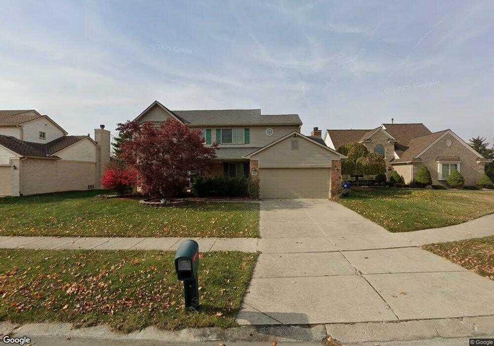
45040 Fox Pointe Dr Unit 25 Canton, MI 48187
Estimated Value: $457,000 - $608,000
4
Beds
4
Baths
2,385
Sq Ft
$218/Sq Ft
Est. Value
About This Home
This home is located at 45040 Fox Pointe Dr Unit 25, Canton, MI 48187 and is currently estimated at $518,784, approximately $217 per square foot. 45040 Fox Pointe Dr Unit 25 is a home located in Wayne County with nearby schools including Canton High School, Discovery Middle School, and Plymouth High School.
Ownership History
Date
Name
Owned For
Owner Type
Purchase Details
Closed on
May 20, 2010
Sold by
Nair Venu G and Nair Sreelekha V
Bought by
Gandhi Chandreshkumar and Gandhi Hina
Current Estimated Value
Purchase Details
Closed on
Nov 19, 2003
Sold by
Cerda Americo and Cerda San Juanita
Bought by
Venugopal Gopalakrishnan
Purchase Details
Closed on
Aug 29, 2002
Sold by
Sava Sarayu
Bought by
Cerda Americo
Create a Home Valuation Report for This Property
The Home Valuation Report is an in-depth analysis detailing your home's value as well as a comparison with similar homes in the area
Home Values in the Area
Average Home Value in this Area
Purchase History
| Date | Buyer | Sale Price | Title Company |
|---|---|---|---|
| Gandhi Chandreshkumar | $220,000 | Capital Title Ins Agency | |
| Venugopal Gopalakrishnan | $279,000 | Multiple | |
| Cerda Americo | $285,000 | -- |
Source: Public Records
Tax History Compared to Growth
Tax History
| Year | Tax Paid | Tax Assessment Tax Assessment Total Assessment is a certain percentage of the fair market value that is determined by local assessors to be the total taxable value of land and additions on the property. | Land | Improvement |
|---|---|---|---|---|
| 2025 | $2,602 | $222,400 | $0 | $0 |
| 2024 | $2,602 | $203,300 | $0 | $0 |
| 2023 | $2,480 | $197,500 | $0 | $0 |
| 2022 | $5,405 | $179,700 | $0 | $0 |
| 2021 | $5,246 | $173,600 | $0 | $0 |
| 2020 | $5,179 | $170,100 | $0 | $0 |
| 2019 | $5,085 | $162,610 | $0 | $0 |
| 2018 | $2,108 | $155,450 | $0 | $0 |
| 2017 | $5,159 | $150,700 | $0 | $0 |
| 2016 | $4,621 | $146,200 | $0 | $0 |
| 2015 | $11,583 | $142,950 | $0 | $0 |
| 2013 | $11,221 | $123,640 | $0 | $0 |
| 2010 | -- | $108,070 | $54,968 | $53,102 |
Source: Public Records
Map
Nearby Homes
- 44585 Nantucket Dr
- 50782 Ross St
- 48590 Ford Rd
- 0000 Ford
- 6171 Gloucester Dr
- 44661 Jeffrey Cir
- 44497 Savery Dr Unit 103
- 6750 N Canton Center Rd
- 45139 Indian Creek Dr
- 1710 Longfellow Dr
- 1625 Longfellow Dr
- 1584 Commodore Cir Unit 33
- 44018 Bannockburn Dr
- 6832 New Providence Way Unit 1007
- 45228 Patrick Dr
- 43737 Westminister Way
- 847 Coldrose Way
- 835 Coldrose Way
- 44995 Quaker Hill Dr
- 45866 S Stonewood Rd
- 45026 Fox Pointe Dr Unit 24
- 45054 Fox Pointe Dr Unit 26
- 45068 Fox Pointe Dr Unit 27
- 45012 Fox Pointe Dr
- 45039 Fox Pointe Dr
- 45053 Fox Pointe Dr
- 44998 Fox Pointe Dr
- 45067 Fox Pointe Dr Unit 7
- 44984 Fox Pointe Dr
- 44955 Fox Pointe Dr
- 44970 Fox Pointe Dr
- 45081 Fox Pointe Dr Unit 6
- 45137 Fox Pointe Dr
- 45151 Fox Pointe Dr Unit 1
- 44956 Fox Pointe Dr
- 44941 Fox Pointe Dr
- 45095 Fox Pointe Dr
- 45123 Fox Pointe Dr
- 45109 Fox Pointe Dr
- 44942 Fox Pointe Dr Unit 18