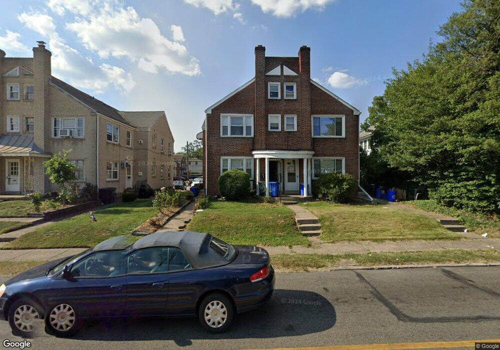
4505 State Rd Drexel Hill, PA 19026
Estimated Value: $292,000 - $400,000
2
Beds
2
Baths
1,720
Sq Ft
$199/Sq Ft
Est. Value
About This Home
This home is located at 4505 State Rd, Drexel Hill, PA 19026 and is currently estimated at $342,160, approximately $198 per square foot. 4505 State Rd is a home located in Delaware County with nearby schools including Aronimink El School, Upper Darby Kdg Center, and Drexel Hill Middle School.
Ownership History
Date
Name
Owned For
Owner Type
Purchase Details
Closed on
Dec 28, 2012
Sold by
Nesfeder Christina and Obrien Christina M
Bought by
Obrien William and Obrien Christina M
Current Estimated Value
Purchase Details
Closed on
Nov 30, 1998
Sold by
Hart Jean H and Hart Paul John
Bought by
Nesfeder Christina
Home Financials for this Owner
Home Financials are based on the most recent Mortgage that was taken out on this home.
Original Mortgage
$115,695
Outstanding Balance
$26,053
Interest Rate
6.68%
Mortgage Type
FHA
Estimated Equity
$316,107
Create a Home Valuation Report for This Property
The Home Valuation Report is an in-depth analysis detailing your home's value as well as a comparison with similar homes in the area
Home Values in the Area
Average Home Value in this Area
Purchase History
| Date | Buyer | Sale Price | Title Company |
|---|---|---|---|
| Obrien William | -- | None Available | |
| Nesfeder Christina | $115,800 | -- |
Source: Public Records
Mortgage History
| Date | Status | Borrower | Loan Amount |
|---|---|---|---|
| Open | Nesfeder Christina | $115,695 |
Source: Public Records
Tax History Compared to Growth
Tax History
| Year | Tax Paid | Tax Assessment Tax Assessment Total Assessment is a certain percentage of the fair market value that is determined by local assessors to be the total taxable value of land and additions on the property. | Land | Improvement |
|---|---|---|---|---|
| 2025 | $7,816 | $184,820 | $41,160 | $143,660 |
| 2024 | $7,816 | $184,820 | $41,160 | $143,660 |
| 2023 | $7,743 | $184,820 | $41,160 | $143,660 |
| 2022 | $7,534 | $184,820 | $41,160 | $143,660 |
| 2021 | $10,159 | $184,820 | $41,160 | $143,660 |
| 2020 | $7,632 | $117,980 | $39,910 | $78,070 |
| 2019 | $7,498 | $117,980 | $39,910 | $78,070 |
| 2018 | $7,411 | $117,980 | $0 | $0 |
| 2017 | $7,219 | $117,980 | $0 | $0 |
| 2016 | $647 | $117,980 | $0 | $0 |
| 2015 | $647 | $117,980 | $0 | $0 |
| 2014 | $647 | $117,980 | $0 | $0 |
Source: Public Records
Map
Nearby Homes
- 820 Wilde Ave
- 833 Anderson Ave
- 1005 Belfield Ave
- 824 Lindale Ave
- 914 Anderson Ave
- 711 Roberts Ave
- 1102 Childs Ave
- 1048 Morgan Ave
- 831 Concord Ave
- 718 Concord Ave
- 930 Ormond Ave
- 4812 Woodland Ave
- 1208 Belfield Ave
- 828 Mason Ave
- 844 Mason Ave
- 729 Edmonds Ave
- 4930 State Rd
- 4400 School Ln
- 521 Blythe Ave
- 719 Mason Ave
- 4503 State Rd Unit 2ND FL
- 4503 State Rd Unit A
- 4503 State Rd
- 4507 State Rd
- 4509 State Rd
- 801 Burmont Rd
- 4515 State Rd
- 4501 State Rd
- 803 Burmont Rd
- 803 Burmont Rd Unit 3
- 805 Burmont Rd
- 4517 State Rd
- 816 Wilde Ave
- 807 Burmont Rd Unit GROUND
- 807 Burmont Rd Unit 1ST FL
- 807 Burmont Rd Unit 2ND FL
- 807 Burmont Rd
- 811 Burmont Rd
- 813 Burmont Rd
- 4601 State Rd Unit 1-03