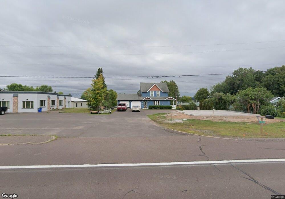
45050 Us Highway 41 Chassell, MI 49916
Estimated Value: $547,057 - $671,000
4
Beds
3
Baths
3,511
Sq Ft
$179/Sq Ft
Est. Value
About This Home
This home is located at 45050 Us Highway 41, Chassell, MI 49916 and is currently estimated at $628,019, approximately $178 per square foot. 45050 Us Highway 41 is a home located in Houghton County with nearby schools including Houghton Elementary School, Houghton Middle School, and Houghton Central High School.
Ownership History
Date
Name
Owned For
Owner Type
Purchase Details
Closed on
Oct 3, 2022
Sold by
Nominelli Gregg R
Bought by
Chamberlain Erik P and Story Elaine
Current Estimated Value
Home Financials for this Owner
Home Financials are based on the most recent Mortgage that was taken out on this home.
Original Mortgage
$418,000
Outstanding Balance
$404,495
Interest Rate
6.9%
Mortgage Type
New Conventional
Estimated Equity
$223,524
Purchase Details
Closed on
Nov 1, 1997
Sold by
Calkins Jay S & Alice M
Bought by
Nominelli Gregg R
Create a Home Valuation Report for This Property
The Home Valuation Report is an in-depth analysis detailing your home's value as well as a comparison with similar homes in the area
Home Values in the Area
Average Home Value in this Area
Purchase History
| Date | Buyer | Sale Price | Title Company |
|---|---|---|---|
| Chamberlain Erik P | $440,000 | M&M Title | |
| Nominelli Gregg R | $175,000 | -- |
Source: Public Records
Mortgage History
| Date | Status | Borrower | Loan Amount |
|---|---|---|---|
| Open | Chamberlain Erik P | $418,000 |
Source: Public Records
Tax History Compared to Growth
Tax History
| Year | Tax Paid | Tax Assessment Tax Assessment Total Assessment is a certain percentage of the fair market value that is determined by local assessors to be the total taxable value of land and additions on the property. | Land | Improvement |
|---|---|---|---|---|
| 2025 | $7,922 | $265,014 | $0 | $0 |
| 2024 | $4,549 | $224,484 | $0 | $0 |
| 2023 | $4,336 | $211,060 | $0 | $0 |
| 2022 | $9,623 | $194,046 | $0 | $0 |
| 2021 | $9,430 | $189,906 | $0 | $0 |
| 2020 | $5,837 | $172,279 | $0 | $0 |
| 2019 | $5,529 | $163,076 | $0 | $0 |
| 2018 | $8,275 | $160,506 | $0 | $0 |
| 2017 | $9,028 | $181,037 | $0 | $0 |
| 2016 | -- | $178,691 | $0 | $0 |
| 2015 | -- | $177,546 | $0 | $0 |
| 2014 | -- | $195,499 | $0 | $0 |
Source: Public Records
Map
Nearby Homes
- 21344 Broemer Rd
- 46333 U S 41
- Unit 2 Greenway Dr Unit 2
- 22086 Greenway Dr Unit 12 and Unit 11
- 22109 River Trails Rd
- 42720 Lakeshore Dr
- 20333 Boundary Rd
- 42385 Wilson Memorial Dr
- 42294 Wilson Memorial Dr
- 42233 Wilson Memorial Dr
- 21703 Peepsock Rd
- TBD Portage Cove
- TBD4 Upper Massie Rd
- TBD1 Upper Massie Rd
- 41985 Wilson Memorial Dr Unit U
- 41890 S Hamar St
- 47566 Second St
- 46396 Maple St
- TBD Michigan 26
- 47663 Main St
- 45050 Us Highway 41
- 45050 U S 41
- 45024 Us Highway 41
- 45080 Us Highway 41
- 45025 U S 41
- 44998 Us Highway 41
- 44980 Us Highway 41
- 45025 Us Highway 41
- 45126 Us Highway 41
- 45119 Us Highway 41
- 44991 Us Highway 41
- 44991 Us Highway 41
- 45136 Us Highway 41
- 44936 Us Highway 41
- 44912 Us Highway 41
- 45170 Us Highway 41
- 44902 Us Highway 41
- 44880 Us Highway 41
- 44897 Us Highway 41
- 44874 Us Highway 41