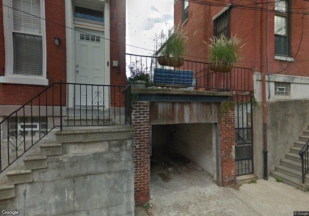
4506 Baker St Philadelphia, PA 19127
Manayunk NeighborhoodEstimated Value: $527,000 - $1,164,877
2
Beds
1
Bath
--
Sq Ft
2,657
Sq Ft Lot
About This Home
This home is located at 4506 Baker St, Philadelphia, PA 19127 and is currently estimated at $763,292. 4506 Baker St is a home located in Philadelphia County with nearby schools including White Oaks Elementary School, James Dobson Elementary School, and Roxborough High School.
Ownership History
Date
Name
Owned For
Owner Type
Purchase Details
Closed on
Jan 11, 2013
Sold by
Mccabe Patrick J
Bought by
Mccabe Patrick J and Carberry Declan
Current Estimated Value
Home Financials for this Owner
Home Financials are based on the most recent Mortgage that was taken out on this home.
Original Mortgage
$211,150
Outstanding Balance
$38,802
Interest Rate
3.35%
Mortgage Type
Commercial
Estimated Equity
$724,490
Purchase Details
Closed on
Aug 18, 2003
Sold by
Long Eugene J and Long Amy L
Bought by
Mccabe Patrick J
Home Financials for this Owner
Home Financials are based on the most recent Mortgage that was taken out on this home.
Original Mortgage
$236,250
Interest Rate
5.87%
Mortgage Type
Commercial
Purchase Details
Closed on
Dec 16, 1998
Sold by
Surkin Titcher Nussbaum & Ginsberg Partn
Bought by
Long Amy L and Long Eugene J
Create a Home Valuation Report for This Property
The Home Valuation Report is an in-depth analysis detailing your home's value as well as a comparison with similar homes in the area
Home Values in the Area
Average Home Value in this Area
Purchase History
| Date | Buyer | Sale Price | Title Company |
|---|---|---|---|
| Mccabe Patrick J | -- | None Available | |
| Mccabe Patrick J | $348,000 | -- | |
| Long Amy L | $202,000 | -- |
Source: Public Records
Mortgage History
| Date | Status | Borrower | Loan Amount |
|---|---|---|---|
| Open | Mccabe Patrick J | $211,150 | |
| Previous Owner | Mccabe Patrick J | $236,250 | |
| Closed | Mccabe Patrick J | $46,935 |
Source: Public Records
Tax History Compared to Growth
Tax History
| Year | Tax Paid | Tax Assessment Tax Assessment Total Assessment is a certain percentage of the fair market value that is determined by local assessors to be the total taxable value of land and additions on the property. | Land | Improvement |
|---|---|---|---|---|
| 2026 | $4,939 | $501,700 | $100,300 | $401,400 |
| 2025 | $4,939 | $501,700 | $100,300 | $401,400 |
| 2024 | $4,939 | $501,700 | $100,300 | $401,400 |
| 2023 | $4,939 | $352,800 | $70,500 | $282,300 |
| 2022 | $5,113 | $352,800 | $70,500 | $282,300 |
| 2021 | $5,113 | $0 | $0 | $0 |
| 2020 | $5,113 | $0 | $0 | $0 |
| 2019 | $4,523 | $0 | $0 | $0 |
| 2018 | $4,065 | $0 | $0 | $0 |
| 2017 | $4,065 | $0 | $0 | $0 |
| 2016 | $4,065 | $0 | $0 | $0 |
| 2015 | $3,891 | $0 | $0 | $0 |
| 2014 | -- | $290,400 | $49,668 | $240,732 |
| 2012 | -- | $33,600 | $3,524 | $30,076 |
Source: Public Records
Map
Nearby Homes
- 142 Carson St
- 4523 Riverside Way
- 4506 Ritchie St
- 131 Carson St
- 152 Carson St
- 4419 Baker St
- 175 Krams Ave
- 4521 Wilde St
- 4413 Baker St
- 223 Dupont St
- 4584 Riverside Way
- 4630 Umbria St
- 168 Gay St
- 4586 Riverside Way
- 144 Levering St
- 2 Leverington Ave Unit 24
- 2 Leverington Ave Unit 21
- 191 Maiden St
- 0 Penn Ave
- 164 Grape St
- 4506 Baker St Unit 3
- 4504 Baker St Unit 1
- 4504 Baker St Unit 1
- 4504 Baker St
- 4508 Baker St
- 4502 Baker St
- 4512 Baker St
- 120 26 Green Ln Unit 3,8,2
- 120 26 Green Ln Unit 3,8,9
- 130 Green Ln Unit 1
- 130 Green Ln Unit 2
- 130 Green Ln Unit 3
- 130 Green Ln
- 4514 Baker St
- 132 Green Ln
- 4518 Baker St
- 4520 Baker St
- 4520 Baker St Unit 8
- 4520 Baker St Unit 16
- 4520 Baker St Unit 6