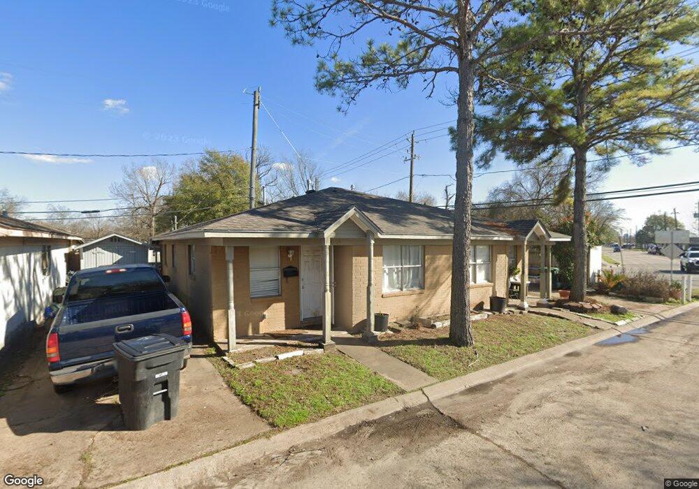
4506 Lelay Cir Houston, TX 77022
Independence Heights NeighborhoodEstimated Value: $166,000 - $300,000
4
Beds
2
Baths
1,662
Sq Ft
$141/Sq Ft
Est. Value
About This Home
This home is located at 4506 Lelay Cir, Houston, TX 77022 and is currently estimated at $234,502, approximately $141 per square foot. 4506 Lelay Cir is a home located in Harris County with nearby schools including Kennedy Elementary School, Williams Middle, and Booker T Washington Sr High.
Ownership History
Date
Name
Owned For
Owner Type
Purchase Details
Closed on
Aug 22, 2002
Sold by
Mid Ohio Securities Corp
Bought by
Garcilazo Juan A and Garcilazo Rutila E
Current Estimated Value
Home Financials for this Owner
Home Financials are based on the most recent Mortgage that was taken out on this home.
Original Mortgage
$36,195
Outstanding Balance
$15,228
Interest Rate
6.47%
Estimated Equity
$219,274
Create a Home Valuation Report for This Property
The Home Valuation Report is an in-depth analysis detailing your home's value as well as a comparison with similar homes in the area
Home Values in the Area
Average Home Value in this Area
Purchase History
| Date | Buyer | Sale Price | Title Company |
|---|---|---|---|
| Garcilazo Juan A | -- | Commonwealth Land Title Co |
Source: Public Records
Mortgage History
| Date | Status | Borrower | Loan Amount |
|---|---|---|---|
| Open | Garcilazo Juan A | $36,195 |
Source: Public Records
Tax History Compared to Growth
Tax History
| Year | Tax Paid | Tax Assessment Tax Assessment Total Assessment is a certain percentage of the fair market value that is determined by local assessors to be the total taxable value of land and additions on the property. | Land | Improvement |
|---|---|---|---|---|
| 2025 | $125 | $180,000 | $50,448 | $129,552 |
| 2024 | $125 | $161,689 | $50,448 | $111,241 |
| 2023 | $125 | $161,689 | $50,448 | $111,241 |
| 2022 | $3,560 | $161,689 | $50,448 | $111,241 |
| 2021 | $2,438 | $104,606 | $20,773 | $83,833 |
| 2020 | $2,533 | $104,606 | $20,773 | $83,833 |
| 2019 | $2,201 | $86,964 | $20,773 | $66,191 |
| 2018 | $1,920 | $75,893 | $20,773 | $55,120 |
| 2017 | $1,919 | $75,893 | $20,773 | $55,120 |
| 2016 | $1,270 | $50,215 | $7,419 | $42,796 |
| 2015 | $1,291 | $50,215 | $7,419 | $42,796 |
| 2014 | $1,291 | $50,215 | $7,419 | $42,796 |
Source: Public Records
Map
Nearby Homes
- 144 Knightsbridge Park Ln
- 147 Knightsbridge Park Ln
- 107 W Whitney St Unit E
- 107 W Whitney St Unit C
- 4423 Yale St
- 225 Noras Ln Unit E
- 8901 N Main St
- 4510 Old Yale St Unit A
- 115 E Thornton Rd
- 4435 Whitney Oak Ln
- 310 Walthall Dr
- 312 Walthall Dr
- 315 E Whitney St
- 0 Victoria Unit 54691087
- 4605 Yale St Unit C
- 4605 Yale St Unit A
- 4605 Yale St Unit J
- 320 Thornton Rd
- 0 E 45th St
- 303 Victoria Dr
- 4510 Lelay Cir
- 4514 Lelay Cir
- 4507 Lelay Cir
- 4511 Lelay Cir
- 4503 Lelay Cir
- 4518 Lelay Cir
- 4515 Lelay Cir
- 4522 Lelay Cir
- 4519 Lelay Cir
- 4506 Pecan Park Cir
- 4502 Pecan Park Cir
- 4510 Pecan Park Cir
- 4514 Pecan Park Cir
- 4523 Lelay Cir
- 4526 Lelay Cir
- 4518 Pecan Park Cir
- 4527 Lelay Cir
- 4522 Pecan Park Cir
- 4530 Lelay Cir
- 4526 Pecan Park Cir