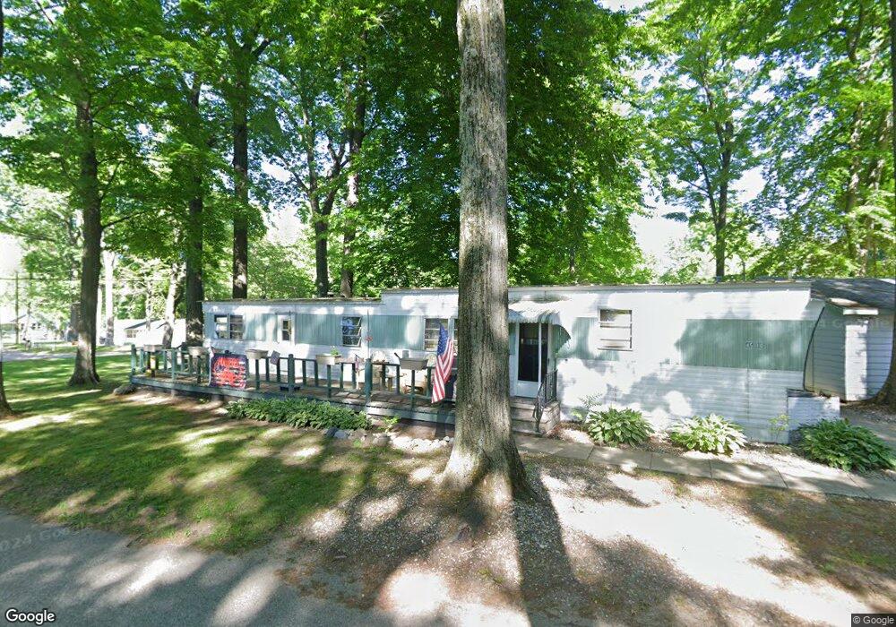
4506 S Parsons Ave Fremont, MI 49412
Estimated Value: $251,000 - $378,000
--
Bed
1
Bath
--
Sq Ft
5,097
Sq Ft Lot
About This Home
This home is located at 4506 S Parsons Ave, Fremont, MI 49412 and is currently estimated at $288,105. 4506 S Parsons Ave is a home located in Newaygo County with nearby schools including Quest High School, Daisy Brook Elementary School, and Pathfinder Elementary School.
Ownership History
Date
Name
Owned For
Owner Type
Purchase Details
Closed on
Feb 26, 2004
Sold by
Michael Ricky and Michael Jennifer
Bought by
Kulerski J Richard and Kulerski Penny L
Current Estimated Value
Home Financials for this Owner
Home Financials are based on the most recent Mortgage that was taken out on this home.
Original Mortgage
$75,200
Interest Rate
5.77%
Mortgage Type
Purchase Money Mortgage
Purchase Details
Closed on
Mar 31, 1999
Sold by
Garter Howard and Barb Cryderman
Bought by
Michael Ricky
Create a Home Valuation Report for This Property
The Home Valuation Report is an in-depth analysis detailing your home's value as well as a comparison with similar homes in the area
Home Values in the Area
Average Home Value in this Area
Purchase History
Date | Buyer | Sale Price | Title Company |
---|---|---|---|
Kulerski J Richard | $94,000 | Chicago Title | |
Kulerski J Richard | $94,000 | -- | |
Michael Ricky | $62,400 | -- |
Source: Public Records
Mortgage History
Date | Status | Borrower | Loan Amount |
---|---|---|---|
Closed | Kulerski J Richard | $75,200 |
Source: Public Records
Tax History Compared to Growth
Tax History
Year | Tax Paid | Tax Assessment Tax Assessment Total Assessment is a certain percentage of the fair market value that is determined by local assessors to be the total taxable value of land and additions on the property. | Land | Improvement |
---|---|---|---|---|
2024 | $5 | $117,900 | $0 | $0 |
2023 | $489 | $103,200 | $0 | $0 |
2022 | $2,130 | $75,500 | $0 | $0 |
2021 | $2,071 | $70,300 | $0 | $0 |
2020 | $2,050 | $72,300 | $0 | $0 |
2019 | $1,965 | $70,000 | $0 | $0 |
2018 | $1,925 | $59,100 | $0 | $0 |
2017 | $1,882 | $57,400 | $0 | $0 |
2016 | $1,758 | $52,500 | $0 | $0 |
2015 | -- | $37,400 | $0 | $0 |
2014 | -- | $49,200 | $0 | $0 |
Source: Public Records
Map
Nearby Homes
- 4410 Delaware Rd
- 8607 S Ferris Ave
- 3833 S Baldwin Ave
- 4295 S Gordon Ave
- 2585 Mayo Dr
- 2551 Mayo Dr
- 5051 S Bliss Ln
- 5095 S Bliss Ln
- 2772 S Wisner Ave
- 105 W 48th St
- 2490 S Parsons Ave
- 3933 S Centerline Rd
- 6854 Bingham Ave
- 2291 W 22nd St
- 5705 Centerline Rd
- VL Woodlawn Ave
- V/L 56th
- 1480 W 72nd St
- 4165 Highland Dr
- 4199 Highland Dr
- 4506 S Parsons Ave
- 4510 S Parsons Ave
- 4500 S Parsons Ave
- 4494 S Parsons Ave
- 2190 Maple Ln
- 2190 Maple Ln
- 2184 Maple St
- 2184 Maple Ln
- 2196 Maple Ln
- 2180 Maple Ln
- 4511 S Parsons Ave
- 4486 S Oak
- 4487 S Parsons Ave
- 4480 S Parsons Ave
- 4483 S Parsons Ave
- 2154 Maple Ln
- 2154 Maple Ln
- 4471 S Parson Ave
- 4537 S Parsons Ave
- 4570 S Oak St