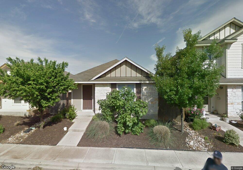
4506 Secure Ln Unit 49 Austin, TX 78725
Hornsby Bend NeighborhoodEstimated Value: $210,000 - $273,000
Studio
2
Baths
1,120
Sq Ft
$207/Sq Ft
Est. Value
About This Home
This home is located at 4506 Secure Ln Unit 49, Austin, TX 78725 and is currently estimated at $231,344, approximately $206 per square foot. 4506 Secure Ln Unit 49 is a home located in Travis County with nearby schools including Hornsby-Dunlap Elementary School, Dailey Middle School, and Del Valle High School.
Ownership History
Date
Name
Owned For
Owner Type
Purchase Details
Closed on
Jun 4, 2012
Sold by
The Secretary Of Housing & Urban Develop
Bought by
Huntley Dean
Current Estimated Value
Purchase Details
Closed on
Mar 15, 2012
Sold by
Wells Fargo Bank Na
Bought by
The Secretary Of Housing & Urban Develop
Purchase Details
Closed on
Mar 6, 2012
Sold by
Strickland Juanita
Bought by
Wells Fargo Bank Na
Purchase Details
Closed on
May 1, 2008
Sold by
Reytex Homes Llc
Bought by
Sanchez Maria
Home Financials for this Owner
Home Financials are based on the most recent Mortgage that was taken out on this home.
Original Mortgage
$105,119
Interest Rate
5.84%
Mortgage Type
Purchase Money Mortgage
Create a Home Valuation Report for This Property
The Home Valuation Report is an in-depth analysis detailing your home's value as well as a comparison with similar homes in the area
Home Values in the Area
Average Home Value in this Area
Purchase History
| Date | Buyer | Sale Price | Title Company |
|---|---|---|---|
| Huntley Dean | -- | None Available | |
| The Secretary Of Housing & Urban Develop | -- | None Available | |
| Wells Fargo Bank Na | $52,000 | None Available | |
| Sanchez Maria | -- | Alamo Title Company |
Source: Public Records
Mortgage History
| Date | Status | Borrower | Loan Amount |
|---|---|---|---|
| Previous Owner | Sanchez Maria | $105,119 |
Source: Public Records
Tax History
| Year | Tax Paid | Tax Assessment Tax Assessment Total Assessment is a certain percentage of the fair market value that is determined by local assessors to be the total taxable value of land and additions on the property. | Land | Improvement |
|---|---|---|---|---|
| 2025 | $3,096 | $196,873 | $21,536 | $175,337 |
| 2023 | $4,289 | $277,261 | $21,536 | $255,725 |
| 2022 | $5,560 | $315,860 | $21,536 | $294,324 |
| 2021 | $3,233 | $174,199 | $21,536 | $152,663 |
| 2020 | $3,025 | $152,037 | $21,536 | $130,501 |
| 2018 | $3,061 | $143,238 | $21,536 | $121,702 |
| 2017 | $2,905 | $131,090 | $21,536 | $109,554 |
| 2016 | $2,853 | $128,745 | $21,536 | $107,209 |
| 2015 | $2,399 | $112,006 | $20,000 | $92,006 |
| 2014 | $2,399 | $106,781 | $20,000 | $86,781 |
Source: Public Records
Map
Nearby Homes
- 4523 Secure Ln
- 4501 Best Way
- 4529 Best Way Unit 62
- 4523 Felicity Ln
- 4503 Senda Ln
- 4512 Senda Ln
- 4510 Inicio Ln Unit 367
- 4607 Truth Way Unit 440
- 4616 Truth Way Unit 456
- 4617 Cleto St
- 4604 Cleto St
- 4503 Halliday Ave
- 4504 Halliday Ave
- 15108 Walcott Dr
- 15105 Verela Dr
- 15904 Narcissus Way
- 15900 Narcissus Way
- 4503 Acers Ln
- 801 Silver Wing Dr
- 16005 Cowslip Way
- 4506 Secure Ln
- 4504 Secure Ln
- 4508 Secure Ln
- 4502 Secure Ln
- 4510 Secure Ln
- 4512 Secure Ln
- 4500 Secure Ln
- 4507 Secure Ln
- 4505 Secure Ln
- 4505 Secure Ln Unit 43
- 4509 Secure Ln
- 4509 Secure Ln Unit 41
- 4501 Secure Ln
- 4511 Secure Ln
- 4503 Secure Ln Unit 44
- 4503 Secure Ln
- 4514 Secure Ln
- 4513 Secure Ln Unit 39
- 4513 Secure Ln
- 4509 Best Way
Your Personal Tour Guide
Ask me questions while you tour the home.