Estimated Value: $139,742 - $234,000
3
Beds
2
Baths
1,404
Sq Ft
$126/Sq Ft
Est. Value
About This Home
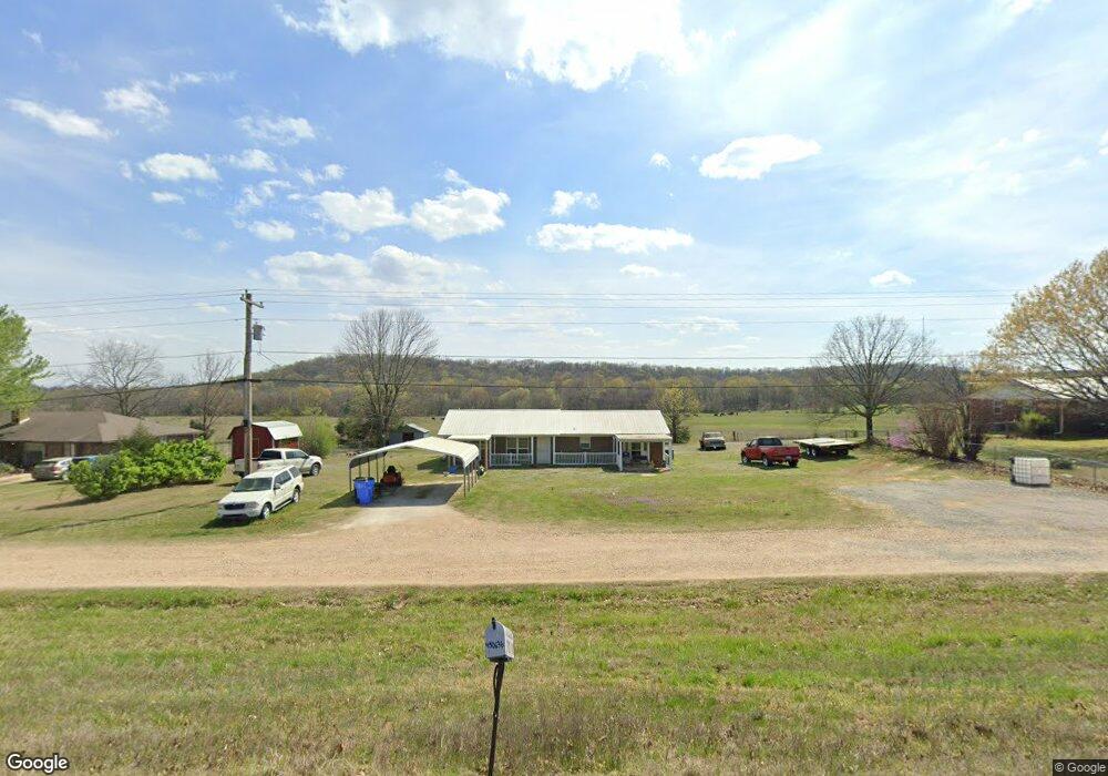
This home is located at 450636 Highway 64, Vian, OK 74962 and is currently estimated at $176,936, approximately $126 per square foot. 450636 Highway 64 is a home located in Sequoyah County with nearby schools including Vian Elementary School, Vian Middle School, and Vian High School.
Ownership History
Date
Name
Owned For
Owner Type
Purchase Details
Closed on
Jan 1, 2005
Sold by
Kittrell Curtis L and Noisy Shannon
Bought by
Walters James A
Current Estimated Value
Home Financials for this Owner
Home Financials are based on the most recent Mortgage that was taken out on this home.
Original Mortgage
$11,468
Interest Rate
5.64%
Mortgage Type
Future Advance Clause Open End Mortgage
Create a Home Valuation Report for This Property
The Home Valuation Report is an in-depth analysis detailing your home's value as well as a comparison with similar homes in the area
Home Values in the Area
Average Home Value in this Area
Purchase History
| Date | Buyer | Sale Price | Title Company |
|---|---|---|---|
| Walters James A | $9,000 | None Available |
Source: Public Records
Mortgage History
| Date | Status | Borrower | Loan Amount |
|---|---|---|---|
| Previous Owner | Walters James A | $11,468 |
Source: Public Records
Tax History Compared to Growth
Tax History
| Year | Tax Paid | Tax Assessment Tax Assessment Total Assessment is a certain percentage of the fair market value that is determined by local assessors to be the total taxable value of land and additions on the property. | Land | Improvement |
|---|---|---|---|---|
| 2024 | $471 | $5,892 | $649 | $5,243 |
| 2023 | $471 | $5,721 | $649 | $5,072 |
| 2022 | $442 | $5,554 | $627 | $4,927 |
| 2021 | $422 | $5,554 | $627 | $4,927 |
| 2020 | $422 | $5,235 | $586 | $4,649 |
| 2019 | $408 | $5,083 | $566 | $4,517 |
| 2018 | $355 | $4,935 | $538 | $4,397 |
| 2017 | $345 | $4,792 | $500 | $4,292 |
| 2016 | $333 | $4,652 | $466 | $4,186 |
| 2015 | $307 | $4,343 | $444 | $3,899 |
| 2014 | $299 | $4,217 | $423 | $3,794 |
Source: Public Records
Map
Nearby Homes
- 105148 S 4500
- 802 Schley St
- 613 S Rodgers St
- 304 Blackstone St
- 0 Leftwich St
- 54 N Rodgers St
- 108 S Thornton St
- 109 W Lee St
- 000 Schley St
- 1 State Highway 82
- 448159 E 979 Rd
- 102 E Thompson
- 457848 E 1013 Rd
- 455748 U S Highway 64
- 103759 S 4490 Rd
- 0 1030 Rd Unit 2520454
- 715 S Clayton
- 713 Clayton St
- TBD E 1055 Rd
- 504 Beverly Dr
- 450696 Highway 64 Unit US
- 450696 Hwy 64
- 450480 Highway 64
- 450811 Highway 64
- 450860 Hwy 64
- 450875 Highway 64
- 104294 S 4505 Rd
- 104606 S 4510 Rd
- 104606 S 4510 Rd
- 104772 S 4510 Rd
- 450199 Highway 64
- 450199 Highway 64
- 104417 S 4510 Rd
- 450612 E 1040 Rd
- 451209 Highway 64
- 451209 Highway 64
- Box 1100 Hc 68
- HC Box 1100 Hc 68
- Box 1208 Hc 68
- Box 1157 Hc 68