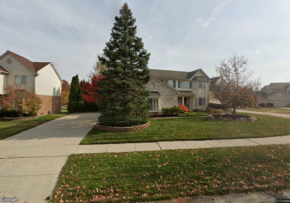
45067 Fox Pointe Dr Unit 7 Canton, MI 48187
Estimated Value: $504,000 - $541,000
4
Beds
4
Baths
2,315
Sq Ft
$226/Sq Ft
Est. Value
About This Home
This home is located at 45067 Fox Pointe Dr Unit 7, Canton, MI 48187 and is currently estimated at $524,250, approximately $226 per square foot. 45067 Fox Pointe Dr Unit 7 is a home located in Wayne County with nearby schools including Canton High School, Discovery Middle School, and Plymouth High School.
Ownership History
Date
Name
Owned For
Owner Type
Purchase Details
Closed on
Dec 30, 2010
Sold by
Qadish Fadi and Qaqish Kati
Bought by
Cerny Glenn and Cerny Kelly
Current Estimated Value
Purchase Details
Closed on
Jun 13, 2007
Sold by
Haddad Wasfi F and Haddad Nansi
Bought by
Qaqish Fadi
Purchase Details
Closed on
May 18, 2007
Sold by
Chase Manhattan Mortgage Corp
Bought by
Homesales Inc
Purchase Details
Closed on
Mar 14, 2007
Sold by
Haddad Wasfi F and Haddad Nansi
Bought by
Chase Manhattan Mortgage Corp
Purchase Details
Closed on
Jun 23, 2004
Sold by
Lehr Gary N and Lehr Melinda A
Bought by
Haddad Wasfi F
Home Financials for this Owner
Home Financials are based on the most recent Mortgage that was taken out on this home.
Original Mortgage
$64,500
Interest Rate
6.39%
Mortgage Type
Stand Alone Second
Create a Home Valuation Report for This Property
The Home Valuation Report is an in-depth analysis detailing your home's value as well as a comparison with similar homes in the area
Home Values in the Area
Average Home Value in this Area
Purchase History
| Date | Buyer | Sale Price | Title Company |
|---|---|---|---|
| Cerny Glenn | $235,000 | First Centennial Title | |
| Qaqish Fadi | $265,000 | Transnation Title Ins Co | |
| Homesales Inc | -- | None Available | |
| Chase Manhattan Mortgage Corp | $264,571 | None Available | |
| Haddad Wasfi F | $322,500 | Great Lake Title Of Mi |
Source: Public Records
Mortgage History
| Date | Status | Borrower | Loan Amount |
|---|---|---|---|
| Previous Owner | Haddad Wasfi F | $64,500 | |
| Previous Owner | Haddad Wasfi F | $258,000 |
Source: Public Records
Tax History Compared to Growth
Tax History
| Year | Tax Paid | Tax Assessment Tax Assessment Total Assessment is a certain percentage of the fair market value that is determined by local assessors to be the total taxable value of land and additions on the property. | Land | Improvement |
|---|---|---|---|---|
| 2025 | $2,772 | $240,600 | $0 | $0 |
| 2024 | $2,772 | $218,800 | $0 | $0 |
| 2023 | $2,643 | $206,900 | $0 | $0 |
| 2022 | $5,749 | $188,100 | $0 | $0 |
| 2021 | $5,579 | $181,900 | $0 | $0 |
| 2020 | $5,508 | $178,100 | $0 | $0 |
| 2019 | $5,409 | $170,020 | $0 | $0 |
| 2018 | $2,246 | $161,150 | $0 | $0 |
| 2017 | $5,477 | $159,800 | $0 | $0 |
| 2016 | $4,914 | $154,300 | $0 | $0 |
| 2015 | $12,343 | $150,970 | $0 | $0 |
| 2013 | $11,957 | $130,760 | $0 | $0 |
| 2010 | -- | $115,450 | $65,609 | $49,841 |
Source: Public Records
Map
Nearby Homes
- 44585 Nantucket Dr
- 50782 Ross St
- 48590 Ford Rd
- 0000 Ford
- 6171 Gloucester Dr
- 44661 Jeffrey Cir
- 44497 Savery Dr Unit 103
- 6750 N Canton Center Rd
- 1710 Longfellow Dr
- 45139 Indian Creek Dr
- 44018 Bannockburn Dr
- 1625 Longfellow Dr
- 1584 Commodore Cir Unit 33
- 6832 New Providence Way Unit 1007
- 43737 Westminister Way
- 45228 Patrick Dr
- 847 Coldrose Way
- 835 Coldrose Way
- 43706 Westminister Way
- 2185 Oakview Dr
- 45081 Fox Pointe Dr Unit 6
- 45053 Fox Pointe Dr
- 45095 Fox Pointe Dr
- 45039 Fox Pointe Dr
- 45068 Fox Pointe Dr Unit 27
- 45054 Fox Pointe Dr Unit 26
- 44955 Fox Pointe Dr
- 45109 Fox Pointe Dr
- 45040 Fox Pointe Dr Unit 25
- 44941 Fox Pointe Dr
- 45137 Fox Pointe Dr
- 45123 Fox Pointe Dr
- 44927 Fox Pointe Dr
- 45151 Fox Pointe Dr Unit 1
- 45026 Fox Pointe Dr Unit 24
- 44970 Fox Pointe Dr
- 44913 Fox Pointe Dr
- 44984 Fox Pointe Dr
- 44956 Fox Pointe Dr
- 45012 Fox Pointe Dr